Weather
Thunderstorms Possible Wednesday; NWS Issues Red Flag Warning
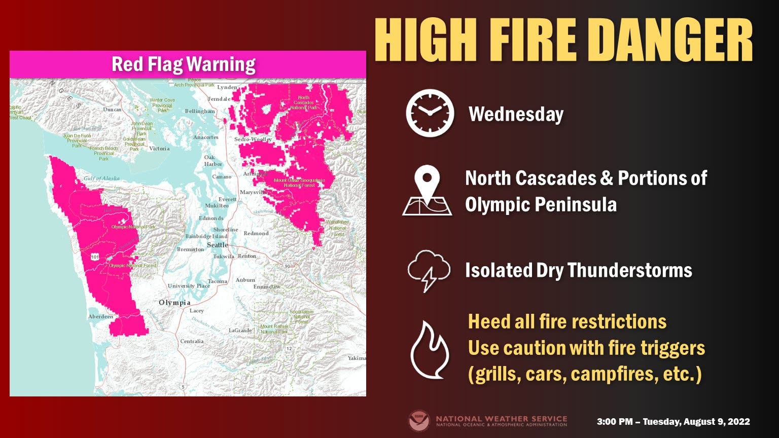
Areas of Western Washington will be under a red flag warning with isolated thunderstorms in the forecast and dry conditions on the ground.

SEATTLE — A red flag warning will be in place for several areas west of the Cascades Wednesday due to potential dry thunderstorms developing, increasing the chance for fires to ignite dry fuels. Wind gusts developing in some places could add another risk factor.
"Scattered lightning in dry fuels can cause multiple fire starts," the National Weather Service wrote Tuesday. "Thunderstorms can also bring sudden sharp wind shifts on existing fires, causing rapid changes in a fire's rate of spread and direction of spread. Thunderstorm outflow winds can be a threat for several hours following the start of a new lightning-caused fire. If a fire were to begin, air quality may diminish in the surrounding area."
The red flag warning will remain in place from 2 a.m. to 11 p.m. Wednesday. Though the warning zone does not include Puget Sound, applying mostly to the North Cascades and Olympic Peninsula, the National Weather Service asked residents to take fire precautions across the region after the recent run of hot and dry weather.
Find out what's happening in Seattlefor free with the latest updates from Patch.
While fire dangers are elevated in the areas covered by the warning, there is also the potential for isolated thunderstorms developing across the region, including Puget Sound, through Wednesday afternoon.
Forecasters predict calmer, sunnier, and warmer weather will return to the region by Thursday, with afternoon highs getting close to 80 degrees as the clouds clear out. The weekend is on track to run a few degrees cooler — while staying sunny — before things warm up again next week.
Find out what's happening in Seattlefor free with the latest updates from Patch.
Get more local news delivered straight to your inbox. Sign up for free Patch newsletters and alerts.
