Weather
WA Snow Forecast: 2 Systems Bring Chances For Lowland Flurries
Some lowland areas could see some snow as early Sunday, while more widespread accumulation is possible Tuesday through Thursday.

SEATTLE — Two weather systems will bring a few chances for lowland snow starting Sunday and continuing well into next week, according to the latest forecasts. The National Weather Service's early predictions for snow appear to be holding steady as the final days of January approach, and the likelihood is increasing that many areas will see at least a few flurries at some point.
For some, the first chance will arrive early Sunday, as snow levels hover between 500 and 1,000 feet and the first weather system moves across the region, forecasters said.
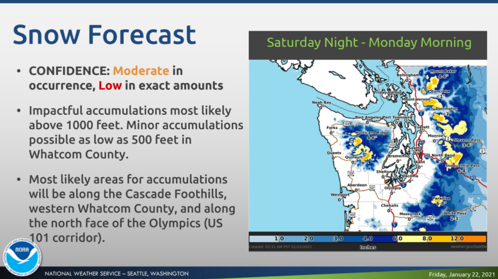
A mix of rain and snow will be possible for much of the lowlands into Monday, but the highest chance for snow will be in the Cascade foothills, western Whatcom County and along the northern face of the Olympics.
Find out what's happening in Seattlefor free with the latest updates from Patch.
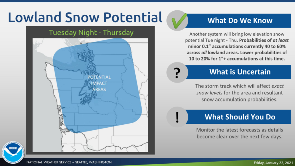
The second system expected Tuesday evening appears to bring the best shot at snow for all, as snow levels dip below 500 feet. According to NWS Seattle, the probability for some accumulation is between 40 and 60 percent across the lowlands between Tuesday night and Wednesday afternoon. The chance for more than an inch of snow is between 10 and 20 percent, with better odds for more in the foothills.
Washingtonians should prepare for overnight temperatures near or below freezing, and the potential for travel impacts in the days ahead. State and local transportation agencies are preparing for snowfall and drivers are encouraged to check current conditions and forecasts before heading out the door.
Find out what's happening in Seattlefor free with the latest updates from Patch.
Snow time like the present to prepare, snow what we mean?https://t.co/viTguIZPla Snow routes Where we plow and sand in @KingCountyWA Lots more!#wawx #KingCountyReady @KCDNRP @wsdot_traffic @wsdot_passes @NWSSeattle pic.twitter.com/KAteTUrjtZ
— KC Road Services (@kcroads) January 22, 2021
The National Weather Service said the exact impacts of next week's weather remains uncertain, as the storm track will play a significant role in how much accumulation occurs. Forecasters will continue to share details as the weather systems near.
Over the long-term, the National Weather Service said colder-than-usual temperatures could be the new normal through at least mid-February.
After a mild start to the year, it seems that winter has arrived. And cooler than normal temperatures could be the story well into next month. #wawx https://t.co/Vi15iMiJsI
— NWS Seattle (@NWSSeattle) January 22, 2021
Get more local news delivered straight to your inbox. Sign up for free Patch newsletters and alerts.
