Weather
Wind Advisory, Flood Watch Monday: Puget Sound Rain Forecast
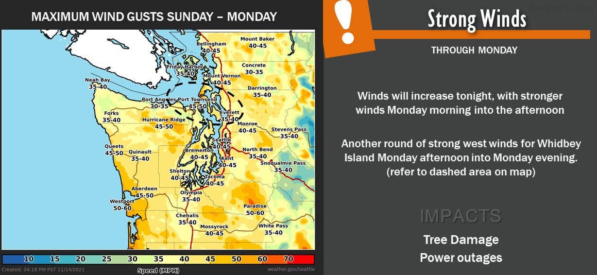
Monday's gusts are forecast to be stronger than initially expected, and a wind advisory is in effect until late in the afternoon.

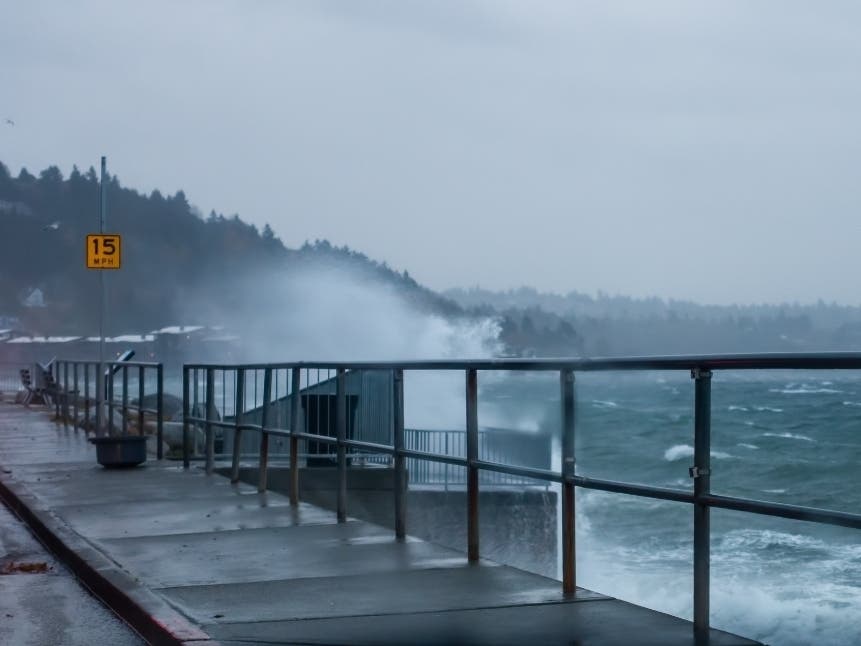
SEATTLE — Puget Sound is in for at least one more stormy day and multiple weather alerts are in place as the latest Pineapple Express finishes out its wet and windy trek across the Pacific Northwest.
Forecasters expect Monday will be a little gustier than initially thought, and a wind advisory will remain in effect until 4 p.m. Strong winds will be possible across Western Washington, bringing back an elevated risk for downed trees and power outages around Puget Sound. Gusts could reach 45 mph around Seattle and Tacoma.
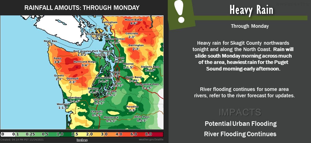
Like Sunday night, Monday will be wet, with forecasters expecting the heaviest rain for most between morning and early afternoon.
Find out what's happening in Seattlefor free with the latest updates from Patch.
"For most areas, the most impactful (outside of Skagit/Whatcom/North Coast) will be during the day on Monday," NWS Seattle wrote Sunday. "Heaviest rain expected to move through between 9 a.m. - 3 p.m. for most of the interior. Urban flooding will be possible for low-lying areas with poor drainage during this, with rates of 0.25 - 0.50" possible."
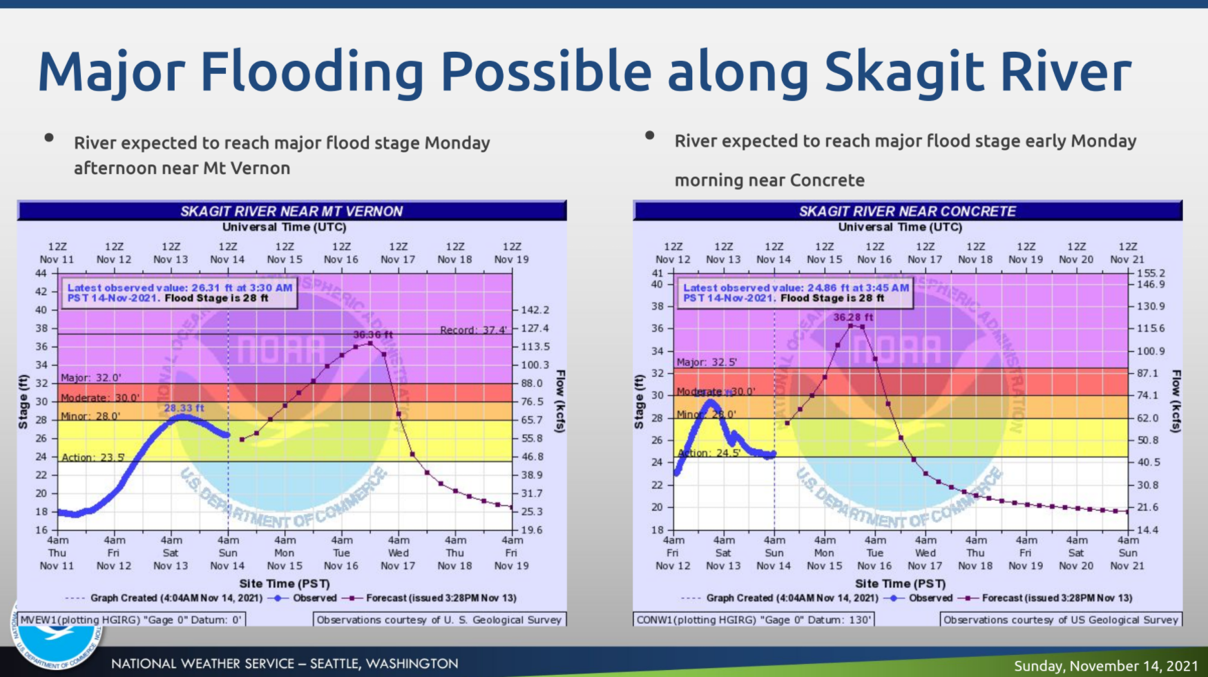
The extended flood watch will stay in place until late Tuesday afternoon, with rivers across the region likely to be running high. The latest river forecasts show flood stages lower than the last storm in the Central and South Sound, potentially reaching the moderate stage along the Snoqualmie and Snohomish rivers. Forecasters are keeping a close eye on northern rivers, some of which could see some major flooding.
Find out what's happening in Seattlefor free with the latest updates from Patch.
- Monitor live river conditions and the latest flood forecasts via the National Weather Service.
- Sign up to receive local flood alerts in King, Pierce, or Snohomish counties.
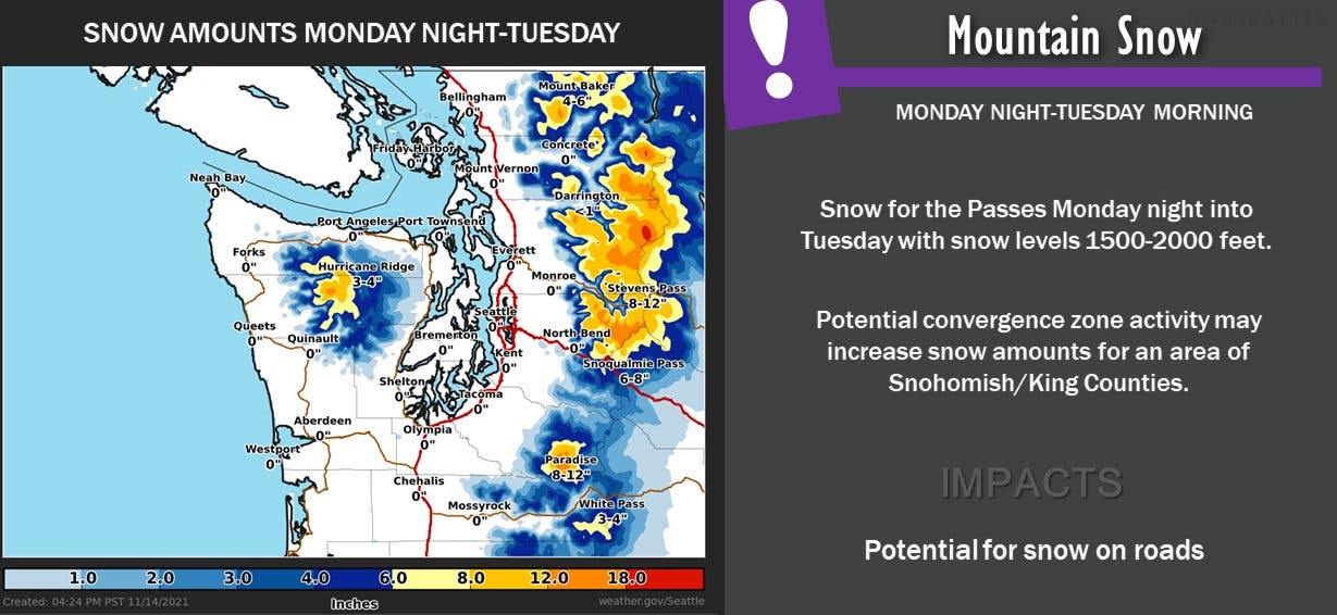
As the atmospheric river moves out of the area, warmer temperatures will go with it. According to the National Weather Service, snow levels will dip below 2,000 feet Monday evening into Tuesday morning, allowing a round of new accumulation at Snoqualmie and Stevens passes. In the lowlands, afternoon temperatures will tumble by ten degrees Tuesday, failing to reach the 40s, and overnight lows could fall to the mid-30s.
Forecasters see drier and cooler weather Tuesday and Wednesday before another rainy system moves in Thursday and Friday.
Get more local news delivered straight to your inbox. Sign up for free Patch newsletters and alerts.