Weather
1-2 Inches Of Snow Headed Our Way; Motorists Warned
The snow is coming, just in time for the evening commute. Weather officials say the most dangerous time to drive are these first snowfalls.

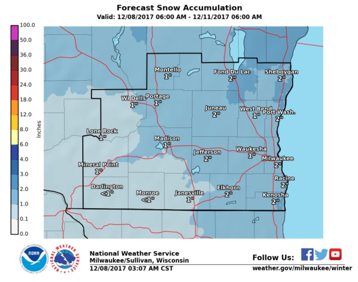
Here comes the snow! The National Weather Service has issued a hazardous weather outlook for southeastern Wisconsin as we expect to see our first snow accumulation today into Saturday.
The first widespread accumulating snowfall of the season is expected from late this afternoon through this evening. Between one and two inches is anticipated, causing snow covered and slippery roads.
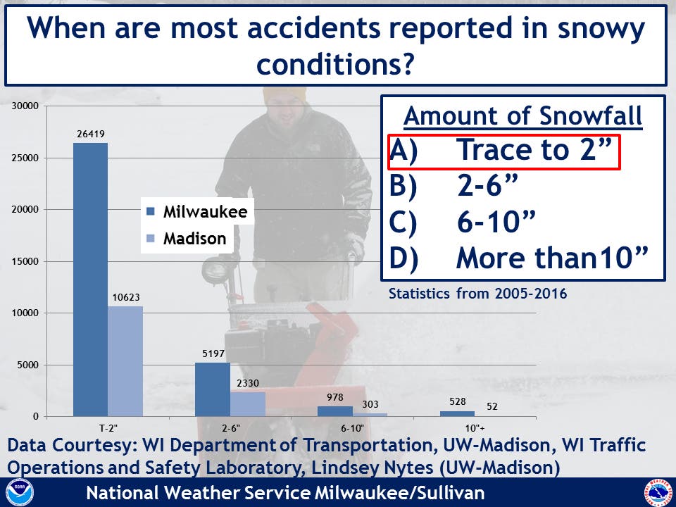
Evening motorists should be prepared to slow down and allow extra time to reach their destination. The National Weather Service says snow may cause rapidly deteriorating travel conditions on roads and walks. This will be the first widespread accumulating snowfall of the season. Most accidents occur in lighter snowfall according to statistics from the Wisconsin Department of Transportation and Wisconsin Traffic Operations and Safety Lab. Also, drivers are not yet acclimated to driving in the snowy, slippery conditions.
Find out what's happening in Greenfieldfor free with the latest updates from Patch.
According to the National Weather Service, the snow is expected to start in the 5 o'clock hour and accumulate up to a half-inch by midnight.
Between midnight and 6 a.m. Saturday, another seven-tenths of an inch are expected to fall. And then about another quarter-inch is expected to fall between 6 a.m. and noon Saturday.
Find out what's happening in Greenfieldfor free with the latest updates from Patch.
This Afternoon
Partly sunny, with a high near 32. West wind around 10 mph.
Tonight
Snow, mainly after 9pm. Low around 23. Southwest wind 10 to 15 mph becoming northwest after midnight. Chance of precipitation is 100%. New snow accumulation of around an inch possible.
Images Via NOAA.gov/Sullivan
Get more local news delivered straight to your inbox. Sign up for free Patch newsletters and alerts.