Weather
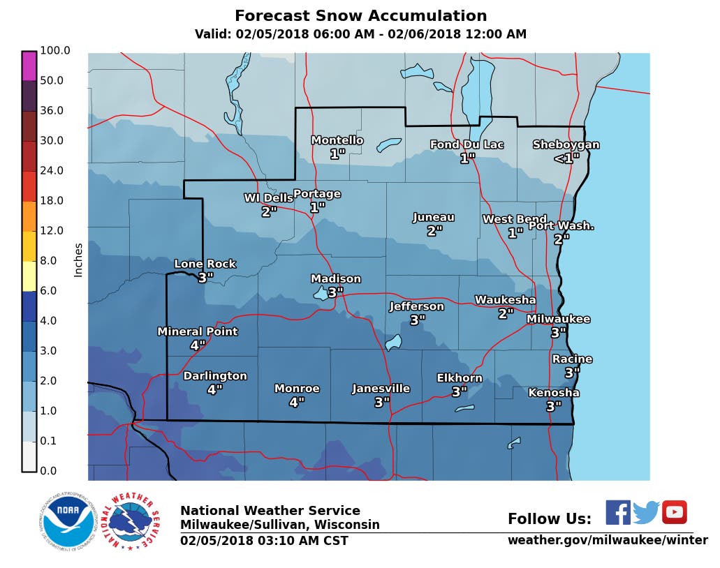
Up To 4 Inches Snow Expected Monday in SE Wisconsin
Super Bowl Sunday saw the continuation of light, fluffy snow in our area, and it's making a comeback Monday.


Super Bowl Sunday saw the continuation of light, fluffy snow in our area, and it's making a comeback Monday.
According to the National Weather Service, accumulating snow will return to southern Wisconsin this afternoon and evening. Between one and four inches is expected, with the highest amounts along and south of the Interstate 94 corridor. The snow is expected to impact the afternoon commute, weather officials say. A Winter Weather Advisory is in effect for most of the area this afternoon into this evening.
According to the National Weather Service, wind chills will fall to between 15 and 25 degrees below zero into the middle morning hours. The coldest wind chills are expected north of Madison and Milwaukee, where a Wind Chill Advisory has been posted.
Find out what's happening in Greenfieldfor free with the latest updates from Patch.
The advisory includes the Sheboygan, Fond du Lac, West Bend, Portage, Port Washington and Montello areas.
Monday Weather Fast Facts
Find out what's happening in Greenfieldfor free with the latest updates from Patch.
* Accumulation: Plan on slippery road conditions, particularly during the evening commute. Total snow
accumulations of 1 to 3 inches are expected.
* Location: Waukesha, Milwaukee, Racine and Kenosha County.
* Timing: 2 p.m. to 9 p.m. Monday.
* Additional Details: Be prepared for reduced visibilities at times.
Lead Image: Scott Anderson, Patch.com Graphic: Via NOAA/Sullivan
Get more local news delivered straight to your inbox. Sign up for free Patch newsletters and alerts.