Weather
Up To 8 Inches Snow Predicted Late Thursday
The snow will likely begin on Thursday evening, increasing in intensity after midnight, and tailing off Friday morning.

The National Weather Service has issued a Winter Storm Watch for late Thursday and into Friday as a band of heavy snow moves into our area.
According to the National Weather Service, a narrow band of heavy snow is likely across southern Wisconsin and northern Illinois, with the heaviest amounts toward northern Illinois.
The snow will likely begin on Thursday evening, increasing in intensity after midnight, and tailing off Friday morning and perhaps into the early afternoon.
Find out what's happening in Greenfieldfor free with the latest updates from Patch.
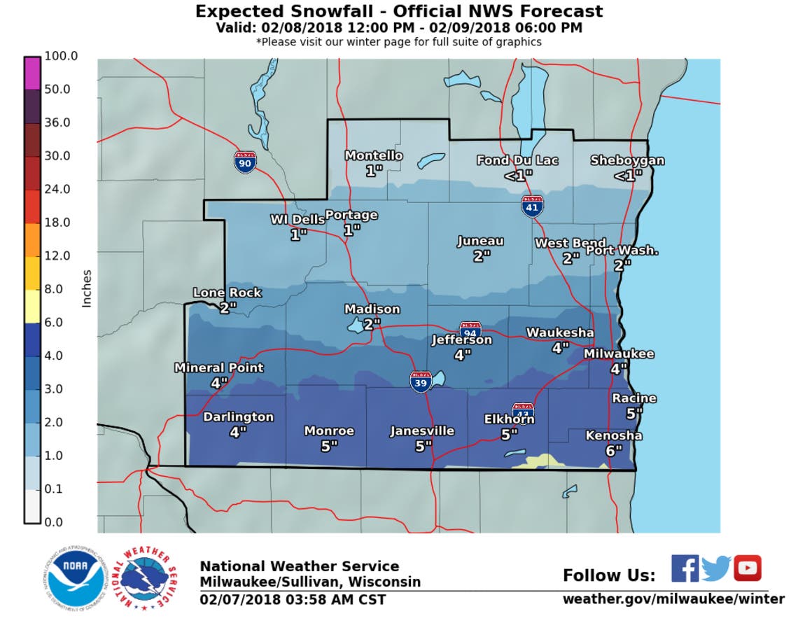
Weather officials say the current forecast shows a sharp gradient in snowfall totals from less than 1 inch near Sheboygan to nearly 6 inches along the state line to nearly 8 inches in Chicago.
Given the sharp gradient, small changes in the storm track would result in drastically different snowfall amounts for a given location. This uncertainty shows up well by comparing the low end amount and high end amount images shown below. Think of these images as the goal posts of this event.
Find out what's happening in Greenfieldfor free with the latest updates from Patch.
Along the state line, snowfall amounts will range from 1 inches to 8 inches: that's quite a range and reflects an uncertain forecast. Even with that uncertainty, we're confident that there will he a band of heavy snow, it's just tough to nail down exactly where at this point.
Image Via National Weather Service
Get more local news delivered straight to your inbox. Sign up for free Patch newsletters and alerts.