Community Corner
More on City's Historic Subdivision Placards
The history of the 30 subdivisions that will receive the signs over the next three years have been heavily researched by the Greenfield Historical Society.


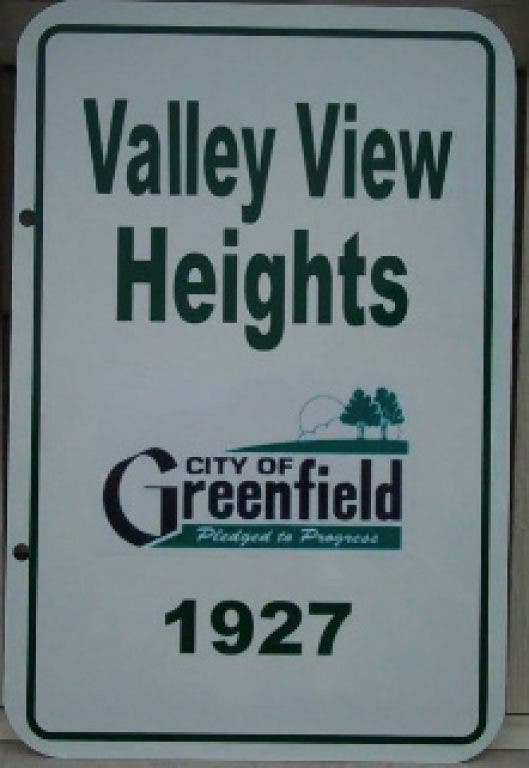
Earlier this week, Greenfield Patch ran a story on the Greenfield Historical Society's efforts to .
Below are the subdivisions that will receive the signs, separated into the years they are expected to get them, courtesy of Greenfield Historical Society president Bob Roesler:
2012BOULDER LANE PARK - 1938 - Spring Green & Edgerton
Find out what's happening in Greenfieldfor free with the latest updates from Patch.
The name of Edgerton Avenue was originally “Boulder Road”. It was changed to “Edgerton Avenue” as part of a county-wide street and address reorganization in 1930.
EDGERTON ACRES - 1954 - 68th & Edgerton
Find out what's happening in Greenfieldfor free with the latest updates from Patch.
This was the first of nine Greenfield subdivisions bearing the name of Edgerton Avenue, a street laid out in Cudahy in 1892 and named after Elisha Edgerton (1816-1904), who operated a stockyard and livestock commission business in Milwaukee.
HOWARD AVENUE PARK - 1927 - 53rd & Wilbur
This was the first of six Greenfield subdivisions bearing the name of John Howard, who acquired a farm southwest of present Howell and Howard Avenues in the Town of Lake in 1836. In 1884 the road in front of his house was named after him, and it retained that name as it was extended west into Greenfield.
JACKSON PARK HOMES - 1940 - 47th & St. Francis
Huge nearby Jackson Park, acquired by the Milwaukee County Parks System in 1908, was an attraction for nearby city dwellers.
LYNNDALE - 1895 - 32nd north of Lynndale
Lynndale is the second-oldest of Greenfield’s surviving subdivisions. Despite its proximity to the City of Milwaukee, the 1890’s depression and other events resulted in almost all of Lynndale’s lots staying undeveloped until well into the 1920’s.
RUE ACRES - 1942 - 67th & Holmes
Like many subdivisions, Rue Acres bears the name of the owner/developer of its acreage, in this case Larry La Rue.
VALLEY VIEW HEIGHTS - 1927 - 110th north of Layton
Though it had been described as “one big hill” with the lowest land value in Greenfield of $50 per acre in 1895, the “roller coaster” topography of the area northwest of Highway 100 and Layton Avenues proved attractive for residential development in the 20th century.
WHITNALL OAKS - 1990 - 82nd south of Layton
Charles Whitnall (1859-1949) was responsible for the purchase of the land and creation of nearby Whitnall Park, the “gem” of the County Park system, during 1929-1932.
WILDCAT CREEK HEIGHTS - 1976 - 117th & Van Beck
Wildcat Creek meanders through the uneven topography of northwestern Greenfield before it empties into the Root River east of S. 108th Street. The name was shortened to two words on the placard so that the larger lettering is readable for viewers.
WURSTER’S - 1924 - Morgan between 47th & 48th The Wurster family, Swiss immigrants, purchased this area in 1840 and owned it until it was subdivided.
2013BELOIT PARK MANOR - 1955 - 103rd south of Beloit Road
Unlike Greenfield’s other major diagonal streets which were originally Indian trails, Beloit Road was laid out by a surveyor in 1840. It never reached its stated goal, terminating on National Avenue in Waukesha County.
CLEMENT MANOR ESTATES - 1987 - 96th & Van Beck
The School Sisters of St. Francis who operate the nearby Clement Manor Care Facility have owned the property since 1902, and are a longtime presence in Greenfield, having built their convent southwest of 27th and Greenfield Avenue in 1891 when it was within the Town of Greenfield.
COLD SPRING GARDENS - 1955 - 64th & Plainfield
This was the first of five subdivisions that bear the name of Greenfield’s oldest continually-named street.
KERLER ACRES - 1938 - 104th north of Howard
This subdivision was established by four members of the Kerler family from Bavaria, which had owned this area since 1849.
KILBOURN ESTATES - 1944 - 34th & Bottsford
The name of South 27th Street during the 19th and early 20th centuries was “Kilbourn Road”, which although a half-mile distant from this subdivision, seems to have suited the developers’ fancy.
LAYTON HEIGHTS - 1955 - 72nd & Squire
This is the first of four Greenfield subdivisions to bear meat packer Frederick Layton of Cudahy’s name. Layton Avenue and many nearby east-west streets in Greenfield were given names that were extensions of those in Cudahy, which had incorporated in 1892.
2013 MAPLE GROVE - 1951 - 71st & Bottsford
The present Maple Grove school building is the fifth built nearby. The first began in the 1850’s southwest of 76th and Forest Home Avenue.
SOUTHGATE MANOR - 1959 - 36th & Bottsford
Southgate Mall in Milwaukee was the metro area’s first major postwar shopping center, opening in 1951.
TOWN HALL TERRACE - 1952 - 70th & Plainfield
The Town of Greenfield’s last town hall, built in 1932, was located nearby on S. 73rd and W. Forest Home Avenue. It was demolished in 1988.
TUCKAWAY ESTATES - 1928 - 30th & Vogel
The Tuckaway Country Club, created in 1924, neighbored this subdivision until it relocated in the City of Franklin.
2014ELMWOOD MANOR - 1928 - Durand & Midland
Named after the once-flourishing and dominant urban elms, this area was the 1835 homesite of William Strothmann, Milwaukee County’s first permanent German settler.
GREENFIELD GLEN - 1976 - 37th north of Edgerton
At its center this subdivision holds the Meyrose farmhouse at 3770 W. Holmes Avenue, dating from 1854. The Meyrose family, immigrants from swampy Hanover, Germany, amassed several hundred acres in Greenfield.
HEGELMEYER’S - 1894 - 52nd & Morgan
Named after Frederick Hegelmeyer, from the German Kingdom of Wurtemberg, who purchased this area in 1845, this tiny triangular portion of the oldest subdivision that remains in Greenfield is bordered by Forest Home Avenue, Morgan Avenue, and South 51st Street. The cream brick buildings on the site are the Leonard Weiler house (1865), Henry Lieber’s Winery (1872), and Zions Evangelical Church (1858).
HONEY CREEK CIRCLE - 1969 - East of Honey Creek Drive on Honey Creek Circle
This is the first of two subdivisions bearing the name of the stream that winds through Greenfield and nearby communities. The creek was given its name by early Greenfield settlers who discovered beehives along its banks.
MITCHELL HIGHLANDS - 1920 - Anthony & Midland
Much of the acreage to the north between Lincoln and Oklahoma Avenues had been the boyhood home of Gen. Billy Mitchell, prominent in the news in the 1920’s, whose father John L. Mitchell had owned the property. The Mitchell mansion, Meadowmere, still stands at 53rd and Lincoln Avenue.
PARKVIEW HIGHLANDS - 1929 - 44th & Ohio
The first of ten Greenfield subdivisions to include the attractive word “Park” in its name, it linked references to nearby Jackson Park with nearby subdivision Mitchell Highlands.
RAMSEY MEADOWS - 1985 - 38th & Kimberly
This is the first of four subdivisions bearing the name of nearby Ramsey Avenue. Originally named “Garden Terrace” when it was laid out in Cudahy, it was renamed “Ramsey Avenue” in 1930 as part of a county-wide changing of many street names. Greenfield’s portion of Ramsey Avenue was not built until later. Probably the Ramsey selected was Thomas Ramsey, who had been a prominent figure in Milwaukee County several decades earlier.
ROOT RIVER - 1949 - 92nd & Root River Parkway
Beginning northwest of Milwaukee County, the Root River winds through Greenfield and several other municipalities before it empties into Lake Michigan at the City of Racine, which means “Root” in French.
THE ORCHARD - 2007 - 90th & Forest Home
Portions of the apple orchard maintained by the Reilly and Karr families starting in 1859 remain on the property.
WEST ALLIS HEIGHTS - 1922 - 91st & Plainfield
The expanding City of West Allis, incorporated in 1902, was little more than a mile to the north of this subdivision when it was named, but it never extended further: The City of Milwaukee lies in between, having annexed the area between Howard and Oklahoma Avenues in 1955.
Get more local news delivered straight to your inbox. Sign up for free Patch newsletters and alerts.