Weather
Snow on its Way; Wintery Mix to Make it More Hazardous Later This Week
A round of snow heads our way Monday, with the potential to create slick, icy conditions on highways and common paths of travel this week.

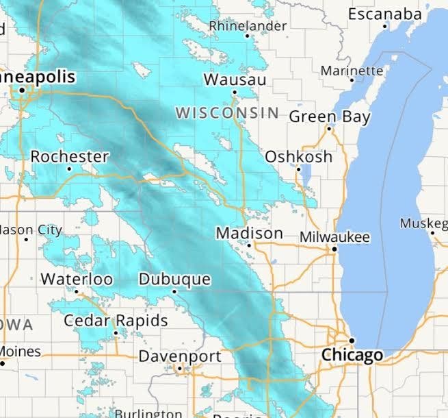
WISCONSIN -- The National Weather Service has issued a Hazardous Weather Outlook for Wisconsin during Monday into Tuesday as a round of snow heads our way, with the potential to create slick, icy conditions on highways and common paths of travel.
Monday
Several periods of light snow to southern Wisconsin this afternoon and tonight. Snowfall of an inch or two is possible with the heaviest towards Fond du Lac, Montello, Berlin and Sheboygan.
Find out what's happening in Greenfieldfor free with the latest updates from Patch.
A wintery mix of light freezing rain...Sleet and snow may cause slippery roads and hazardous travel across parts of the area late tonight into early tuesday.
Tuesday
Find out what's happening in Greenfieldfor free with the latest updates from Patch.
Areas of light snow mixed with sleet and light freezing rain will change over to mostly rain Tuesday morning. Total snowfall of 1 to 3 inches is possible.
Passing low pressure may bring another round of light snow and wintery weather to southern Wisconsin later Wednesday into Wednesday night. A period of light freezing rain is possible over parts of southeast and south central Wisconsin which would impact the Thursday morning commute.
>>> image via National Weather Service
Get more local news delivered straight to your inbox. Sign up for free Patch newsletters and alerts.