Weather
Severe Storms Could Hit Wisconsin In Several Rounds Wednesday
Large hail, damaging winds, tornadoes, flash flooding, heat and dangerous swimming conditions are all possible Wednesday.


MILWAUKEE, WI — Wisconsin residents waking up Wednesday should be ready for a potentially active and dangerous weather day.
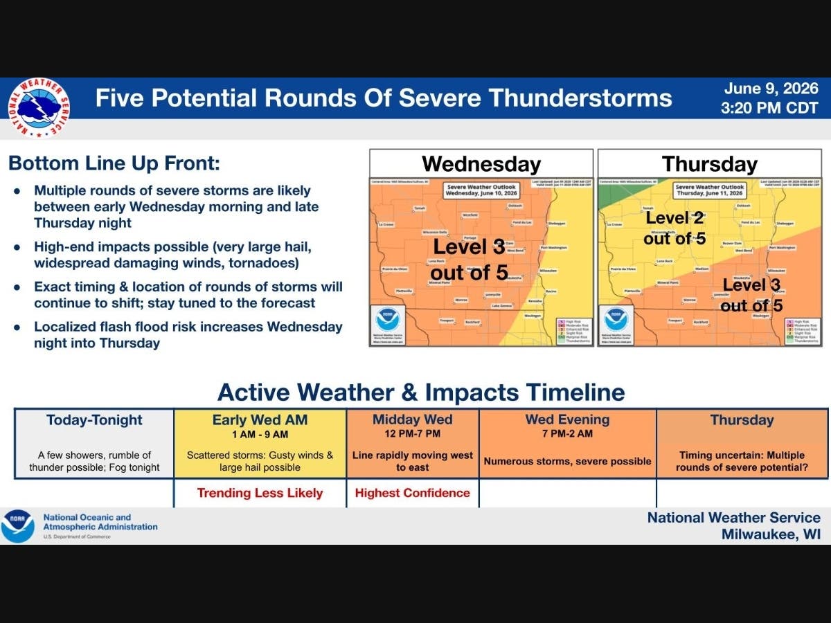
Multiple rounds of thunderstorms could reach severe levels Wednesday and continue into late Thursday night, according to the National Weather Service in Milwaukee/Sullivan. Large hail, damaging winds and tornadoes are all possible.
The Storm Prediction Center placed much of southern Wisconsin under a Level 3 out of 5 risk for severe weather Wednesday. Parts of Wisconsin are also under a severe weather risk Thursday, with a Level 3 risk in southeastern Wisconsin and a Level 2 risk farther west.
Find out what's happening in Milwaukeefor free with the latest updates from Patch.
Forecasters said the exact timing and location of the storms may continue to shift, but the National Weather Service said the highest-confidence period for severe weather is Wednesday afternoon.
Here is the general timeline from the National Weather Service:
Find out what's happening in Milwaukeefor free with the latest updates from Patch.
Early Wednesday morning, 1 a.m. to 9 a.m.
Scattered storms are possible, with gusty winds and large hail the main concerns. This round was expected to begin between 1 a.m. and 3 a.m., peak between 3 a.m. and 6 a.m., and end between 6 a.m. and 9 a.m.
Wednesday afternoon, noon to 7 p.m.
All hazards are possible, including tornadoes, damaging winds, hail and flooding. The storms are expected to move quickly from west to east. This round is expected to begin between noon and 2 p.m., peak between 2 p.m. and 5 p.m., and end between 5 p.m. and 7 p.m.
Wednesday night, 7 p.m. to 2 a.m.
More storms are possible, with all hazards still in play. The National Weather Service said the flash flooding risk will increase during this period. This round is expected to begin between 7 p.m. and 9 p.m., peak between 9 p.m. and midnight, and end between midnight and 2 a.m.
Forecasters said additional severe storms may be possible Thursday, though the exact timing remains uncertain.
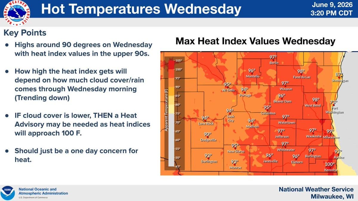
Other weather hazards are also possible Wednesday. Heat index values may approach advisory levels, especially in southeast Wisconsin.
A high swim risk is also likely at Sheboygan and Ozaukee beaches from late Wednesday afternoon into Wednesday night, according to the National Weather Service. Southeast winds are expected to drive high waves and dangerous currents. Swimming is not advised.
Spotter activation will likely be needed Wednesday and Thursday, the National Weather Service said.
Residents should keep multiple ways to receive weather alerts, including Wireless Emergency Alerts, a NOAA Weather Radio and local forecasts.
Get more local news delivered straight to your inbox. Sign up for free Patch newsletters and alerts.