Weather
Snow, Possible Thunderstorms This Week For Milwaukee Metro: WI Weather
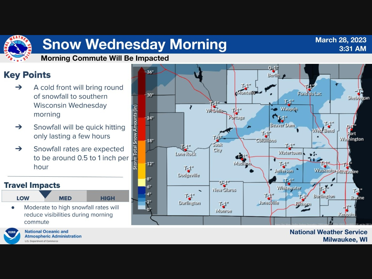
Residents can expect snow accumulations of less than an inch, but the storm will be "quick-hitting," advises the National Weather Service.


MILWAUKEE METRO — Mother Nature appears to be throwing everything but the kitchen sink at Minnesota this week. Weather officials are currently tracking storms that will bring rain, snow, and thunder to various parts of the state.
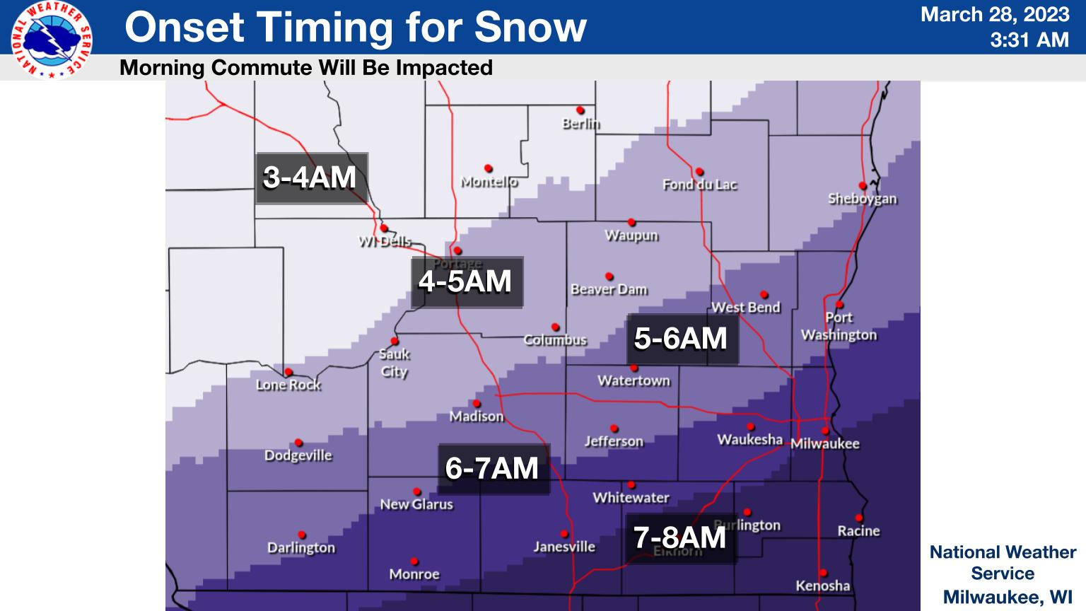
"A round of snow is likely to push through the area with a cold front late Tuesday night into Wednesday morning," the National Weather Service said.
"Snow accumulations under an inch are possible. Snowfall will be quick-hitting, only lasting a few hours, but rates will be moderate to high."
Find out what's happening in Milwaukeefor free with the latest updates from Patch.
Following the snow, Thursday and Friday will see rain and possible thunderstorms.
The good news for spring-lovers is that the temperature will jump quickly this weekend. Sunday will feature sun and temperatures in the mid-50s, according to the latest forecast.
Find out what's happening in Milwaukeefor free with the latest updates from Patch.
Here's the specific NWS forecast from the Milwaukee General Mitchell International Airport:
Wednesday: Snow, mainly between 8am and 11am. High near 34. Northwest wind 10 to 15 mph. Chance of precipitation is 80%. New snow accumulation of less than one inch possible.
Wednesday Night: Mostly clear, with a low around 18. West wind 5 to 10 mph.
Thursday: A slight chance of rain and snow after 2pm. Increasing clouds, with a high near 46. Southwest wind 5 to 15 mph becoming southeast in the afternoon. Chance of precipitation is 20%.
Thursday Night: Rain likely, then rain and possibly a thunderstorm after 2am. Temperature rising to around 47 by 3am. Breezy, with a southeast wind 15 to 20 mph, with gusts as high as 30 mph. Chance of precipitation is 90%. New rainfall amounts between a tenth and quarter of an inch, except higher amounts possible in thunderstorms.
Friday: Rain, with thunderstorms also possible after 2pm. High near 59. Breezy, with a southwest wind 15 to 20 mph becoming east in the afternoon. Winds could gust as high as 30 mph. Chance of precipitation is 90%. New rainfall amounts between a quarter and half of an inch possible.
Friday Night: Rain before 2am, then rain and snow likely. Some thunder is also possible. Low around 31. Windy, with an east wind 15 to 25 mph becoming northwest after midnight. Winds could gust as high as 35 mph. Chance of precipitation is 90%. New precipitation amounts between a half and three quarters of an inch possible.
Saturday: Rain and snow likely, mainly before 8am. Partly sunny, with a high near 40. Breezy. Chance of precipitation is 70%.
Saturday Night: Partly cloudy, with a low around 27.
Sunday: Mostly sunny, with a high near 52.
Sunday Night: A 20 percent chance of rain. Partly cloudy, with a low around 41. Breezy.
Monday: A 30 percent chance of rain. Partly sunny, with a high near 54.
Get more local news delivered straight to your inbox. Sign up for free Patch newsletters and alerts.