Weather
What To Expect From The Halloween Snowstorm: WI Weather
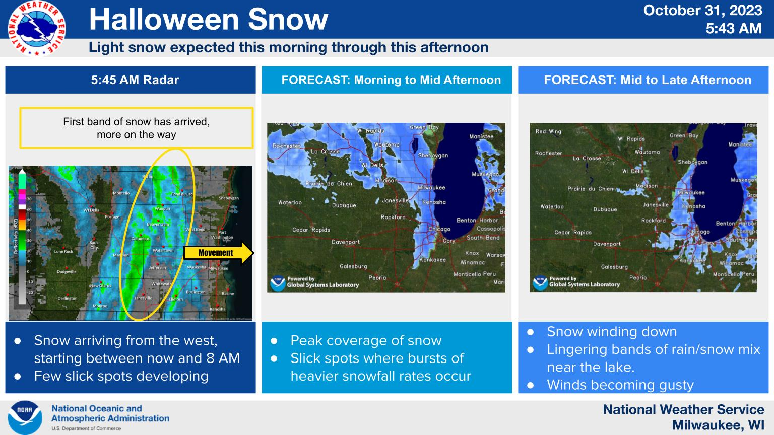
The morning's initial band of snow is followed by a second one expected to arrive Tuesday afternoon.


MILWAUKEE — A moderate snowstorm is still on track to impact the Milwaukee metro area and other parts of southeast Wisconsin Tuesday afternoon.
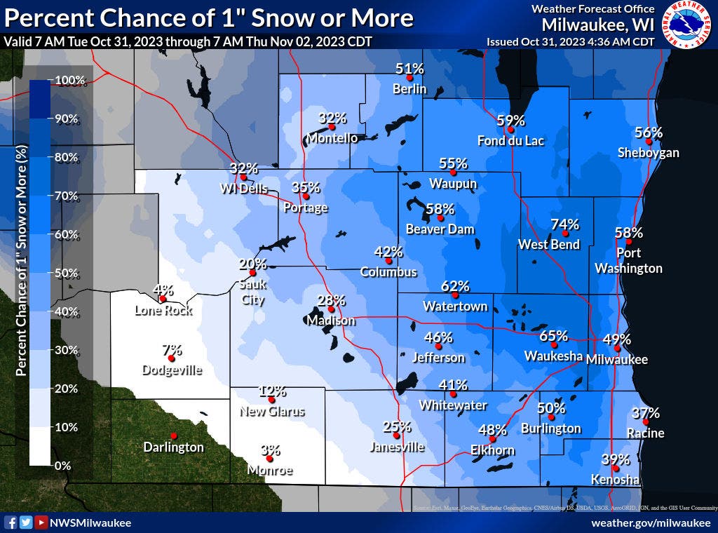
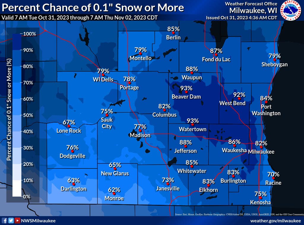
"Today will mark the first accumulating snow of the season, with anywhere from trace accumulations to 2 inches," the National Weather Service said.
"The highest amounts are forecasted for east central Wisconsin. Breezy winds will arrive this afternoon as the snow tapers off. Snow totals remain uncertain for areas along Lake Michigan, given that some rain is expected to mix in with the snow."
Find out what's happening in Milwaukeefor free with the latest updates from Patch.
The morning's initial band of snow is followed by a second one expected to arrive Tuesday afternoon.
Find out what's happening in Milwaukeefor free with the latest updates from Patch.
Here's the week-ahead NWS forecast from the Milwaukee Airport:
Tuesday: Snow showers before 1pm, then snow showers, possibly mixed with rain. Some thunder is also possible. High near 39. Breezy, with a southwest wind 5 to 10 mph becoming northwest 15 to 20 mph in the afternoon. Winds could gust as high as 30 mph. Chance of precipitation is 80%. Total daytime snow accumulation of less than one inch possible.
Tuesday Night: A chance of rain and snow showers before 8pm, then a chance of rain showers between 8pm and 10pm. Some thunder is also possible. Mostly cloudy, then gradually becoming clear, with a low around 24. Blustery, with a northwest wind 15 to 20 mph decreasing to 10 to 15 mph after midnight. Winds could gust as high as 30 mph. Chance of precipitation is 40%.
Wednesday: Mostly sunny, with a high near 41. Southwest wind 5 to 10 mph.
Wednesday Night: Mostly cloudy, with a low around 30. Southwest wind around 10 mph.
Thursday: Partly sunny, with a high near 47. Southwest wind around 10 mph.
Thursday Night: Partly cloudy, with a low around 34. Southwest wind around 10 mph.
Friday: Mostly cloudy, with a high near 52. Southwest wind 10 to 15 mph.
Friday Night: A 30 percent chance of showers, mainly before 1am. Mostly cloudy, with a low around 41. Southwest wind around 10 mph.
Saturday: A 20 percent chance of showers. Mostly cloudy, with a high near 51.
Saturday Night: A 20 percent chance of showers. Mostly cloudy, with a low around 38.
Sunday: A 30 percent chance of showers. Partly sunny, with a high near 50.
Sunday Night: A 40 percent chance of showers. Mostly cloudy, with a low around 42.
Monday: Showers likely. Cloudy, with a high near 51. Chance of precipitation is 60%.
Get more local news delivered straight to your inbox. Sign up for free Patch newsletters and alerts.