Weather
Strong Storms, Flooding Tuesday Evening
Be ready to seek shelter or safe harbor if you are on an inland lake if these storms approach your location.

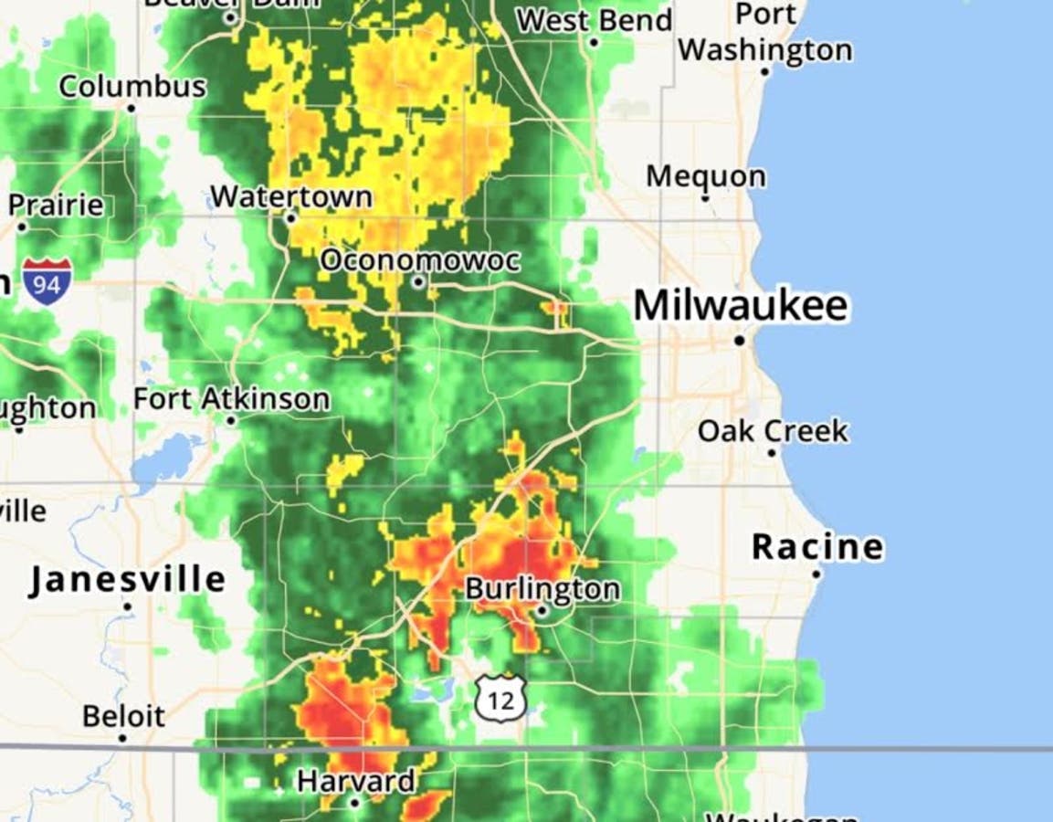
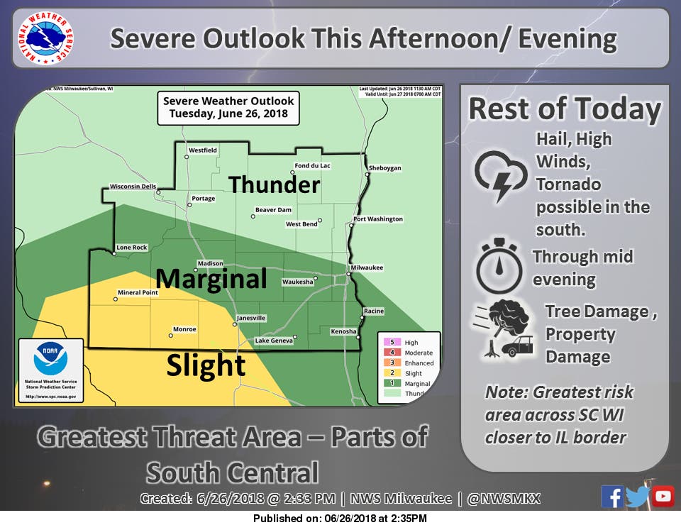
WISCONSIN — The National Weather Service is predicting that scattered strong to severe thunderstorms will continue to move across south central Wisconsin through mid-afternoon. A severe thunderstorm is possible, possibly producing large hail, damaging winds and a few tornadoes.
Flash flooding is also possible along with frequent cloud to ground lightning strikes. Be ready to seek shelter or safe harbor if you are on an inland lake if these storms approach your location.
Fast Facts:
Find out what's happening in Mount Pleasant-Sturtevantfor free with the latest updates from Patch.
- Hazards: Flooding and flash flooding.
- Areas Impacted: Far southern Wisconsin, bottom row of counties.
- Timing and Duration: This afternoon and through later tonight.
- Impacts: Flooded roadways and creek/river rises.
- Certainty and Considerations: Flooding to be most likely in areas that see repeated rounds of heavier rainfall.
Forecast
4pm - Mostly Cloudy, 70°
Chance of rain: 22%. Wind 8 mph from the SE.
5pm- Rain, 70°
Chance of rain: 53%. Wind 9 mph from the SE.
Find out what's happening in Mount Pleasant-Sturtevantfor free with the latest updates from Patch.
6pm - Rain, 70°
Chance of rain: 63%. Wind 11 mph from the ESE.
7pm - Rain, 70°
Chance of rain: 68%. Wind 11 mph from the ESE.
8pm - Rain, 70°
Chance of rain: 67%. Wind 10 mph from the ESE.
9pm - Rain, 70°
Chance of rain: 65%. Wind 10 mph from the ESE.
10pm - Rain, 69°
Chance of rain: 61%. Wind 11 mph from the ESE.
11pm - Rain, 68°
Chance of rain: 56%. Wind 9 mph from the SE.
12am - Light Rain, 68°
Chance of rain: 40%. Wind 7 mph from the SE.
Image Via NOAA/SullivanGet more local news delivered straight to your inbox. Sign up for free Patch newsletters and alerts.