Weather
23K Without Power As Nor’Easter Continues Siege In NJ
Rounds of high-tide flooding are anticipated along with strong winds as the nor'easter finishes its New Jersey assault.


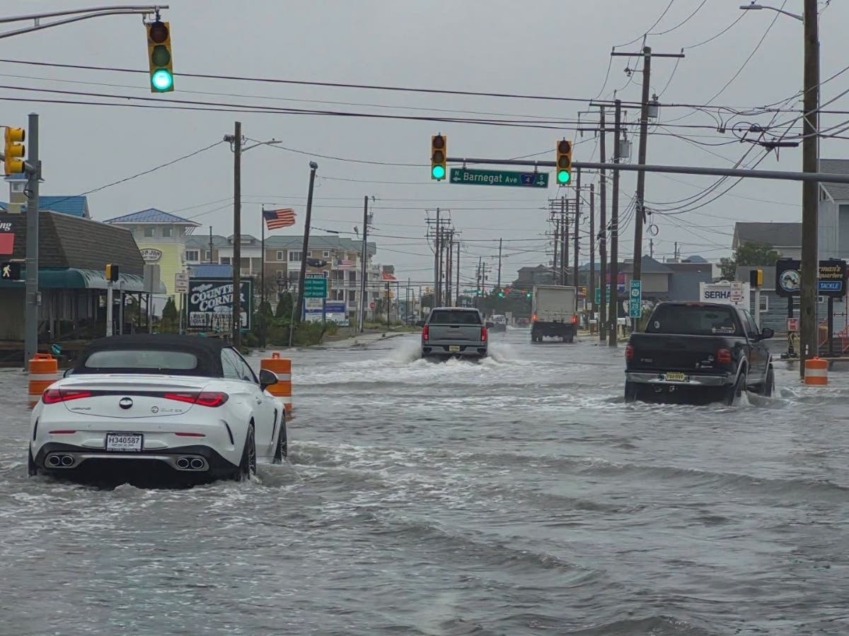
The nor'easter that caused flooding up and down New Jersey's coastline on Saturday and ramped up Sunday is not done with us yet, Governor Mikie Sherrill said Sunday.
”We’re not out of the woods yet,” Sherrill said, noting the Jersey Shore was still in for more bad weather.
Tens of thousands were without power as of 10 a.m. Sunday. The brunt of the losses were JCP&L customers, who were logging 22,861 interruptions in service. Atlantic City electric noted 166 outages impacting 1,165 customer snd PSE&G said 125 outages had 3,145 customers in the dark.
Sunday morning the National Weather Service said tidal flooding remains a risk.
Find out what's happening in Across New Jerseyfor free with the latest updates from Patch.
” Spotty major tidal flooding is still possible this morning across the back bays,” the NWS said. “Additional minor coastal flooding is possible this evening, but impacts will be gradually diminishing.”
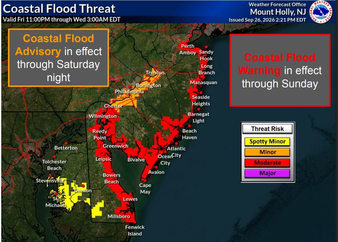
A state of emergency remains in effect across the state as high winds remain a threat.
Find out what's happening in Across New Jerseyfor free with the latest updates from Patch.
Flooding around Saturday morning's high tides prompted bridge closures and left many of Long Beach Island's streets under water.
Bayside areas have been particularly affected. Video published by OCNJ Drone showed the bayside of Ocean City significantly inundated.
The back bay tides will happen between midnight and 1 a.m., with the later times coming the farther inland the coastline is located.
The high tides will continue to be driven in part by the strong winds the nor'easter is packing. They remain persistently north to northeast, with sustained winds of 30 to 40 mph and gusts to 60 mph along the coast.
Inland gusts of 30 to 60 mph are expected for most of the state.
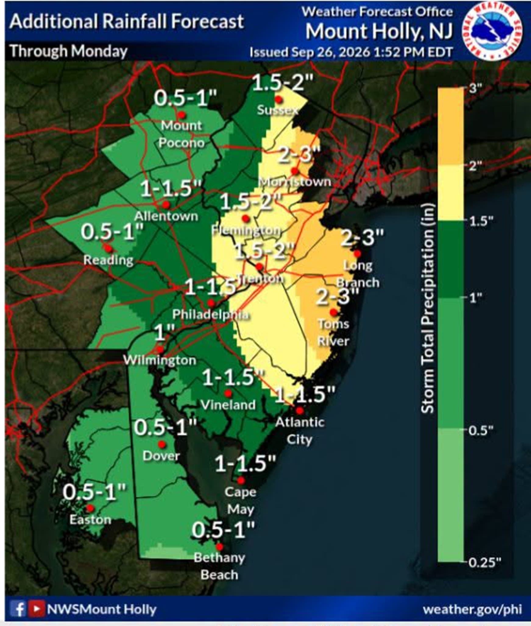
Additional rain is expected, with 1 to 2 inches along the I-95 corridor and as much as 1 to 3 more inches along the easter and northern parts of the state, with the rain continuing into Monday.
The rain could affect rivers across the state but most are not forecast to go into flood stage with the exception of the Millstone River, which is forecast to reach minor flood stage early Monday morning.
Isolated poor drainage and urbanized flooding may continue with any heavier rain through Sunday night, the weather service said.
Get more local news delivered straight to your inbox. Sign up for free Patch newsletters and alerts.