Weather
Isaias Weakens As Flooding, High Winds Remain Threats For AL Saturday
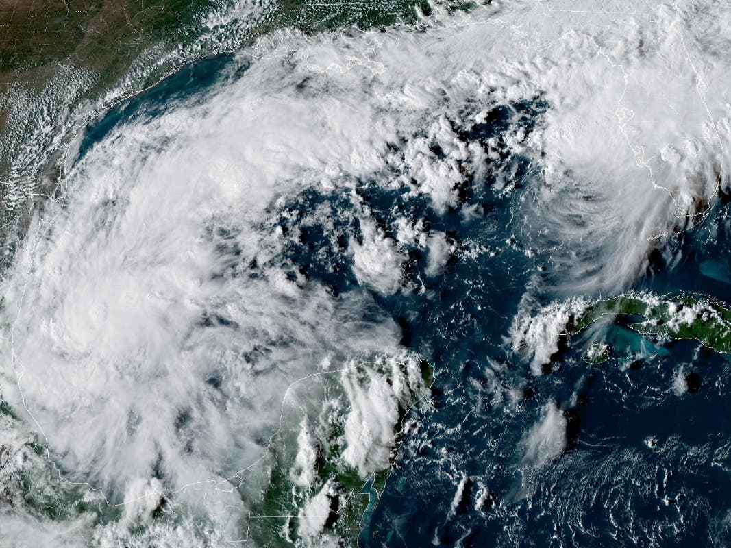
Hurricane Isaias weakened into a post-tropical cyclone overnight, but its remnants continued to bring impacts across Alabama.


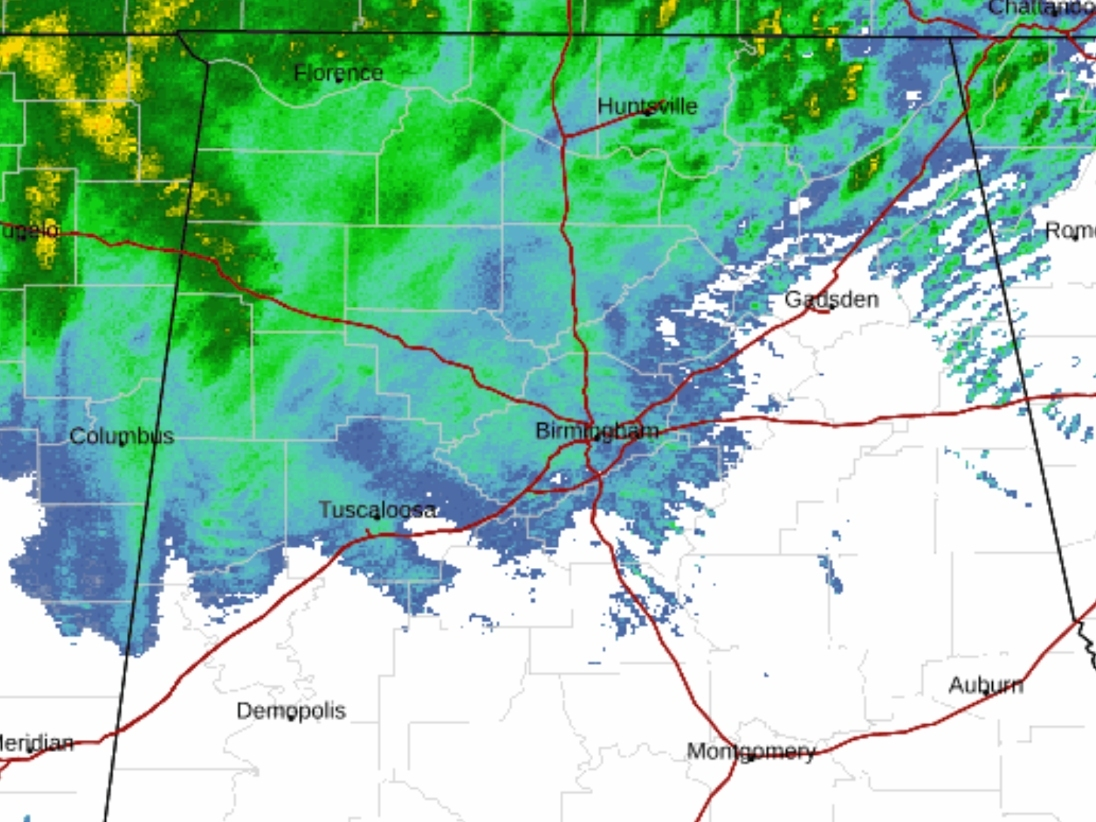
TUSCALOOSA, AL — Hurricane Isaias weakened into a post-tropical cyclone overnight, but its remnants continued to bring heavy rainfall, strong winds and flooding concerns to much of Alabama Saturday morning.
Click here to subscribe to our free daily newsletter and breaking news alerts.
As of 10 a.m. Saturday, the National Weather Service forecast office in Birmingham said lingering impacts from Isaias would continue through the afternoon, with wind gusts potentially reaching 40 to 50 mph in parts of central Alabama.
Find out what's happening in Across Alabamafor free with the latest updates from Patch.
A flood watch also remained in effect through 7 a.m. Sunday for much of the region, including Tuscaloosa County, as additional rainfall threatened to worsen flooding in low-lying areas and along creeks, streams and roadways.
The latest available numbers show 262,791 homes and businesses without power in Alabama, including 2,122 in Tuscaloosa County as of 10:30 a.m.
Find out what's happening in Across Alabamafor free with the latest updates from Patch.
The following counties are reporting the most outages:
- Houston County: 25,761 outages
- Mobile County: 24,843 outages
- Coffee County: 19,663 outages
- Baldwin County: 19,115 outages
- Jefferson County: 15,629 outages
- Geneva County: 12,774 outages
- Dale County: 11,794 outages
- Covington County: 8,847 outages
Officials confirmed to Patch Saturday morning that no damage or major flooding has been reported in Tuscaloosa County as of the publication of this story. This comes just hours before the University of Alabama's highly anticipated matchup with Georgia in Tuscaloosa.
NWS forecasters said portions of eastern central Alabama received between 2 and 4 inches of rain overnight, with another 2 inches possible Saturday, primarily across northern portions of the region.
Despite the continued threats, conditions are expected to gradually improve as the remnants of Isaias move northeast and out of Alabama.
The Alabama Emergency Management Agency said Saturday morning that Isaias had lost its tropical characteristics, prompting the discontinuation of all hurricane and tropical storm warnings.
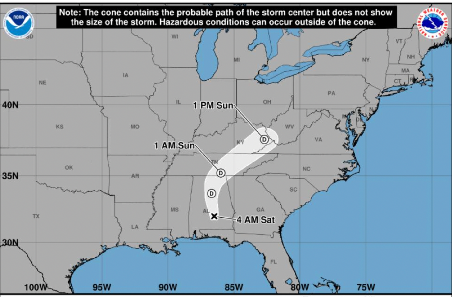
The storm's center was located just south of Montgomery at 4 a.m. and was expected to move north of Birmingham by early afternoon before exiting northeastern Alabama late Saturday.
The agency said there was no tornado threat anywhere in Alabama Saturday, a significant improvement from earlier forecasts that warned of possible isolated tornadoes as the hurricane moved inland.
Tuscaloosa And West Alabama Impacts
For Tuscaloosa and surrounding west Alabama communities, flooding and gusty winds remained the primary concerns Saturday morning.
The National Weather Service said a flood watch would continue through Sunday morning for Tuscaloosa, Hale, Greene, Pickens, Perry and Marengo counties, among others.
In addition to the outages reported in larger counties like Tuscaloosa and Jefferson, here are the latest impacts to other customers in the Tuscaloosa Patch coverage area:
- Bibb County: 2,592 outages
- Walker County: 2,252 outages
- Perry County: 977 outages
- Pickens County: 764 outages
- Lamar County: 659 outages
- Sumter County: 461 outages
- Greene County: 417 outages
- Fayette County: 402 outages
- Marengo County: 400 outages
- Hale County: 344 outages
While the heaviest rainfall was beginning to move out of southern Alabama, forecasters said areas near and north of Interstate 20 could receive an additional half-inch to 2 inches of rain before Saturday evening.
Wind gusts of 30 to 40 mph were also expected across portions of central Alabama, with stronger gusts possible elsewhere in the state.
Officials said the combination of saturated ground and gusty winds could create additional hazards from falling trees and power lines, while heavy runoff could lead to flooding in urban areas and locations with poor drainage.
The Alabama Emergency Management Agency said most rainfall should end statewide after 7 p.m. Saturday.
Storm Disrupts Alabama-Georgia Game Day
The storm's arrival also comes ahead of Saturday's highly anticipated Southeastern Conference matchup between No. 6 Alabama and No. 2 Georgia at Bryant-Denny Stadium.
As Patch previously reported, the University of Alabama announced sweeping changes to game-day operations Friday, including prohibiting all outdoor activities and tailgating on campus before noon Saturday.
Only uncovered tailgating will be permitted after noon, weather permitting, while campus parking lots and shuttle services are not scheduled to begin operating until noon.
Several traditional pregame activities have also been canceled or modified, while ESPN moved its popular College GameDay broadcast indoors to Coleman Coliseum.
Meanwhile, Patch reported Friday that President Donald Trump would no longer attend the game because of the hurricane.
Despite the disruptions, the game remained scheduled for a 6:30 p.m. CT kickoff as of Saturday morning.
Elsewhere in Tuscaloosa, the city canceled its weekly farmers market scheduled for Saturday at the Tuscaloosa River Market because of concerns about high winds and heavy rainfall.
The market is expected to resume its regular schedule Saturday, Oct. 17.
State Of Emergency Remains In Effect
As Patch previously reported, Gov. Kay Ivey declared a state of emergency Wednesday for 40 Alabama counties ahead of the hurricane.
The declaration includes Tuscaloosa and several surrounding west Alabama counties and is scheduled to remain in effect through Oct. 14 unless amended.
As Patch previously reported, Isaias made landfall near Destin, Florida, around 8:30 p.m. CT Friday as a Category 2 hurricane with maximum sustained winds of 105 mph, according to the National Hurricane Center.
The storm had previously strengthened into a Category 3 hurricane with sustained winds of 120 mph before weakening as it approached the Gulf Coast.
Improving Weather Expected Sunday
The National Weather Service said rain should gradually taper off Saturday evening as the remnants of Isaias continue moving northeast.
Temperatures Saturday are expected to remain relatively cool, with highs ranging from the mid-60s to mid-70s across central Alabama.
Overnight lows are expected to fall into the mid- to upper 50s before mostly sunny skies return Sunday, when temperatures should rebound into the mid-70s to mid-80s.
Despite the improving forecast, officials continue to urge motorists to avoid flooded roads and remain alert for downed trees and power lines.
Residents can follow the latest watches, warnings and forecasts through the National Weather Service in Birmingham.
This is a developing story. Patch will have more information as it becomes available.
Get more local news delivered straight to your inbox. Sign up for free Patch newsletters and alerts.