Weather
Severe Storms Possible in Alabama Thursday Night
The National Weather Service says the threat for severe weather for Central Alabama, is possible from 5 p.m. until 1 a.m.

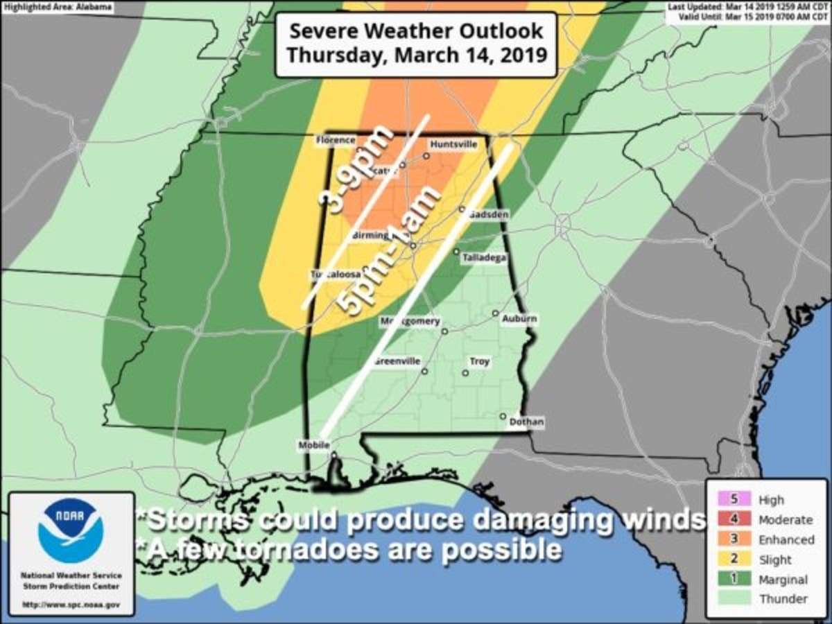
BIRMINGHAM, AL - The National Weather Service posted a statement warning of possible severe weather for parts of Alabama Thursday night. The NWS said the threat for severe weather in central Alabama will be at its highest between 5 p.m. and 1 a.m.
The Storm Prediction Center has introduced an enhanced risk (level 3 of 5) for parts of north Alabama, including places like Cullman, Jasper, Haleyville, Decatur and Huntsville. A slight risk (level 2 of 5) extends as far south as Demopolis, Calera and Weiss Lake. And a marginal risk runs down to Grove Hill, Rockford and Heflin.
(For more updates on this story and free news alerts for your neighborhood, sign up for your local Patch morning newsletter.)
Find out what's happening in Birminghamfor free with the latest updates from Patch.
Heavier storms will be capable of producing strong, potentially damaging winds, hail and a few tornadoes. Even with no thunderstorms involved, pressure gradient winds today out of the south could gust as high as 30 mph, maybe even up to 40 mph on ridges.
Get more local news delivered straight to your inbox. Sign up for free Patch newsletters and alerts.