Weather
Hurricane Zeta: How It Will Affect Alabama
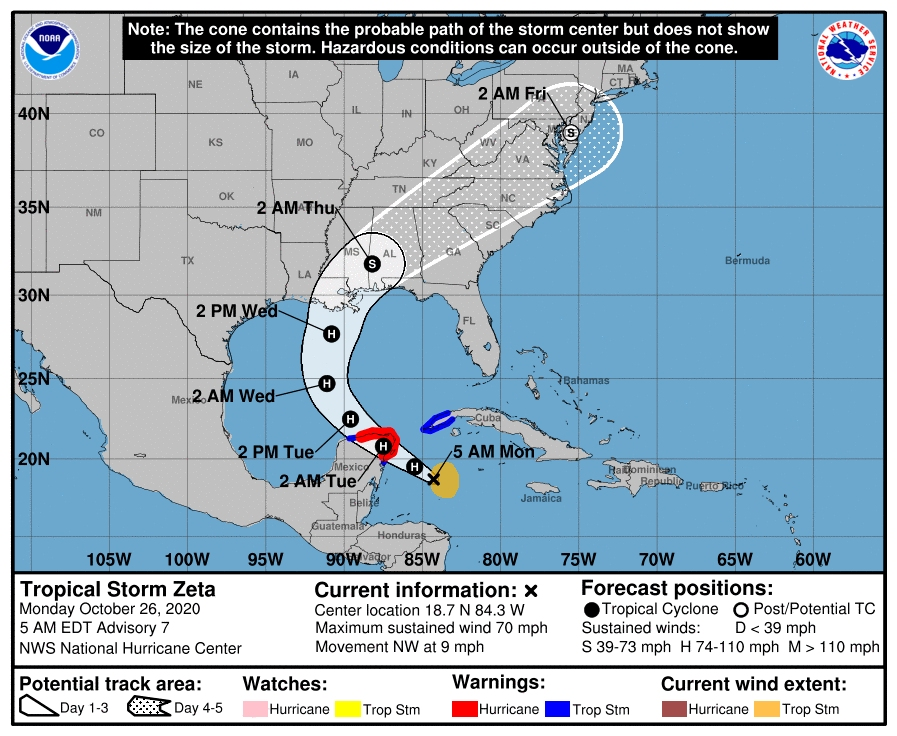
The National Hurricane Center forecasts Zeta to arrive on the southeast Louisiana coast late Wednesday or Wednesday night.

BIRMINGHAM, AL — The National Hurricane Center announced that Zeta, which was headed to the Yucatan Peninsula Monday morning, has reached hurricane strength, and Alabama should receive some of the effects of the storm later in the week.
Meteorologist James Spann said Zeta should drop below hurricane strength again due to increasing shear and the cooler shelf waters as it moves into the northern Gulf of Mexico Wednesday.
The National Hurricane Center forecasts Zeta to arrive on the southeast Louisiana coast late Wednesday or Wednesday night.
Find out what's happening in Birminghamfor free with the latest updates from Patch.
"Dangerous rip currents are likely on the coast from Gulf Shores to Panama City Beach Tuesday through Wednesday night; expect red or double red flags," Spann said. "Winds on the Alabama Gulf Coast Wednesday night could gust as high as 50 mph; sustained winds of 20-40 mph are likely. Gusts over the Florida Panhandle could reach 35-40 mph. There is also some risk of brief, isolated waterspouts or tornadoes Wednesday and Wednesday night along the coast."
Spann said Zeta will move quickly, limiting rain amounts. Rain totals for the coast will be between 1 and 3 inches. Also, some storm surge flooding is possible on the Alabama coast.
Find out what's happening in Birminghamfor free with the latest updates from Patch.
Rain is expected across Alabama after midnight Tuesday night, and Wednesday will be wet much of the day, Spann said. Rain continues Wednesday night and will end from west to east during the day Thursday. Rain amounts will also be in the 1- to 3-inch range for most of inland Alabama.
Spann said no major flooding is expected in the inland portions of Alabama.
"Winds across central and south Alabama Wednesday night could gust as high as 30-40 mph, but they won’t be high enough for tree or power line damage," Spann said. "There is also some risk of a few isolated, brief tornadoes over the southern half of Alabama Wednesday night."
Get more local news delivered straight to your inbox. Sign up for free Patch newsletters and alerts.