Weather
Breezes, Rain, Cooler Temperatures Arrive In The Pass Area
Banning, Beaumont's weather forecast for the weekend and beyond.

BANNING, CA — Breezes, light to moderate rain, and some snowfall at higher elevations, are in the forecast across the Inland Empire beginning Tuesday evening, with another system anticipated for the weekend, according to the National Weather Service.
"The main band of rainfall is still on track to move through Wednesday morning through mid-afternoon," the NWS said in a statement of the storm system descending out of the Pacific Northwest. "Light to moderate rain is expected in the rain band, and rainfall rates will mainly range from .1 to .2 inches per hour."
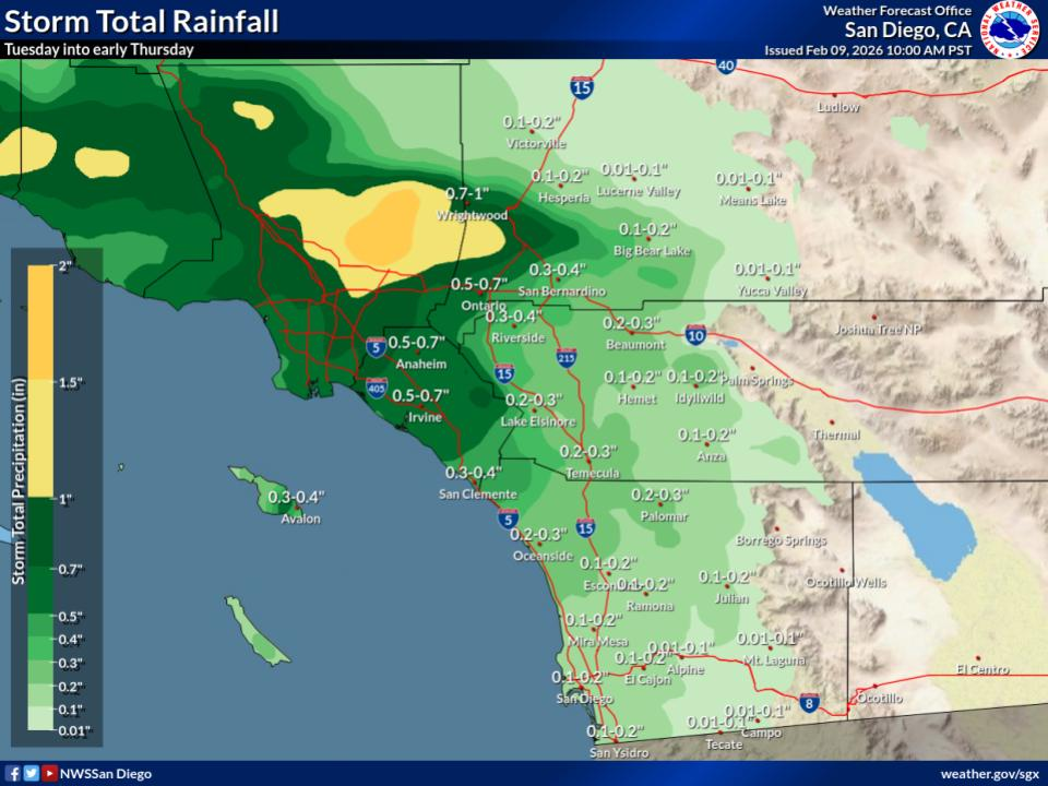
The Riverside metropolitan area is predicted to receive about a quarter inch of precipitation as the trough of low pressure lurches eastward. Lingering scattered showers are also expected Thursday, followed by clearing on Friday and most of Saturday, the weather service said.
Find out what's happening in Banning-Beaumontfor free with the latest updates from Patch.
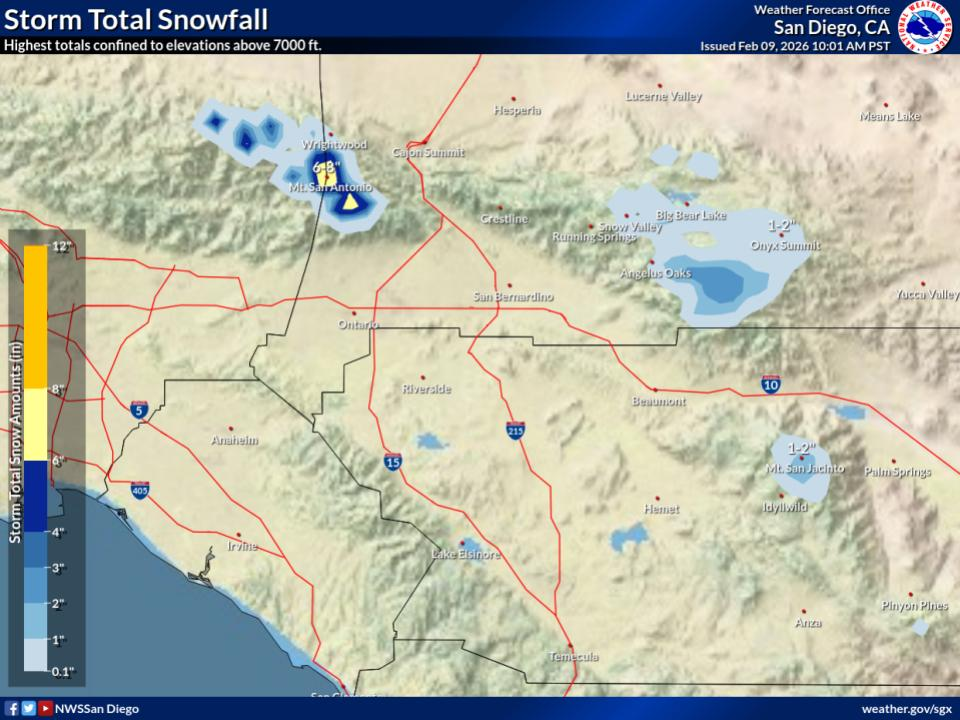
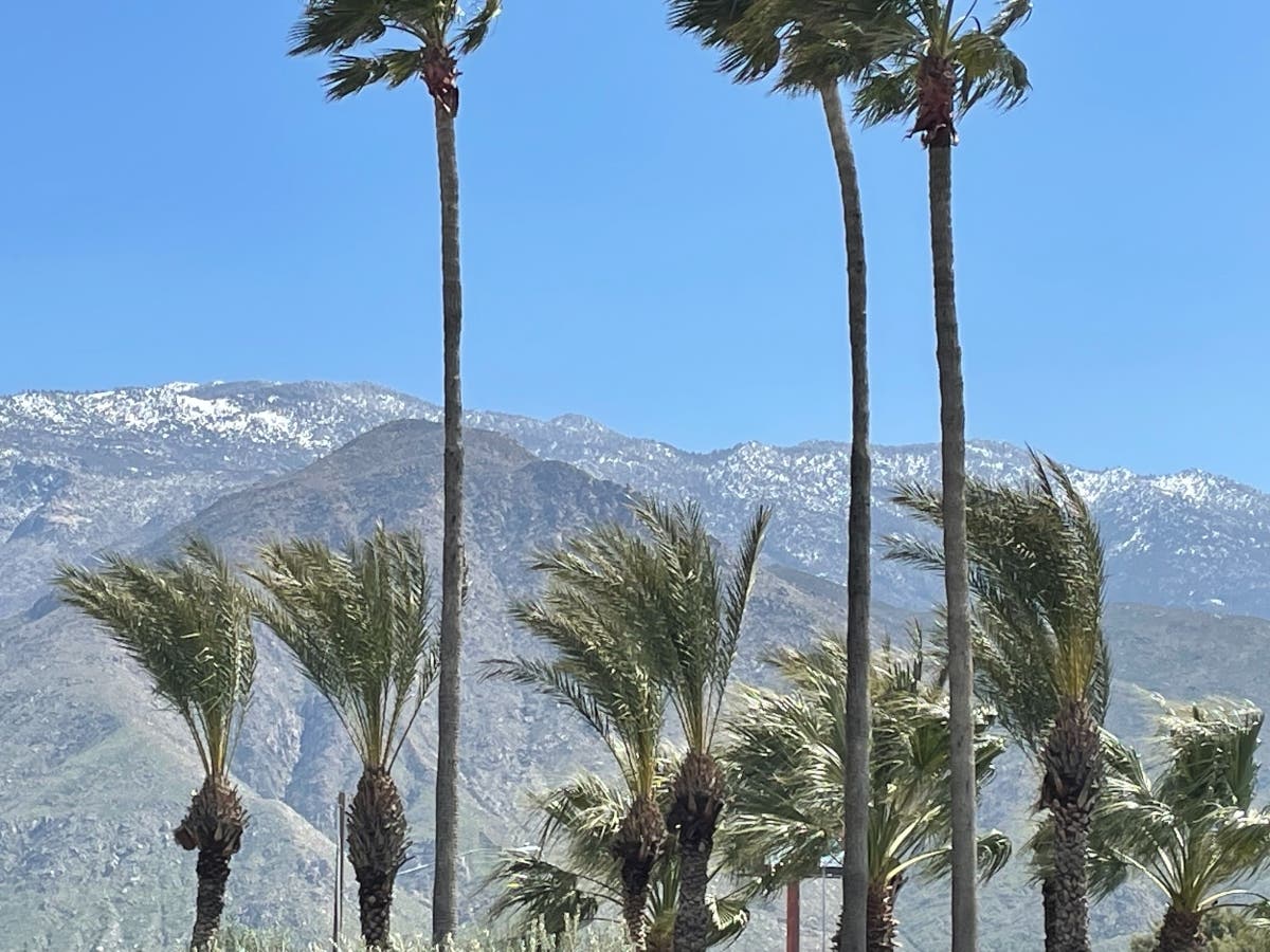
"Snow levels during the highest chance of precipitation are expected to be 6,500 to 7,000 feet," the NWS stated. "The latest forecast has one to three inches of snow from Tuesday night through Thursday for most locations. Higher accumulations will be above 7,000 feet."
Another series of troughs are winding down from the Gulf of Alaska behind a cold front, likely to sweep across the inland region Saturday night and Sunday, with lingering impacts going into Monday of next week, forecasters said.
Find out what's happening in Banning-Beaumontfor free with the latest updates from Patch.
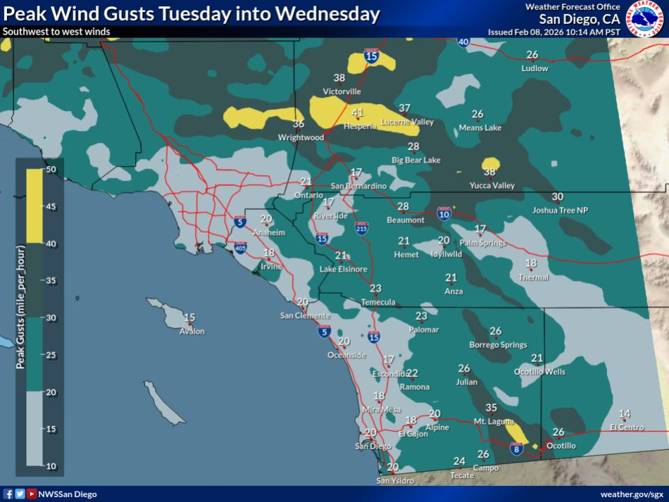
Along with the storm, gusting winds were expected through mountain passes and the deserts of the Inland Empire.
No precipitation amounts have been estimated yet, but as forecast models crystallize, meteorologists were expected to start making predictions.
Tuesday the Riverside metropolitan area's daytime high will top out around 70, with an overnight low in the low 50s. For the remainder of the week, highs will remain restrained due to the inclement conditions, with daytime temps in the mid 60s and lows in the upper 40s.
In the Coachella Valley, Tuesday's high will peak around 80, falling into the mid 50s overnight. From Wednesday to Saturday, highs will crest in the low 70s and bottom out in the low 50s.
The Temecula Valley's temperature range will be less than the rest, owing to coastal influences. Forecasters said Tuesday's high will reach the upper 60s, followed by a low around 50. From Wednesday to Saturday, highs will hover in the low to mid 60s, with the mercury dropping into the upper 30s at night.
Your seven day forecast from the National Weather Service is as follows for Banning, Beaumont, and the Pass Area:
Tuesday
Partly sunny, with a high near 67. Southwest wind 5 to 15 mph, with gusts as high as 25 mph.
Tuesday night
A chance of showers, mainly after 10pm. Patchy fog after 10pm. Otherwise, mostly cloudy, with a low around 49. West wind around 10 mph, with gusts as high as 20 mph. Chance of precipitation is 50%. New precipitation amounts of less than a tenth of an inch possible.
Wednesday
A chance of showers. Patchy fog. Otherwise, cloudy, with a high near 58. West wind 10 to 15 mph, with gusts as high as 25 mph. Chance of precipitation is 50%. New precipitation amounts between a tenth and quarter of an inch possible.
Wednesday Night
A slight chance of showers before 4am. Patchy fog. Otherwise, mostly cloudy, with a low around 43. West wind 5 to 10 mph. Chance of precipitation is 20%.
Thursday
A slight chance of showers after 10am. Patchy fog before 10am. Otherwise, partly sunny, with a high near 61. West wind 5 to 15 mph, with gusts as high as 25 mph. Chance of precipitation is 20%.
Thursday Night
A slight chance of showers. Partly cloudy, with a low around 45. Chance of precipitation is 20%.
Friday
Sunny, with a high near 63.
Friday Night
Mostly clear, with a low around 44.
Saturday
Sunny, with a high near 65.
Saturday Night
A slight chance of showers after 10pm. Mostly cloudy, with a low around 46.
Sunday
A chance of showers. Partly sunny, with a high near 60. Breezy.
Sunday Night
A chance of showers. Mostly cloudy, with a low around 42.
Washington's Birthday
Showers likely. Mostly cloudy, with a high near 54. Breezy.
Get more local news delivered straight to your inbox. Sign up for free Patch newsletters and alerts.