Crime & Safety
Current CA Fires: 5,000 Firefighters Battling 11 Major Blazes In Golden State [MAP, STATS]
Check out California's latest statewide fire summary and location map as of Thursday, July 27. (Breaking)


As warmer temperatures return to much of California, approximately 5,000 firefighters were deployed across the state as of Thursday, battling 11 large wildfires. Fortunately, crews continue to make progress on the largest incident, the devastating Detwiler Fire near Yosemite, which is now 75 percent contained.
You can catch the full California Statewide Fire Summary for Thursday, July 27 below. (Scroll down for a map of current fires and details on the major incidents)
High temperatures have returned to most of the state today. Many of the valleys and desert regions will experience triple digits today, as well as low humidity. These conditions are expected to remain through the weekend.
Find out what's happening in Banning-Beaumontfor free with the latest updates from Patch.
Many people don’t realize that 95 percent of all wildfires are caused by the activities of humans. It is imperative that all Californians do their part to prevent the next wildfire! Learn more at www.ReadyforWildfire.org
Find out what's happening in Banning-Beaumontfor free with the latest updates from Patch.
Courtesy of Cal Fire, here are the main fires of interest that crews are fighting as of Thursday, July 27:
**CAL FIRE Incidents**
Detwiler Fire, Mariposa County (more info…)
Detwiler Rd x Hunters Valley Rd, east of Lake McClure
∙ 81,350 acres, 75% contained
∙ Evacuations orders and warnings have been lifted in some areas
∙ CAL FIRE Incident Management Team 4 (Derum) in command
Ranch Fire, Amador County (more info…) NEW
Ranch Camp Road at Omo Ranch Road, NE of Fiddletown
∙ 140 acres, 50% contained
∙ Evacuations orders changed to evacuation advisory
Latrobe, Sacramento County NEW
Latrobe Road at Scott Road, near Rancho Murieta
∙ 1,286 acres, 85% contained
Park Fire, Fresno County (more info…)
Parkfield Rd x Hwy 198, west of Coalinga
∙ 1,649 acres, 99% contained
High Fire, San Bernardino County **FINAL**
High Road at Santa Rosa Road, Lucerne Valley
∙ 170 acres, 100% contained
**Unified Command**
Lost Fire, San Diego County (more info…) **FINAL**
Highway 79, north of Warner Springs
∙ 255 acres, 100% contained
**Federal Incidents**
Whittier Fire, Santa Barbara County (more info…)
Lake Cachuma area, south of Hwy 154
· 18,430 acres, 87% contained
Modoc July Complex, Modoc County (more info…)
Devil’s Garden and Warner Mountain Ranger Districts
· 40 fires
· Fires total 2,230 acres, 15% contained
Dollar Fire, San Bernardino County (more info…)
City Creek Road, NE of Highland
· 50 acres, 70% contained
Marble Fire, Siskiyou County (more info…)
Klamath River Highway north of Somes Bar
· 319 acres, 96% contained
Canyon Fire, Ventura County (more info…)
· 35 acres, 85% contained
Island Fire, Siskiyou County (more info…)
14 miles west of Etna in the Marble Mountain Wilderness
· 1,291 acres
Schaeffer Fire, Tulare County (more info…)
17 miles north of Kernville
· 16,031 acres, 94% contained
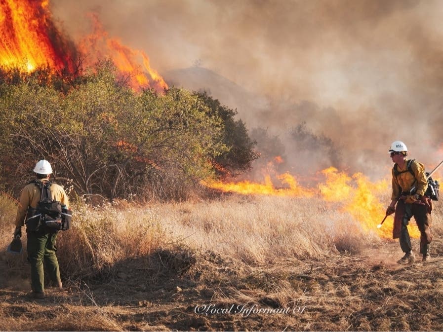
Image courtesy: Rodeo-Hercules Firefighters
Get more local news delivered straight to your inbox. Sign up for free Patch newsletters and alerts.