Weather
Heat, Monsoon Chances Next Week In The Pass Area: See How Hot It Will Get
Heat returns to the Pass Area and storm chances start Sunday in the mountains, the National Weather Service says. Will rain reach you?


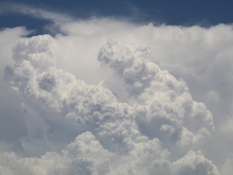
PASS AREA, CA — This weekend's slight cooling trend will burn off early next week as another high-pressure system parks over the Inland Empire, the National Weather Service says.
Starting Tuesday, temperatures in the Inland Empire will rise, bringing thunderstorms and monsoonal moisture to mountain areas. This will increase humidity and raise nighttime temperatures across the entire region, according to meteorologist Lauren Villafane.
Starting Sunday through much of the week, afternoon thunderstorms are expected in the mountains of the Inland Empire, possibly spilling over into area deserts and valleys, said meteorologist Lauren Villafane.
Find out what's happening in Banning-Beaumontfor free with the latest updates from Patch.
"Monsoon thunderstorms will be possible beginning Sunday and running through much of the week, accompanied by lightning, gusty and erratic winds and brief heavy rainfall," she said.
The biggest chance for afternoon monsoon storms is Monday, with 40 to 70 percent chances. Tuesday will see 20 to 40 percent monsoon chances, with more storms forecast through Thursday and Friday, at 30 to 50 percent chance in the mountains.
Find out what's happening in Banning-Beaumontfor free with the latest updates from Patch.
"It depends on what this ridge decides to do throughout the week.
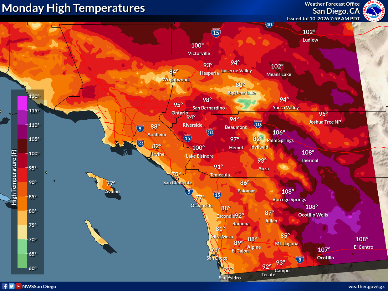
Monday, low deserts will see temperatures of 108, rising to 113 midweek. Pass Area residents will hover in the mid-90s, while Temecula Valley residents will hold in the low 90s, and mountain temperatures will hover in the low 80s.
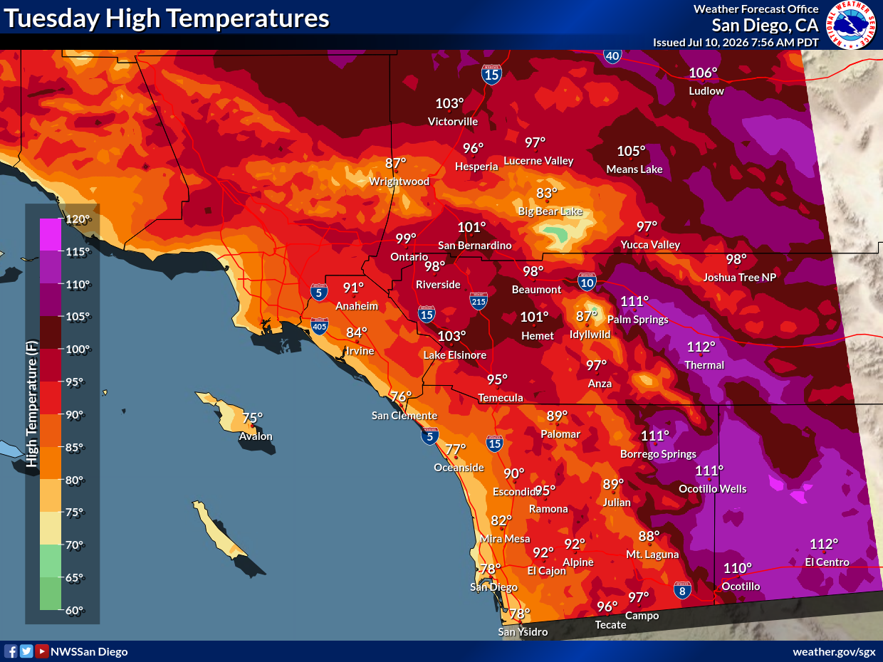
On Tuesday and Wednesday, temperatures will increase by about five degrees across the board, the NWS predicts.
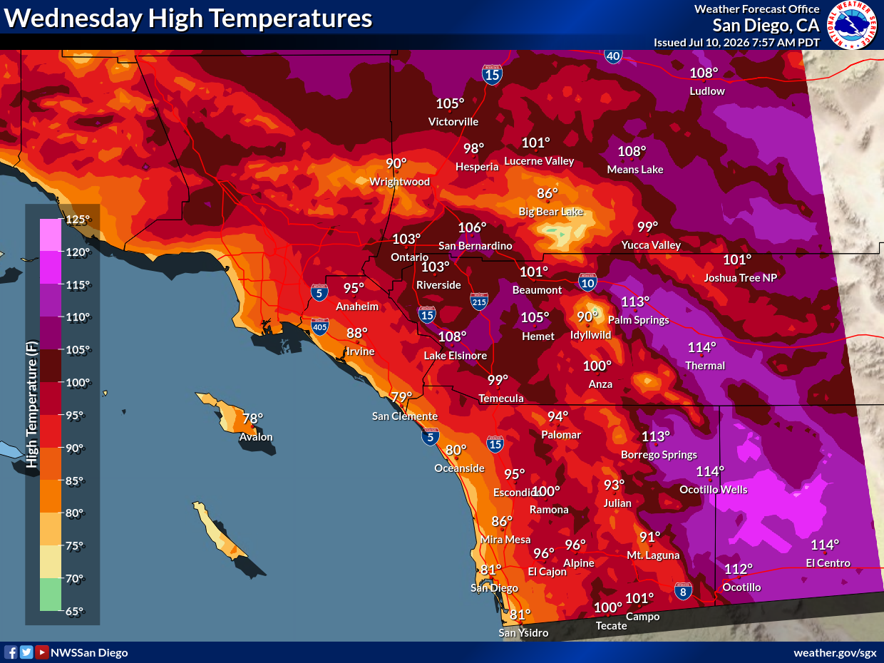
By Thursday, temperatures may trend slightly cooler due to the afternoon monsoonal moisture.
.png)
The National Weather Service Forecast for the Pass Area, is as follows:
Saturday:
Sunny, with a high near 100. East wind 5 to 10 mph becoming southwest in the afternoon. Winds could gust as high as 20 mph.
Saturday Night:
Partly cloudy, with a low around 70. West wind 5 to 10 mph becoming northeast after midnight. Winds could gust as high as 20 mph.
Sunday:
Partly sunny, with a high near 98. Southeast wind 5 to 10 mph becoming west in the afternoon. Winds could gust as high as 20 mph.
Sunday Night:
Partly cloudy, with a low around 71.
Monday:
Showers likely and possibly a thunderstorm after 11am. Partly sunny, with a high near 94. Chance of precipitation is 60%.
Monday Night:
A slight chance of showers before 11pm. Mostly clear, with a low around 70.
Tuesday:
A slight chance of showers and thunderstorms after 11am. Mostly sunny, with a high near 98.
Tuesday Night:
Mostly clear, with a low around 72.
Wednesday:
A slight chance of showers. Mostly sunny, with a high near 102.
Wednesday Night:
A slight chance of showers. Mostly clear, with a low around 73.
Thursday:
A chance of showers and thunderstorms. Mostly sunny, with a high near 99.
Get more local news delivered straight to your inbox. Sign up for free Patch newsletters and alerts.