Weather
IE Braces For Heavy Rain, 55 MPH Winds Thursday
Wind advisories are in effect for the San Gorgonio Pass and Riverside County mountains as a storm brings rain and possible thunderstorms.


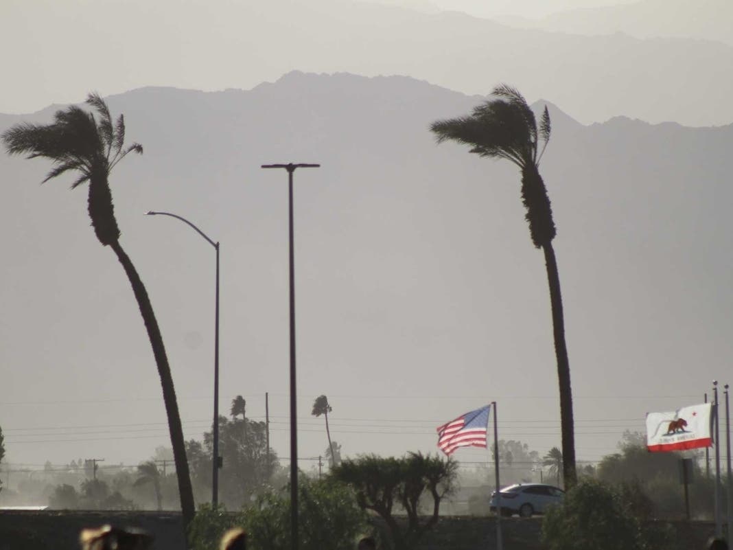
INLAND EMPIRE, CA — A powerful storm system is expected to bring heavy rain, possible thunderstorms, and wind gusts of up to 55 mph to parts of San Bernardino and Riverside Counties Thursday, raising concerns about localized flooding, power outages, and hazardous driving conditions, according to the National Weather Service.
Wind advisories will be in effect for the San Gorgonio Pass near Banning and the Riverside County mountains from 11 p.m. Wednesday to 4 p.m. Thursday. The advisories include Banning, Desert Hot Springs and Idyllwild-Pine Cove, with the strongest mountain winds expected along desert-facing slopes.
The approaching storm is forecast to move through Southern California on Thursday, bringing widespread showers, isolated thunderstorms and cooler temperatures to much of western Riverside County. Rain could become locally heavy, particularly during the afternoon, creating the potential for flooding along roadways and in areas with poor drainage.
Find out what's happening in Banning-Beaumontfor free with the latest updates from Patch.
Forecasters said the storm could produce intense rainfall over short periods, increasing the risk of localized urban flooding. Drivers should be prepared for wet roads, reduced visibility, and possible ponding during heavier downpours.
In the San Gorgonio Pass, west winds of 20 to 30 mph are expected, with gusts reaching 45 to 55 mph. Similar speeds are forecast in the Riverside County mountains, where south winds of 20 to 30 mph could produce gusts as high as 55 mph.
Find out what's happening in Banning-Beaumontfor free with the latest updates from Patch.
The gusty conditions could blow around unsecured outdoor objects, bring down tree limbs and cause isolated power outages, according to the weather service.
Thursday's Forecast Across Riverside County
Temperatures will vary across the region Thursday, with highs reaching only the upper 50s and low 60s in many inland communities while the Coachella Valley remains warmer.
In southwest Riverside County, Temecula and Murrieta are expected to reach highs near 61 degrees, with a 90% chance of afternoon showers. Lake Elsinore is forecast to reach 62 degrees, with an 86% chance of rain and the potential for water to collect on streets and in poorly drained areas.
Farther east, Banning is expected to reach a high of 57 degrees, while Beaumont will be cooler at approximately 54 degrees. Both communities face an 88% chance of rain Thursday, with showers possible from late morning into the evening. Gusty winds will create additional hazards through the San Gorgonio Pass.
In the Coachella Valley, Palm Springs and surrounding desert communities, including Palm Desert, Indio and La Quinta, can expect partly cloudy skies and highs generally in the low to mid-70s. Showers are possible during the afternoon, with the National Weather Service forecasting a 50% chance of measurable precipitation across the valley.
During the wind advisory, all residents are encouraged to secure loose outdoor furniture, decorations and other items that could become airborne during Thursday's strongest winds.
Motorists, particularly those driving trucks, recreational vehicles and other high-profile vehicles, should use extra caution in the San Gorgonio Pass and along exposed mountain roadways.
The wind advisories are scheduled to expire at 4 p.m. Thursday, but residents should continue monitoring National Weather Service forecasts for changing conditions.
What To Expect After The Storm
The storm is expected to move out of the region Thursday night, although lingering showers remain possible into early Friday.
Cooler, drier conditions are expected Friday through Sunday, with mostly sunny skies returning across much of Riverside County.
Friday's highs are forecast near 65 degrees in Temecula, 66 in Murrieta, 67 in Lake Elsinore, 61 in Banning and 57 in Beaumont. Palm Springs is expected to reach approximately 71 degrees.
According to the NWS, a second weaker storm system could bring additional light rain to Southern California late Sunday into Monday.
Get more local news delivered straight to your inbox. Sign up for free Patch newsletters and alerts.