Crime & Safety
Mother Nature Doubly Cruel To Apple Fire Residents, USFS Warns
"Remain alert to weather events and plan ahead" when traveling along roads and trails within and downstream from the burned areas.
CHERRY VALLEY, CA — The Apple Fire is 95 percent contained Thursday morning, 20 days after it broke out, and U.S. Forest Service officials said the blaze will have inevitable impacts well after it is fully extinguished.
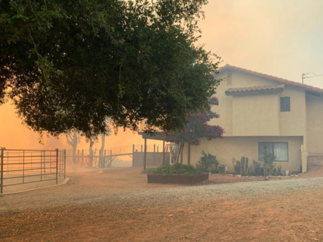
The impacts of the fire, which has burned 33,424 acres, include compromised soil that will increase flood risks that could damage homes and other structures in areas around the burn scar, the Forest Service said.
The agency released a statement urging "residents and visitors (to) remain alert to weather events and plan ahead when traveling along roads and trails within and downstream from the burned areas on the San Bernardino National Forest."
Find out what's happening in Banning-Beaumontfor free with the latest updates from Patch.
The USFS is already standing by to "assist affected businesses, homeowners and landowners in preparing for rain events" as the summer monsoon season reaches its apex, and as the winter rainy season approaches, according to the statement.
In its advisory, the Forest Service encouraged residents in Riverside and San Bernardino counties who are in the vicinity of charred spaces to pay close attention to National Weather Service alerts, as well as county evacuation warnings and mandates.
Find out what's happening in Banning-Beaumontfor free with the latest updates from Patch.
"Prepare for rainstorms by being prepared to evacuate if county or city emergency officials determine that flooding and mudflows are expected which could pose an increased threat to human life, safety and property," the agency stated. "Practice evacuations prior to real events. Understand that all drainages within and downstream of the burned areas can produce flooding."
High-intensity thunderstorm cells fueled by monsoonal moisture developed over the San Bernardino National Forest early Tuesday afternoon and tracked to the north, looking as though they would stall over the portion of the burn scar close to Forest Falls. However, the cells veered sharply to the northwest, with most of the energy shifting away from the fire zone.
The USFS released a burn severity map Tuesday highlighting the corrosive impacts of the nearly three-week Apple Fire, and according to the assessment, 75% of the burn area sustained moderate to severe soil damage.
"The (USFS) team expects erosion and run-off within the Apple Fire area to increase as a result of the fire because 75 percent of the burned area experienced moderate or high soil burn severity," agency spokesman Todd Ellsworth said.
He said the greater the burn severity, the higher the likelihood of heavy water and debris flows from slopes, threatening roads and communities below.
The map indicated run-off threats to Cherry Valley, the Morongo Indian Reservation and neighboring locations in both Riverside and San Bernardino counties.
Since sparking July 31 in Cherry Valley because of burning exhaust from a diesel vehicle, the Apple Fire has injured four firefighters and destroyed four homes and eight outbuildings. An estimated 2,600 residences and 7,800 people were evacuated at the height of the blaze, which has cost $51.8 million to confront.
Roughly 250 fire personnel remain assigned to the blaze, tightening containment lines, aided by five water-dropping helicopters, according to the USFS.
The brusher burned through federal, state and private lands, according to Cathleen Thompson of the U.S. Department of Agriculture, and several governmental agencies will have to conduct their own post-fire assessments, as the Forest Service has already done, she said.
The San Gorgonio Wilderness area -- where 7,249 acres have burned -- remains closed to the public.
The Pacific Crest Trail, which had been closed since the first weekend of this month, will be available to outdoor enthusiasts after daybreak Friday, with all barricades lifted between the Cottonwood Trailhead near Whitewater and Forest Road 1N01, also known as Pipes Canyon Road, at Onyx Summit.
"Portions of the San Gorgonio Wilderness on the San Bernardino National Forest, including inbound trails and associated parking lots, will remain closed at this time," according to a USFS statement. "Until the interior pockets of heat are mitigated, there remains a risk that the fire could flare up and move deeper into the wilderness."