Weather
Rain, Mountain Snow Heads To Pass Area: How Much, And When To Expect It
Falling temperatures, air quality alerts, and maybe even snowy weather is coming to the Pass Area. See when it will arrive.

BANNING, CA — The temperature is falling, and rain is expected to spread across parts of the Inland Empire and linger into the first half of the weekend, though precipitation is forecast to be light, according to the National Weather Service.
The agency said an upper-level trough of low pressure that formed over the Pacific and reached Central California Wednesday afternoon will "dig down" into the inland region Thursday, generating sporadic rain, which won't be intense.
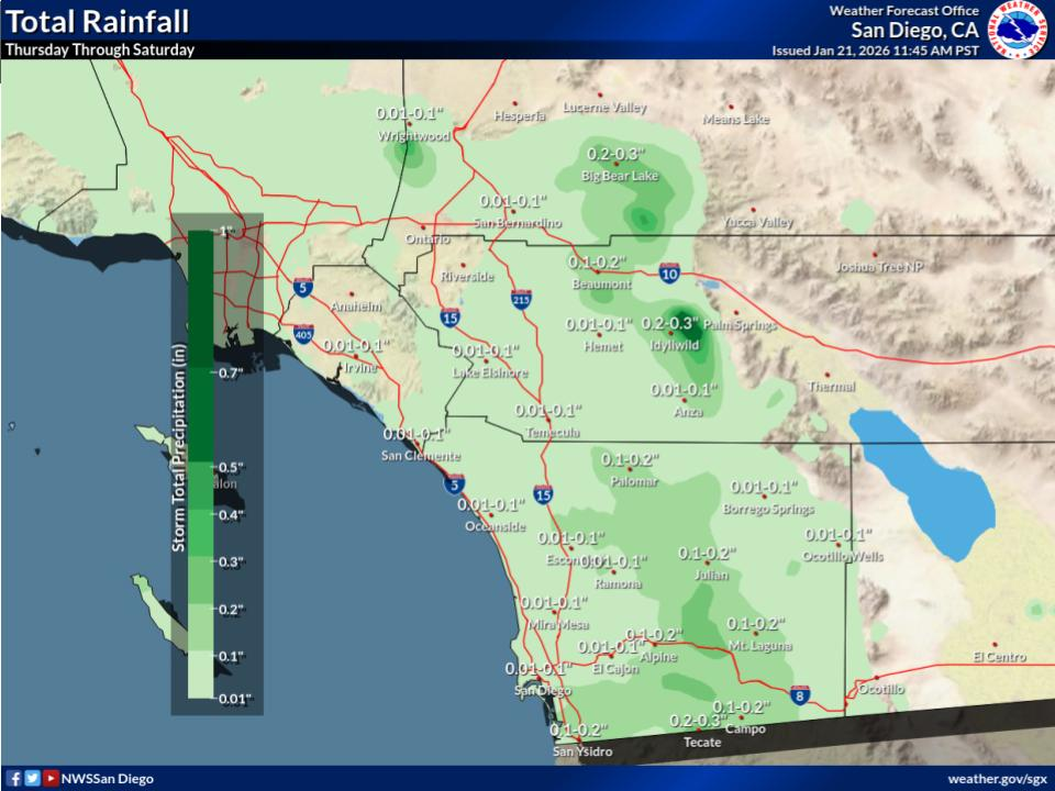
"The latest guidance is indicating hourly rainfall rates will range from .05-.25 inches per hour," the NWS said in a statement. "Rates at or near .25 inches per hour will be fairly isolated and most likely occur Friday."
Find out what's happening in Banning-Beaumontfor free with the latest updates from Patch.
Rainfall accumulations will be low in most places, meteorologists said.
Eyes are focused on the San Bernardino Mountains and ski areas. Snow levels will be above 8,000 feet until Friday night, when frozen precipitation may materialize around 6,500 feet, according to the Weather Service. The highest snowfall will occur at or above 7,000, with one or two inches of snow possible by Saturday.
Find out what's happening in Banning-Beaumontfor free with the latest updates from Patch.
The trough will be gone by Saturday night, followed by a ridge of high pressure that will spur the return of mild, dry conditions, according to forecasters.
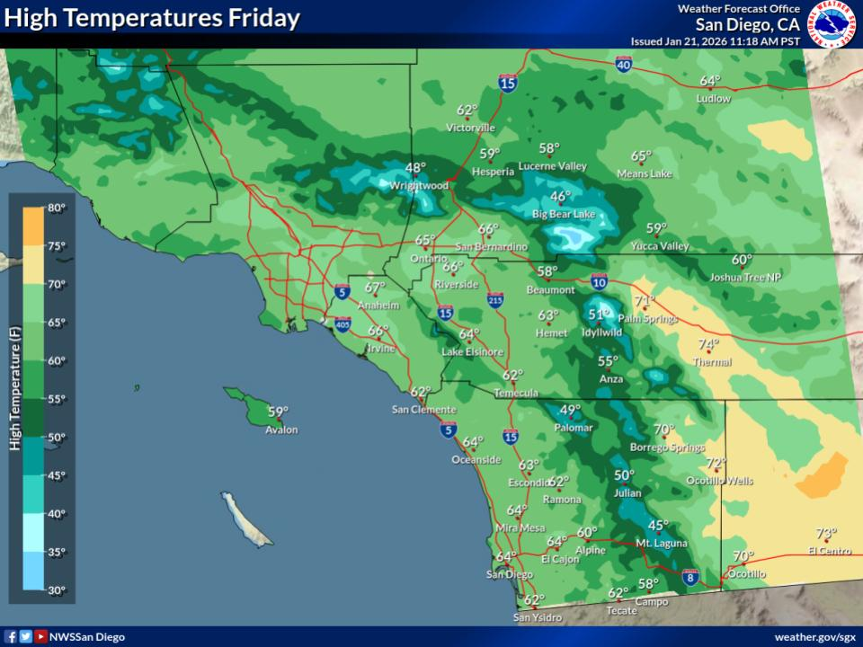
For Thursday to Sunday, daytime highs in the Riverside metropolitan area will generally top out in the mid 60s, falling into the low to mid 40s during nighttime hours.
In the Coachella Valley, the mercury will hover in the low 70s, followed by overnight temps in the upper 40s, from Thursday to Sunday.
The Temecula Valley's daytime highs will hold in the low 60s, dropping into the upper 30s at night, the NWS said.
The seven-day weather forecast in Banning and Beaumont is as follows:
Thursday:
A chance of showers. Mostly cloudy, with a high near 64. Calm wind. Chance of precipitation is 30%. New precipitation amounts of less than a tenth of an inch possible.
Thursday night
A chance of showers before 10pm. Patchy fog before 1am, then patchy fog after 4am. Otherwise, partly cloudy, with a low around 47. Southwest wind 5 to 10 mph. Chance of precipitation is 40%. New precipitation amounts of less than a tenth of an inch possible.
Friday
A slight chance of showers after 10am. Patchy fog before 7am. Otherwise, mostly sunny, with a high near 61. West wind 5 to 10 mph, with gusts as high as 20 mph. Chance of precipitation is 20%.
Friday Night
Patchy fog. Otherwise, increasing clouds, with a low around 47. West wind around 10 mph, with gusts as high as 20 mph.
Saturday
Patchy fog. Otherwise, mostly sunny, with a high near 60. West wind 10 to 15 mph, with gusts as high as 25 mph.
Saturday Night
Mostly clear, with a low around 42.
Sunday
Sunny, with a high near 59.
Sunday Night
Mostly clear, with a low around 43.
Monday
Sunny, with a high near 62.
Monday Night
Mostly clear, with a low around 44.
Tuesday
Sunny, with a high near 65.
Tuesday Night
Partly cloudy, with a low around 47.
Wednesday
Sunny, with a high near 66.
Get more local news delivered straight to your inbox. Sign up for free Patch newsletters and alerts.