Politics & Government
Changes Coming to Road Near Wilderness Park
There will soon be new stripes on Mills Avenue, a new pathway to the Claremont Hills Wilderness Park, and even a new ordinance for pedestrians aimed at keeping park users safe and area residents comfortable.

Members of Claremont’s City Council and city staff got some help shaping a plan proposed aimed at helping residents near the Claremont Hills Wilderness Park curb the amount of noise from park users and cut the number of encounters between pedestrians and motorists.
On Tuesday, after an hour and a half of negotiations, the council unanimously approved a plan to relocate the existing walkway on the east side of Mills Avenue to the west side.
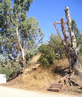
The plan, called the Mills Avenue Pedestrian Circulation Plan, also involves the installation of a mid-block crosswalk, striping of the roadway – which currently is not striped; the possible addition of a city ordinance allowing residents to cross Mills, but making it a citable offense if they walk up the road; and the removal of a row of Oleander trees that would run parallel to the new pathway that could possibly conceal path and hikers.
Find out what's happening in Claremont-La Vernefor free with the latest updates from Patch.
Different vegetation that is native to the area will replace the outgoing trees to the approval of some residents who came out to hear the discussion of the project.
The approval allows the city manager to put the project out to bid and appropriates $79,414 to cover additional costs. The removal of Oleanders will add only about $2,000 to the cost of the project.
Find out what's happening in Claremont-La Vernefor free with the latest updates from Patch.
“The northern portion of the pathway, from where it veers off to the left all the way up, is actually on PVP property, Pomona Valley Protective Agency property,” said Brian Desatnik, community development director. “Their board has reviewed this and supported the concept.”
The support is essential given how complex the work is. The PVPA and the Los Angeles County Flood Control District have some jurisdiction over the work that is done there.
Initially, the city’s plan addressed the pathway and crosswalk. Residents who said they were worried moving the path was not enough to encourage hikers to stop walking down the middle of the road, requested some of the other work, including the striping.
The city is dealing with a rising numbers of park users, many of whom are disturbing residents from the nearby Adirondack Lane neighborhood. Neighbors have complained of noise and foot traffic.
One resident told the council Tuesday that several people walk straight up the road paying no mind to residents driving in on their way home. When asked to take the existing pathway, “most people are nice, but others will tell you where to put it.”
It makes it tough on motorists who are uncomfortable having to follow a pedestrian on the street. It poses a risk for everyone, several residents said.
And with the eventual addition of a new parking lot near the park, it could bring even more people and worsen the problem. That work was stopped at the request of the Los Angeles County Flood Control District, who wants to review the project, said city manager Tony Ramos.
Get more local news delivered straight to your inbox. Sign up for free Patch newsletters and alerts.