Weather
Red Flag Warning Issued For Mendo Complex Fire Burn Area
Potential impacts are "dangerous and rapid irregular spreading of a large wildfire," the National Weather Service Sacramento says.

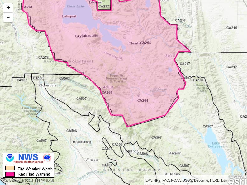
NORTHERN CALIFORNIA — A red flag warning is set to go into effect Friday morning just north of Sonoma and Napa counties in fire weather zones 279 and 264, where the 110,000-plus-acre Mendocino Complex Ranch and River fires continue to burn, officials with the National Weather Service in Sacramento said Thursday. The red flag warning begins at 11 a.m. Friday and continues until 11 p.m. Saturday, when very dry conditions and locally gusty ridgetop winds are forecast.
The highest threat will be in fire weather zone 264 near the Mendocino Complex burn area in Lake and Mendocino counties, with potential impacts being dangerous and rapid irregular spreading of a large wildfire, NWS officials said.
Locally west to southwest ridgetop wind gusts of up to 30 mph are forecast, with afternoon humidity levels of 15 to 20 percent expected and overnight humidity recoveries as low as 30 to 40 percent, weather officials said.
Find out what's happening in Healdsburgfor free with the latest updates from Patch.
This combination of strong winds, low relative humidity and warm temperatures can contribute to extreme fire behavior, according to the NWS.
As of noon Thursday, the Mendocino Complex fires were 39-percent contained, according to Cal Fire.
Find out what's happening in Healdsburgfor free with the latest updates from Patch.
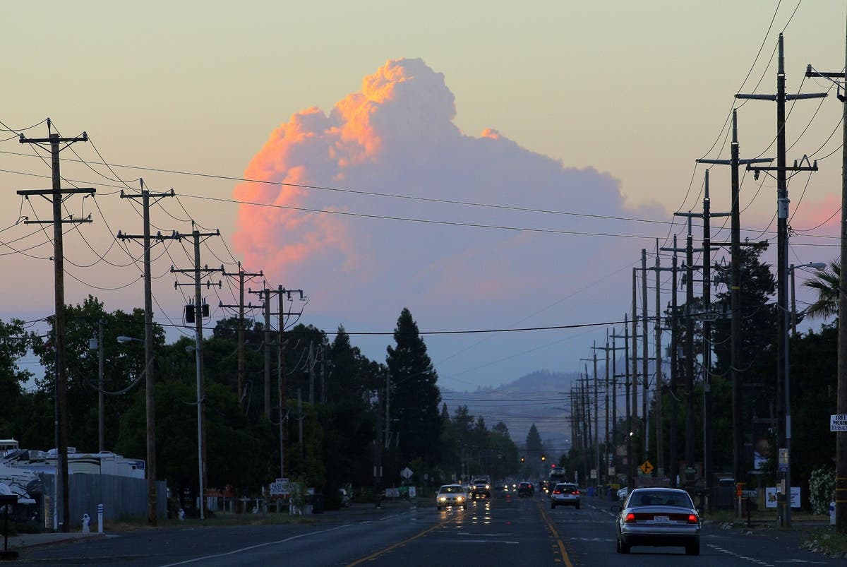
Main photo: A huge fire cloud created by Lake County fires at sunset Wednesday evening, Aug. 1, 2018 from South Santa Rosa Avenue near Rohnert Park city limit, looking north (Photo by Al Francis/Napasonomaphotos.com)
Get more local news delivered straight to your inbox. Sign up for free Patch newsletters and alerts.