Community Corner
Coastal Rail Line: San Clemente's Chris Duncan Op-Ed Piece Nailed It!
SC Mayor Pro Tem Chris Duncan's Voice of OC Op-Ed "We Must Act Now To Save Our Coastal Rail Line": What Non-Partisan Leadership Looks Like
As a professional land use analyst myself, plus the Executive Director of a watershed and coastal ecosystem watchdog NGO (Clean Water Now---founded in 1998), I was very pleased to read Mr. Duncan's excellent overview and summation of the situation.
https://voiceofoc.org/2022/10/duncan-we-must-act-now-save-our-coastal-rail-line/
I'm sure he was quite capable of going into the weeds, "wading in" on this 7 mile long conundrum but perhaps he avoided minutiae intentionally, not wanting to lose his audience's attention?
Find out what's happening in Laguna Beachfor free with the latest updates from Patch.
His piece was astutely succinct. My only purpose here is to educate, to backfill, provide more details about the origins, the genesis that has led us here. "Here" being the very expensive solution scenarios, the remedial actions and mitigations measures currently in HELP, EMERGENCY, SOS mode.
Many a time that decisions made in semi-panic, in anxious haste themselves led to unintended negative consequences. Ones made in anger or retribution even more so. This is not the time for incriminations or partisanship: Mr. Duncan's Op-Ed is to me, as a USMC veteran, a challenging call to action, great community outreach, i.e., "All Hand's On Deck!"
Find out what's happening in Laguna Beachfor free with the latest updates from Patch.
The negative consequences of SOC build-out seemed to unravel in an apparent incremental, unrelated fashion, when in fact human activities during a very brief window of time (50s---early 70s) made our present quandary, scientifically, quite predictable.
Complex in the contributive causal factors, the majority having occurred 50-60 years or so ago, any path(s) forward will in turn be complicated as a function of that huge pile of irreversible influences, murky alternatives and resulting hindrances which got us here.
To paraphrase the cartoon figure Pogo, most should recognize my personal exasperation and frustration were previously memorialized in a poster from the very first Earth Day on April 22, 1970: "We have met the enemy and they is us."
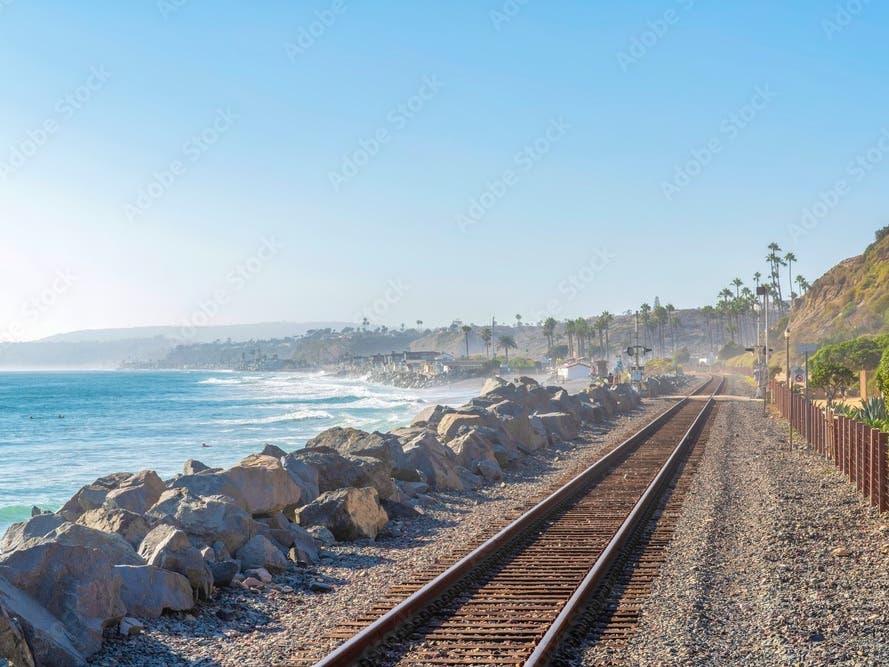
There is a historical nexus between the ramped up development of the San Juan Creek Watershed (SJCW), Doheny State Beach (DSB), Dana Point Harbor (DPH) and the now sand-starved beach strands beginning at Do Ho on down to around Cotton's Point in south San Clemente.
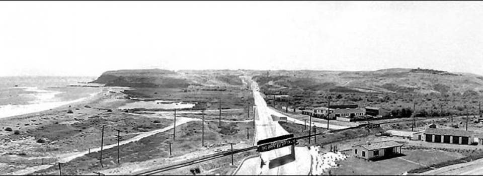
This photo, looking west up the Roosevelt Highway (today’s Pacific Coast Hwy.), was taken in the 1920s before there was a Doheny State Beach. Note the train tracks and bridge. Source: Doheny State Beach Foundation Archives
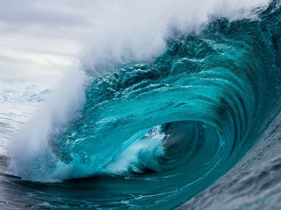
And for those with a sarcastic humorous bent (like me), there's no small irony in that name "Pacific Surfliner." That's because the train itself could well end up in the Pacific Ocean surf lineup, hopefully empty and no one injured, but if occupied, COWABUNGA! That'd be some kinda el bizarro stoke.
Like an algorithm, unfortunately an apparently unforeseen formula for failure, this South OC coastal rail section, just as it has in Del Mar, had a shelf life when planned then aggressively pursued. Finger pointing, blame game time is over.
Those who planned and built are probably deceased or in nursing homes anyway, so if you must, disinter or dislodge them for retributive sanctions and tribunals. Obviously, a dead end strategy.
The SD Association of Governments (SANDAG) and the City of Del Mar seem to have procured public agency attention and beaucoup ducats (oodles of funds) for the preliminary phases, to the tune of $300 million according to a column posted last Thursday at ENR (see below). Photo provided by SANDAG

$300 million to study, to plan the realignment of a mere 1.7 miles of track. Recent studies and citizen working groups were diligent, but their clock is ticking, time is running out, something we in SOC have in common.
"The funds are earmarked to complete the environmental process and advance engineering work for a long-term solution for construction of the realignment, even as the agency continues to seek funding for the project that officials say could range between $3 and $4 billion."
https://www.enr.com/articles/55049-erosion-threatened-calif-rail-line-gets-300m-for-relocation-plan
If you can't open this link, there are others that can be found online with the same information. Do the math: SOC is dealing with ≈ 4 times that of Del Mar, about 7 miles.
Many negative environmental factors compounded each other both down there and up here, thus entropy is progressing faster than political or public agency apologists and posturing can stay up with.....let alone earmarking precious gross funds during tough fiscal times.
Returning to our unique SOC riddle, contemporaneous with the inland development of SJCW, now approaching 50% impervious surface, was the creation of DPH and DSB.
Replenishing sediment transportation from formerly rural, open space, which contained large volumes of sand that found their way to the SJC mouth during peak rant events, were discharged and then dispersed/spread along those few precious miles of coast? That no longer occurs.
Most experts agree: Approximately 85% of our sand came from inland, natural sloughing processes and eventual downstream migration, 15% from the erosion of coastal bluffs. Hence with 50% of the SJCW now hardened, homes built on the bluffs, it's plain common sense, one gets this disappearing beach effect.
Little if any now finds its way to ocean. The "littoral zone," that HAD acted as an offshore sand bank parallel to the beach, that redeposited resources which moved according to seasonal swell and deeper current directions? It has been wiped out like the point break I remember surfing, Killer Dana.
The littoral is now at best extremely dysfunctional, and DPH has severely disrupted circulation patterns that historically kept the area scoured and scrubbed for several miles, but in a natural equilibrium stasis for millennia. Plus higher dissolved oxygen levels that help sustain marine life.
The once thriving floodplain and estuary at DSB acreage was reduced by 90% (see photo above). It HAD populations of indigenous species of both flora and fauna in residence, today missing them entirely. Go down there now, the lagoon is stagnant, it's in pitifully distressed shape and no one other than NGOs like mine seems interested in restoring it.
For those of us who know Trestles, San Ono, etc., the point of discharge and estuary of San Mateo Creek, just around the corner from Cotton's, it reflects an entirely different world: Indigenous threatened and endangered riparian and aquatic species (flora and fauna taxa) in residence, not only surviving but thriving from the lagoon up through Camp Pendleton to the Cleveland Nation Forest pristine headland waters.
In its sub-watersheds too. Acres and acres of open space, natural erosion, sediment transport hence sand migration and replenishment processes are relatively intact for this OC-SD County border watershed system. Unlike the SJCW, the natural components are still in place because it's relatively undeveloped in comparison.
Which is the way the San Mateo Creek Watershed should stay. A showcase for nearly extirpated classic So Cal coastal sage scrub ecosystems, an estuary with Tidewater Goby and Southern Steelhead trout, hopefully all of the resources never exploited and their critical heritage, their legacy permanently destroyed.
Mother Nature bats last, and She's not capricious, frivolous or haphazard in Her actions. As stewards and Her willing assistants, neither should we. All else is folly.