Crime & Safety
Lake Forest Evacuation Maps Released: What To Know
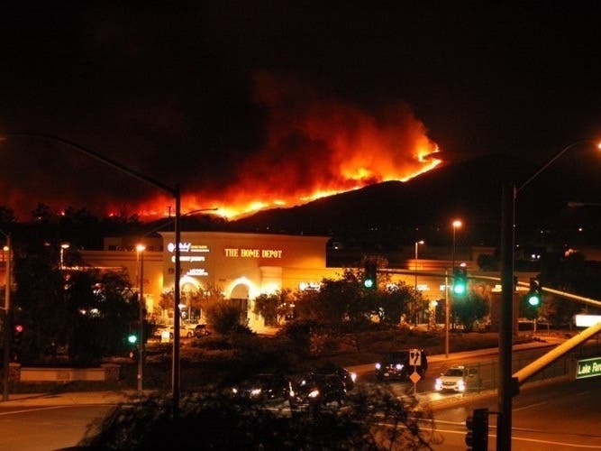
Lake Forest is a high fire risk city, so knowing not just one but two evacuation routes is essential.

LAKE FOREST, CA —The city of Lake Forest has released its latest evacuation maps for residents.
If an evacuation is ordered because of wildfire or other emergencies, type your address in the map to determine the status of the order in your neighborhood.
Residents living in neighborhoods near high-risk fire areas are encouraged to be ready for wildfires by practicing fire safety. Ready, Set, Go! gives you the tools to protect you, your family, property and your community from wildfires, the city of Lake Forest says.
Find out what's happening in Lake Forestfor free with the latest updates from Patch.
"Firefighters train hard to prepare for wildfires—residents need to do the same, according to the city," they say.

For more information on how you can be ready for wildfires, visit the Orange County Fire Authority's Ready, Set, Go! Safety program.
Find out what's happening in Lake Forestfor free with the latest updates from Patch.
Get more local news delivered straight to your inbox. Sign up for free Patch newsletters and alerts.