Community Corner
Lake Forest Sky Dance Sunset Heralds Rain On The Way
Patch loves photos! A Lake Forest resident showed what she called a dance in the sky above our lake! Thunderstorms are coming, the NWS says!

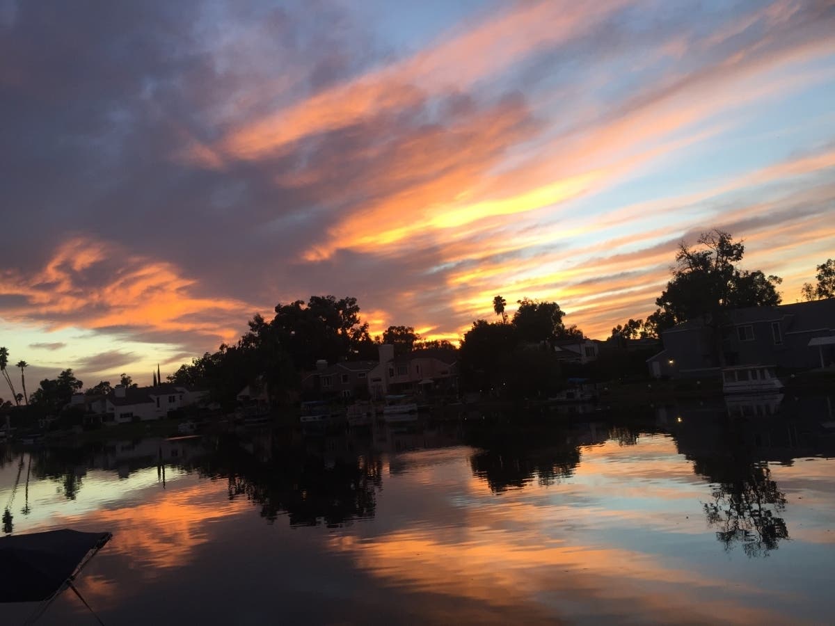
LAKE FOREST, CA — Let's all pause and drink in this glorious Lake Forest sunset. Resident Waheeda Kurji shared this lovely image with Patch, capturing a sunset moment and the true feeling of stopping to remember what makes living here worthwhile.
"I live in Beautiful Lake Forest, and want to share my sunset moments with Patch," she told us. "I am a Kitchen & Bath Consultant and work for OMG Kitchen & Bath Specialists." To Kurji, snapping a quick pic of the reflective light is one of the things that shows what California living is all about. In the next few days, however, rain and even thunderstorms are on the way!
The clouds, scattered across the sky, were just one of the tells of the storm headed our direction, according to the National Weather Service.
Find out what's happening in Lake Forestfor free with the latest updates from Patch.
Southland temperatures will dip sharply Tuesday as a storm out of the Pacific Northwest bears down on the region, poised to unleash rainfall as early as Tuesday evening, forecasters said.
National Weather Service forecasters said they expect brief, heavy downpours late Tuesday evening into Wednesday, along with a slight chance of thunderstorms in Lake Forest.
Between a quarter-inch and three quarters of an inch of rain are expected in Orange, LA and Riverside Counties as a result of the weather event.
Find out what's happening in Lake Forestfor free with the latest updates from Patch.
The storm will also trigger snowfall, with six inches expected in the San Gabriel Mountains above 5,500 feet, causing roads to become dangerously slick and threatening some flooding, which could prompt road closures, forecasters said, adding that the issuance of a winter storm advisory is a distinct possibility.
"A low-pressure trough approaching the California coast will bring significantly cooler conditions, and periods of rain as well as mountain snow Wednesday and Thursday," according to a National Weather Service statement. "Drier and warmer conditions will return going into the weekend."
As of Tuesday morning, forecasters do not expect the Southland's first rain of the season to trigger mud slides or debris flows in Southern California areas previously denuded by wildfire, unless a thunderstorm produces an inordinate volume of rain, said Oxnard-based NWS meteorologist Rich Thompson.
"We don't yet see any significant issues," he said, adding that the lion's share of the storm system would strike San Diego County.
The offshore flow that kept the region warm Monday began to weaken Monday night, giving way to an onshore flow that will generate "a significant cooling trend" Tuesday, with high temperatures 10 to 20 degrees cooler than Monday across coastal and valley areas.
Going into effect Tuesday evening is a high surf advisory scheduled to be in force from 9 p.m. until noon Thursday. The surf will build to between 4 and 7 feet Tuesday evening, continuing through Thursday morning.
"There is an increased risk for ocean drowning," warned an NWS statement. "Rip currents can pull swimmers and surfers out to sea. Large breaking waves can cause injury, wash people off beaches and rocks and capsize small boats near shore.
Always swim near a lifeguard. If caught in a rip current, relax and float. Don't swim against the current. If able, swim in a direction following the shoreline. If unable to escape, face the shore and call or wave for help."
The NWS forecast partly cloudy skies in Orange County Tuesday, along with temperatures of 64 on Santiago Peak; 70 in San Clemente; 71 in Laguna Beach; 72 in Newport Beach and on Ortega Highway at 2,600 feet; 76 in Fremont Canyon; 77 in Yorba Linda, Fullerton and Trabuco Canyon; 78 in Irvine, Lake Forest, and Mission Viejo; and 79 in Anaheim. Amid showers, Wednesday's highs will be up to 18 degrees cooler.
Would you like to showcase a picture on Patch? Send your favorite photograph (no selfies, please) to Autumn.Johnson@Patch.com and tell us a little bit about why you love the place you live! You just may just be featured on Patch!
Get more local news delivered straight to your inbox. Sign up for free Patch newsletters and alerts.