Crime & Safety
Fairmont Fire: See Macy Fire Perimeter, Evacuation Zones
The fast moving fire quickly burned more than 1,600 acres, putting people in Kern and Los Angeles counties under evacuation warnings.

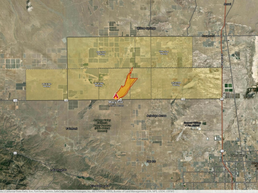
FAIRMONT, CA — A rapidly spreading brush fire burned more than 1,600 acres in far northern Los Angeles County and into Kern County Friday, prompting evacuation warnings.
The Macy Fire triggered evacuation orders in Kern County that were downgraded to evacuation warnings as of 8 p.m.
The fire was reported just before 3 p.m. Friday and quickly grew to hundreds of acres, scorching 1,600 by 8 p.m. CalFire officials warned residents to monitor changing evacuation orders and warnings.
Find out what's happening in Los Angelesfor free with the latest updates from Patch.
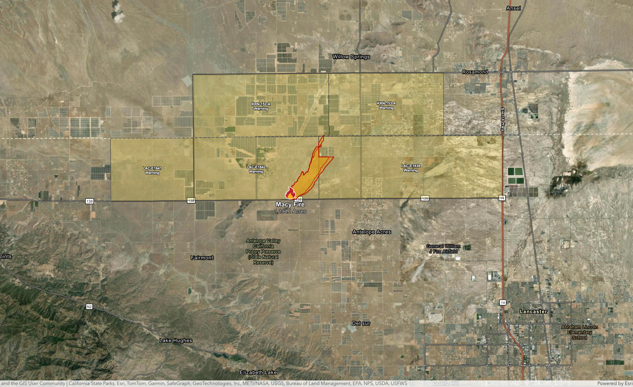
Evacuation warnings mean residents face a potential threat to live and property and should be ready to evacuate at a moment's notice. Residents with livestock should leave when an evacuation warning is issued.
The fire was reported about 2:45 p.m. near Highway 138 and North 110th Street West, where flames initially scorched about 100 acres of brush, according to the Los Angeles County Fire Department.
Find out what's happening in Los Angelesfor free with the latest updates from Patch.
By 5 p.m., firefighters reported that the blaze had crossed into Kern County.
Get more local news delivered straight to your inbox. Sign up for free Patch newsletters and alerts.