Weather
Flood And Wind Hazards As Another Strong Storm Slams SoCal
Southern California will feel the impacts of a robust storm system into Wednesday, but calmer days are ahead. Here's what to know.


LOS ANGELES — Southern California is kicking off the first full day of spring with another strong storm. Heavy rain and potentially damaging winds linger in the forecast through Wednesday.
According to the National Weather Service, the Los Angeles metro can expect a dousing followed by "a near continuous stream of showers" Tuesday, and even a slight chance for thunderstorms in the afternoon for some places.
"Rainfall totals still call for 1-3 inches across the [coasts and valleys] with 3-6 inches across the foothills and mountains through Wednesday night," NWS Los Angeles said Tuesday. "Rainfall rates will generally range between 0.25-0.50 inches/hour, but local rates of 0.50-1 inches/hour will be possible this morning with the front and associated with any thunderstorm activity."
Find out what's happening in Los Angelesfor free with the latest updates from Patch.
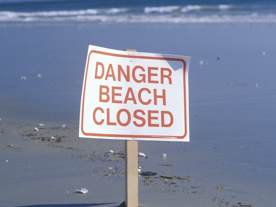
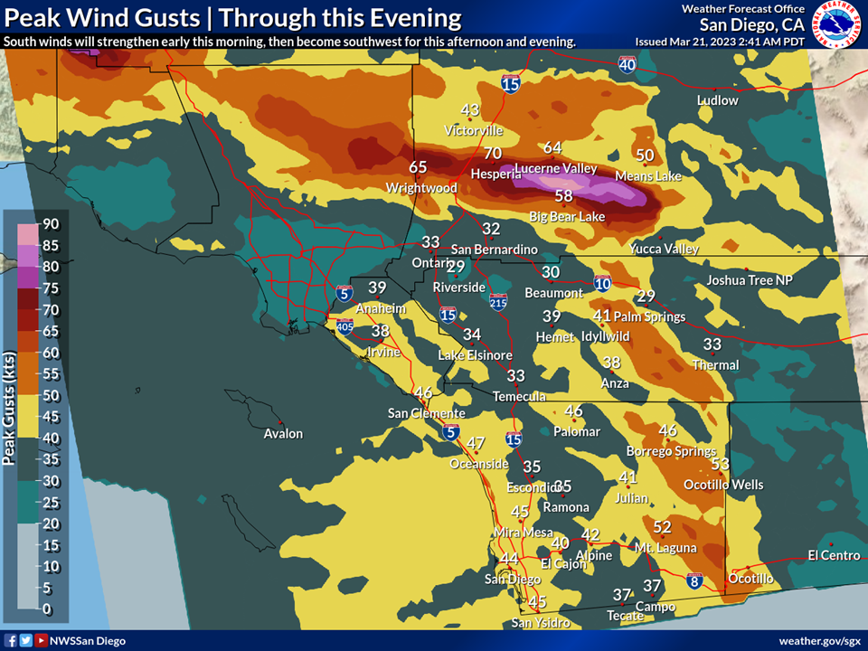
The National Weather Service issued wind advisories for Los Angeles, Riverside, Orange and San Diego counties for Tuesday. A Winter Weather Advisory is in place through Wednesday in the local mountains. A high surf advisory will be in effect from Malibu to San Diego Wednesday. While the surf advisory is set to expire for Los Angeles and Orange County beaches by Thursday, it will remain in effect for San Diego through Thursday.
Flood watches are in effect across Southern California stretching into Wednesday evening. Irvine, Riverside and San Diego could each see 2 inches of rain by Wednesday evening, with up to 4 inches possible around Temecula, Lake Elsinore and Beaumont.
Find out what's happening in Los Angelesfor free with the latest updates from Patch.
The 12th atmospheric river-fueled storm to hit Southern California since January, the threat posed by the latest storm includes the potential for sinkholes, flooding and mudslides in already water-logged areas. Several stretches of the Pacific Coast Highway in Orange County were closed due to flooding in Huntington Beach and Dana Point. Floodwaters also shut down portions of State Route 74 connecting Orange and Riverside Counties Tuesday morning.

A winter storm warning will be in effect until 11 p.m. Wednesday in the San Gabriel Mountains and in the 5 and 14 Freeway corridors. Forecasters predicted accumulations of 2 to 5 feet of snow above 6,000 feet, with 10-20 inches possible between 5,000 and 6,000 feet, and 2-10 inches between 3,500 and 5,000 feet — accompanied by winds gusting to 75 mph. According to the NWS, several inches of snow could fall in the Grapevine section of the Golden State (5) Freeway.
"Tuesday to Tuesday night there is a slight risk (15% to 40% chance) for excessive rainfall and flash flooding along and west of the mountains with a marginal risk (5% to 15% chance) of flash flooding for our deserts," NWS Los Angeles said. "Mainly snow is expected at higher mountain elevations."
A flood watch will also be in effect for Orange County coastal and inland areas from early Tuesday morning through Wednesday evening — with rivers, creeks, streams and other low-lying and flood-prone locations susceptible.
Forecasters said the low is situated much closer to the area than usual, increasing the strength of the pressure gradient and fueling stronger winds. The mountains could see gusts between 70 and 80 mph, while the strongest winds elsewhere are forecast for the interior valleys of Santa Barbara and San Luis Obispo counties and Antelope Valley.
For most, south winds will hit 20 to 30 mph with gusts as high as 50 mph.
According to AccuWeather, the unusually strong winds are blowing from an uncommon direction, which may boost the threat of downed trees, power outages and other hazards.
"This is important because my experience is that when damaging winds originate from [a] wind direction uncommon for them to do so, you increase the risk for lots of problems with trees toppling," said Jonathan Porter, AccuWeather's chief meteorologist. "[This is] likely because the root systems of trees 'build up' over time to be more supportive of force from the common wind directions and thereby less supportive of force from the uncommon wind directions."
Active weather will roll into Wednesday, with temperatures running 10 to 15 degrees below normal, and a few showers could stick around into early Thursday. Fortunately, Southern California is in for a break after that, with temps warming a few degrees and plenty of sunshine in the forecast through the weekend.
City News Service contributed to this report.
Get more local news delivered straight to your inbox. Sign up for free Patch newsletters and alerts.