Weather
Parade Of Storms To Drop Staggering Amounts Of Rain And Snow On SoCal
Much of Southern California is under a flood watch, as another intense storm moves into the region Monday.

SOUTHERN CALIFORNIA — President Joe Biden declared a state of emergency in California, and the entire city of Montecito was ordered to evacuate Monday as another round of storms threatens flooding across a wide swath of Southern California.
A powerful storm is expected to batter the region Monday through Tuesday evening, bringing high winds and flooding risks to an area already waterlogged from last week's atmospheric-river-fueled storm. The National Weather Service forecast rainfall amounts on track for 2-4 inches for the coast and valleys, and up to 4-8 inches in the mountains.
A “relentless parade of atmospheric rivers” — storms that are long plumes of moisture stretching out into the Pacific and are capable of dropping staggering amounts of rain and snow — will bear down on the region, the weather service warned. Last week's storms knocked out power to thousands, flooded streets, and battered the coastline with high surf. More of the same is expected Monday and Tuesday followed by a brief reprieve until another storm moves in over the weekend, according to the weather service.
Find out what's happening in Los Angelesfor free with the latest updates from Patch.
"We expect to see the worst of it still in front of us," Gov. Gavin Newsom told the Los Angeles Times Sunday. "We're anticipating very intense weather coming in [Monday] and Tuesday morning."
Newsom said 12 people died as a result of violent weather during the past 10 days, and he warned that this week’s storms could be even more dangerous. He urged people to stay home.
Find out what's happening in Los Angelesfor free with the latest updates from Patch.
"Heaviest rain likely Mon afternoon-Tue. Impacts include urban and small-stream flooding. possible mainstem river flooding & mud and debris flows in and around recent burn areas," the NWS tweeted Sunday. The weather service also warned of gales and high surf expected over the region through Tuesday.
Scattered showers moved into parts of Los Angeles and Orange counties Monday morning with the most intense downpours expected Monday evening and Tuesday. Downpours are expected to reach San Diego County by nightfall Monday.
The National Weather Service issued a flood watch to remain in effect Monday and Thursday for the Los Angeles County coast, mountains, downtown Los Angeles, the San Fernando, Santa Clarita, San Gabriel and Antelope valleys and inland areas including Hollywood, Compton, Long Beach, Pomona, Downey, Norwalk, East Los Angeles, Culver City, Lakewood and Beverly Hills.

It is also in effect in Orange County's coastal areas, inland areas including Santa Ana, Anaheim, Garden Grove, Irvine, Orange, Fullerton and Mission Viejo, and the Santa Ana Mountains and foothills.
The weather service predicts unusually cold temperatures and possible thunderstorms on Tuesday for downtown Riverside, Hemet and Temecula, where winds are expected to come in at 10 to 20 mph and some as high as 30 mph.
In San Diego County, widespread rainfall, strong winds and high-elevation snow are expected to slam the region late Monday night and Tuesday, the National Weather Service said.
Biden approved an emergency declaration for California on Sunday and authorized the Federal Emergency Management Agency to coordinate disaster relief efforts and provide emergency resources, the White House said in a statement.
Montecito was ordered to evacuate Monday as the storm moved into the community prone to deadly mudslides.
Parts of the Santa Barbara County communities of Carpinteria , Summerland, and the city of Santa Barbara also faced evacuation orders Monday, the Los Angeles Times reported.
In Los Angeles, the Los Angeles Department of Transportation implemented a road closure of Mulholland Drive between Laurel Canyon Boulevard and Coldwater Canyon Drive in anticipation of the storm activity.
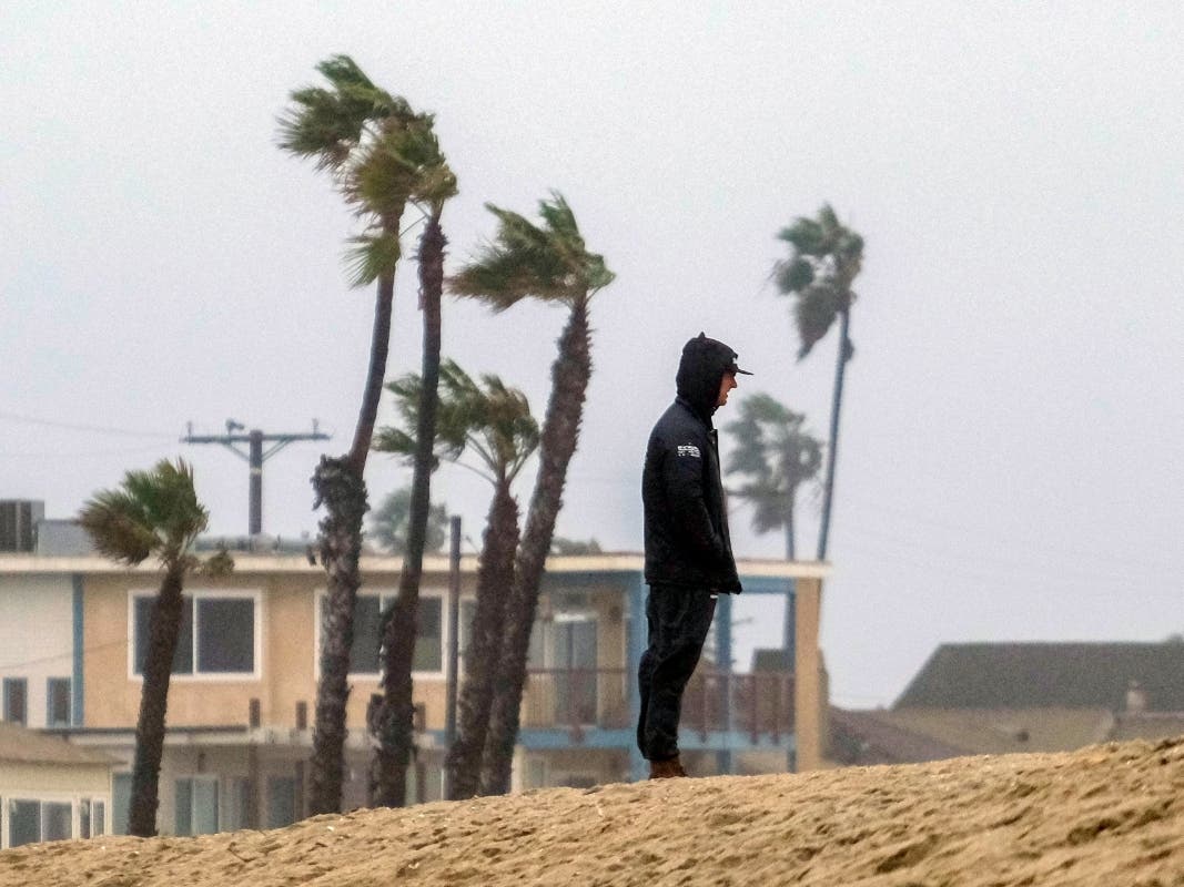
Gusts of up to 65 mph were predicted for the Los Angeles County mountains Sunday night, and up to 70 mph Monday. The snow level could drop to 6,000 feet Tuesday.
A high wind warning is in effect for parts of Orange County from 4 p.m. Monday until 4 p.m. Tuesday. South to southeast winds from 15 to 25 mph with gusts from 35 to 40 mph are expected in Huntington Beach, Costa Mesa, Newport Beach, Laguna Beach, San Clemente, Santa Ana, Anaheim, Garden Grove, Irvine, Orange, Fullerton and Mission Viejo.
Temperatures will stay cool throughout the week, with highs in the lower 60s. Overnight lows will mostly be in the 40s and lower 50s, but will drop into the 30s in the mountains and high desert.
Partly sunny skies will return Wednesday and Thursday, but more rain is possible next weekend, possibly as early as Friday night, according to the NWS.
The storms won’t be enough to officially end California’s ongoing drought — but they have helped.
State Climatologist Michael Anderson said at a news briefing late Saturday that officials were closely monitoring Monday’s incoming storm and another behind it and were keeping an eye on three other systems farther out in the Pacific.
City News Service, the Associated Press and Patch Staffer Paige Austin contributed to this report.
Get more local news delivered straight to your inbox. Sign up for free Patch newsletters and alerts.