Weather
80 MPH Gusts Hit SoCal As Windstorm Continues
Hazardous winds threatened to topple trees, power lines and unsecured items throughout the Southland this week. See wind totals.

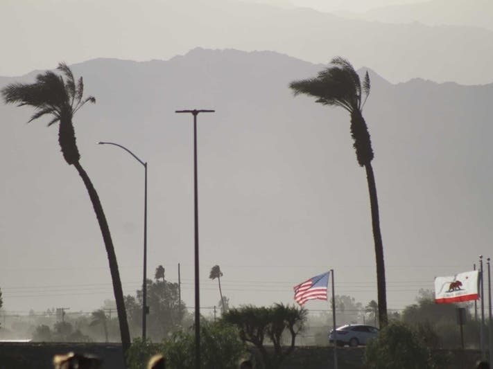
LOS ANGELES, CA — The Santa Ana winds have returned to the Southland, and they are likely here to stay through the weekend, according to the National Weather Service.
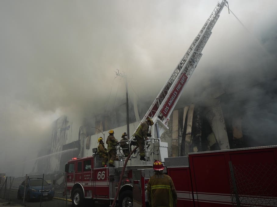
The high-intensity winds raise the potential for fire danger in a region that experienced a mostly dry January. Such powerful winds also threatened to knock out power, topple trees, down power lines and affect high-profile vehicles, officials said.
A high-wind warning was issued for the affected areas of the L.A. mountains, and it will be in effect through noon Thursday. The forecast in the mountains called for northeast winds of 35 mph to 45 mph, with gusts up to 60 mph — and as high as 70 mph in particularly wind-prone areas.
Find out what's happening in Los Angelesfor free with the latest updates from Patch.
The NWS reported a gust that topped 80 mph Wednesday morning at the Magic Mountain Truck Trail.
"People should avoid being outside in forested areas and around trees and branches," according to the weather service. "If possible, remain in the lower levels of your home during the windstorm, and avoid windows. Use caution if you must drive."
Find out what's happening in Los Angelesfor free with the latest updates from Patch.
Here are the 10 highest recorded winds as of Monday evening:
1. Magic Mountain Truck Trail - 81 mph
2. Palo Sola Truck Road - 64 mph
3. Oat Mountain - 58 mph
4. Chilao RAWS - 56 mph
5. Escondido Canyon - 53 mph
6. SCE Magic Mountain - 51 mph
7. Malibu Hills RAWS - 49 mph
8. Rattle Snake Road - 47 mph
9. Corral Canyon Park - 46 mph
10. Topanga RAWS - 45 mph
The upwelling of gusty northeast winds was expected to sweep across Orange County, Los Angeles County, the Santa Ana Mountains, San Bernardino County Mountains and valleys in Riverside County starting Wednesday.
Southland residents were advised to use caution while driving and to secure outdoor objects.
Less-severe high wind advisories will be in place through noon Thursday for the San Fernando, San Gabriel and Santa Clarita valleys, the Santa Monica Mountains Recreational Area, the L.A. County coast and downtown L.A.
Winds of 20 mph to 30 mph, gusting to 50 mph, were in the forecast for those areas.
A wind advisory was also in place for Orange County inland areas, continuing through noon Thursday, with northeast winds 15 mph to 25 mph and gusts to 40 mph in the forecast.
A dust advisory was also issued Tuesday to last through Thursday morning for parts of Orange, Riverside and San Bernardino counties, the South Coast Air Quality Management District announced.
High winds could hamper air quality, creating conditions that are unhealthy for sensitive groups. The most impacted areas will be Orange County, along with parts of the Inland Empire, the Coachella Valley and eastern Riverside County, the agency said.
Weaker winds could linger into Friday, followed by a brief reprieve Saturday before another Santa Ana pattern develops for Sunday and Monday.
"We are in a very consistent Santa Ana wind pattern that will last well into next week," according to the NWS. "Wind peaks will occur today (Wednesday), Friday, Sunday and next Wednesday with breezy but lighter winds the other days."
City News Service contributed to this report.
Get more local news delivered straight to your inbox. Sign up for free Patch newsletters and alerts.