Weather
Sharks, Flooding And Heatwaves: How 'The Blob' And El Niño Could Wreak Havoc On CA
An enormous heat wave over the Pacific Ocean and a possibly historic El Niño could have major weather impacts on California.


This year's El Niño now has an 81 percent chance of becoming among the strongest on record, national climate experts announced Thursday. Combined with a massive marine heat wave in the Pacific, Californians may expect hotter inland temperatures as early as next week, a greater chance of a wet winter, coastal flooding and even a surge in juvenile great white sharks along the coast.
Meteorologists are closely watching the possible effects of two unusual Pacific Ocean patterns now.
As El Niño continues to strengthen along the equator, the sprawling marine heat wave has developed across the North Pacific.
Find out what's happening in Los Angelesfor free with the latest updates from Patch.
"The nickname for this thing is "the Pacific Blob," longtime broadcast meteorologist David Murray told Patch. "It runs across the North Pacific from Japan to the West Coast. Unusual for this year is that we also have a growing El Niño, which is different from the Blob."
El Niño is a band of warmer-than-average water that develops along the equatorial Pacific. It's a routine climate pattern that famously can impact weather globally.
Find out what's happening in Los Angelesfor free with the latest updates from Patch.
"It looks like there's a pretty good chance for a 'strong' or 'very strong' El Niño pattern to occur later this year," National Weather Service meteorologist Adam Roser told Patch.
Forecasters with NOAA's Climate Prediction Center on Thursday increased confidence that El Niño will continue.
"There is an 81% chance of a very strong El Niño during October-December that would rank among the largest El Niño events in the historical record going back to 1950. Even the strongest El Niño events do not lead to the typical impact everywhere, but stronger events can more significantly tilt the odds in favor of expected outcomes," the NOAA's Climate Prediction Center announced. "In summary, El Niño continues and will strengthen through the end of the year, with a 97% chance it will last through early spring 2027."
The phenomena could contribute to hotter inland weather this this month and increase the odds of a wetter winter, stronger tropical storm activity and higher coastal water levels, though meteorologists caution that none of those outcomes are guaranteed.
'The Blob' Explained
The marine heat wave is creating conditions of most immediate concern, while the impacts of El Niño won't be felt until later this year, meteorologists say.
Marine heat waves are prolonged periods of unusually warm ocean temperatures. Scientists rank them based on both their intensity and how long they last.
The current Pacific marine heat wave stretches across a vast portion of the Pacific Ocean. It covers an area larger than eight times the size of the contiguous United States, extending from waters near Asia to the California coast, the Washington Post reported.
"The Blob is caused by this monster high-pressure system that just won't leave," Murray said. "It's stagnant."
Normally, winds help churn colder water from deeper in the ocean to the surface through a process known as upwelling. Murray said that process has been suppressed, allowing warm surface waters to persist.
The Blob isn't a new phenomenon.
Scientists first gave it that nickname after a major marine heat wave developed in 2013 and lingered for nearly two years.
"It was discovered in 2013," Murray said. "It's most likely it happened before that."
The Blob's California Ripple Effects
One possible outcome is a stronger ridge of high pressure over the western United States, which could favor hotter-than-normal conditions across inland California.
Thunderstorms currently bubbling over the ocean heat wave could promote the formation of a powerful heat dome over the Western U.S. in mid-July, according to the Post.
"Typically, when you get this dome, the storm track gets pushed way to the north, past Alaska, and then it will try to make a dip down into the Great Lakes and Northeast," Murray said. "As that dome of high pressure expands, you would make the correlation that the West should be warmer for the rest of the summer."
As is usually the case, inland California should expect to bear the greatest brunt of that impact. Communities on the coast likely won't experience the same degree of heat because of the ocean's moderating influence, Murray said.
Hurricane Remnants
The impacts of El Niño are likely to hit toward the end of the summer and into the fall and winter.
"Warmer water temperatures can bring increased tropical activity as we get later into the summer and the early parts of fall," Roser said.
Aside from pleasant beach-swimming temperatures, that could also mean storms coming into California reminiscent of August 2023, when the remnants of Hurricane Hilary brought flooding and mudslides to Southern California.
"I would not be surprised this Pacific season if the remains of a tropical storm or hurricane make its way into Southern California," Murray said.
If that happens, Californians could see periods of increased humidity, gusty winds, clouds and even rainfall.
A Wet Winter?
Historically, El Niño is felt strongest in winter in California.
"The biggest impacts are usually in the winter across North America," Roser said. "Usually that can mean a wetter-than-normal pattern across our region."
But Roser cautioned against assuming California is headed for a repeat of infamous El Niño winters.
"Our last 'very strong' El Niño event in 2015 was quite dry," he said. "It really depends."
That uncertainty is echoed by climate scientists.
SFGATE reported that while forecasters are increasingly confident this year's El Niño could become one of the strongest on record, that doesn't necessarily mean California will experience a particularly wet winter.
Coastal Flooding Could Increase
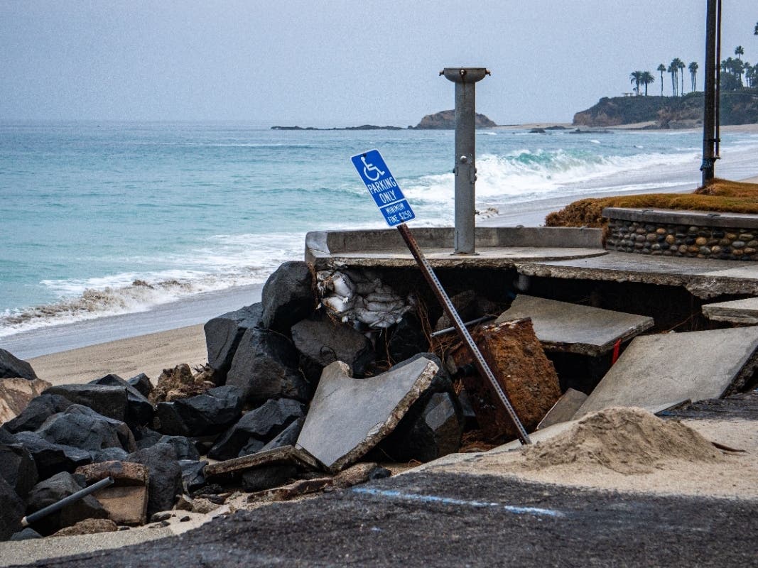
Scientists are also watching what the combination of El Niño and the marine heat wave could mean for California's coastline.
Climate scientist Daniel Swain said during a recent livestream that warmer Pacific waters may contribute to higher sea levels along California this winter, increasing the potential for coastal flooding during king tides and major storm events.
“This coming winter, right now ... does look like one where there’s an increased likelihood of historically unusual to unprecedented rain and storm events,” Swain said.
Swain stressed those impacts are possible — not guaranteed — and impossible to determine this far in advance. Any such threat is likely to start to become apparent about two weeks before a storm hits, he said.
Still, Swain urged local governments to prepare for a higher likelihood of unusually disruptive coastal flooding if major winter storms develop.
Marine Life Could See Big Impacts
While scientists continue to work to determine exactly how all of this will influence California's weather, the effects on marine life are already underway.
Chris Lowe, director of Cal State Long Beach's Shark Lab, recently told Patch that this year's marine heat wave is creating conditions similar to 2015, when the original blob combined with a strong El Niño. That year, juvenile great white shark activity surged along the California coast.
During that event, water off Baja California became too warm for young white sharks, pushing many north into Southern California waters. Researchers are already seeing signs of a similar shift this year. Lowe said baby sharks began appearing off California in February — earlier than normal — and more could move into nearshore nursery habitat as ocean temperatures continue warming through the summer.
SEE ALSO: 'Sharky Summer' Predicted For CA Beaches: 'A Perfect Storm'
Additionally, in 2015 researchers observed baby white sharks farther north than ever before, in waters off Santa Cruz. Since then, researchers have documented a nursery aggregation in the Monterey Bay area.
The warmer water is also expected to support larger stingray populations, providing more food for juvenile sharks.
"This is becoming a perfect storm," Lowe said. "This is what we think is going to make SoCal the white shark Mecca this summer."
NOAA has also linked previous marine heat waves to harmful algal blooms, which can sicken marine mammals and close shellfish fisheries.
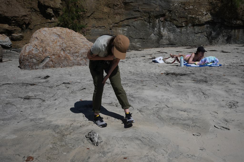
Researchers in San Diego have observed a large number of seabirds dying off in recent months as record-setting ocean temperatures decreased the band of cold, nutrient-rich surface water where krill, anchovies and sardines thrive near the shore, according to marine ornithologist Tammy Russell at the University of California, San Diego, Scripps Institution of Oceanography.
Scientists fear the die-off could worsen with the recently formed El Nino.
Despite growing attention surrounding the blob, Murray emphasized that it is part of a naturally changing Pacific climate pattern known as the Pacific Decadal Oscillation.
"It flips from cold to warm," Murray said. "Nature tries to balance itself out."
"The biggest thing is it's not permanent," he added. "It's not the end of the world."
Material from the Associated Press was used in this report.
Get more local news delivered straight to your inbox. Sign up for free Patch newsletters and alerts.