Crime & Safety
1,427-Acre Chaparral Fire Near Murrieta Fully Contained
The fire erupted Aug. 28 in the Cold Springs area at the edge of the Cleveland National Forest.


UPDATE Sept. 9, 2021: The fire has been fully contained.
MURRIETA, CA — The 1,427-acre Chaparral Fire, which has been burning for over a week and briefly prompted evacuations early on, was 95 percent contained Sunday, with full containment expected by Wednesday, officials said.
The fire erupted Aug. 28 in the Cold Springs area at the edge of the Cleveland National Forest at the corner of southwest Riverside and San Diego counties.
Two structures were burned the first day of the fire and a firefighter suffered minor injuries, according to the Riverside County Fire Department. The fire eventually grew to span both Riverside and San Diego counties.
The last remaining evacuees in San Diego County, near the Cold Springs area, were allowed to return to their homes Tuesday afternoon, the agency said.
#ChaparralFire Morning Update 8/31/21 The Chaparral Fire remains 1,427 acres and 50% contained. Evacuation ORDERS and WARNINGS remain in place; changes will be re-evaluated later today.@ClevelandNF @CALFIRERRU @RivCoReady @RSO @cityofmurrieta @CHP_Border @SDSheriff pic.twitter.com/RDafACcZd9
— CAL FIRE/SAN DIEGO COUNTY FIRE (@CALFIRESANDIEGO) August 31, 2021
Mandatory evacuations for residents north of the Tenaja Truck Trail, south of Calle Cielo, east of Calle Collado and west of Calle De Dietel in Riverside County were lifted at 4 p.m. Monday and reduced to evacuation warnings.
An evacuation warning for Tenaja Road, west of Calle Pino and Gallop Lane, south of Hombre Lane and west of Cleveland National Forest Road in Riverside County was also lifted Monday.
Only residents will be allowed in the areas, according to Cal Fire. A complete closure of the Cleveland National Forest was announced Tuesday due to wildfire risk.
The Chaparral Fire was 50 percent contained as of Tuesday night, according to fire officials. The containment was unchanged per a Tuesday morning update from Cal Fire/San Diego County.
A handline now encircles the entire fire, and a bit of precipitation was aiding crews, officials said Tuesday.
Sunday night the agency said 1,500 acres had burned, "but acreage decreased slightly due to improved mapping," Cal Fire/San Diego County announced Monday morning.
#ChaparralFire Morning Update 8/30/21 The Chaparral Fire is now 1,427 acres and 13% contained. Acreage decreased slightly due to improved mapping. All Evacuation ORDERS and WARNINGS remain in place. @ClevelandNF @RivCoReady @Riversidecountysheriff @cityofmurrieta pic.twitter.com/Hh5QveFvH4
— CAL FIRE/SAN DIEGO COUNTY FIRE (@CALFIRESANDIEGO) August 30, 2021
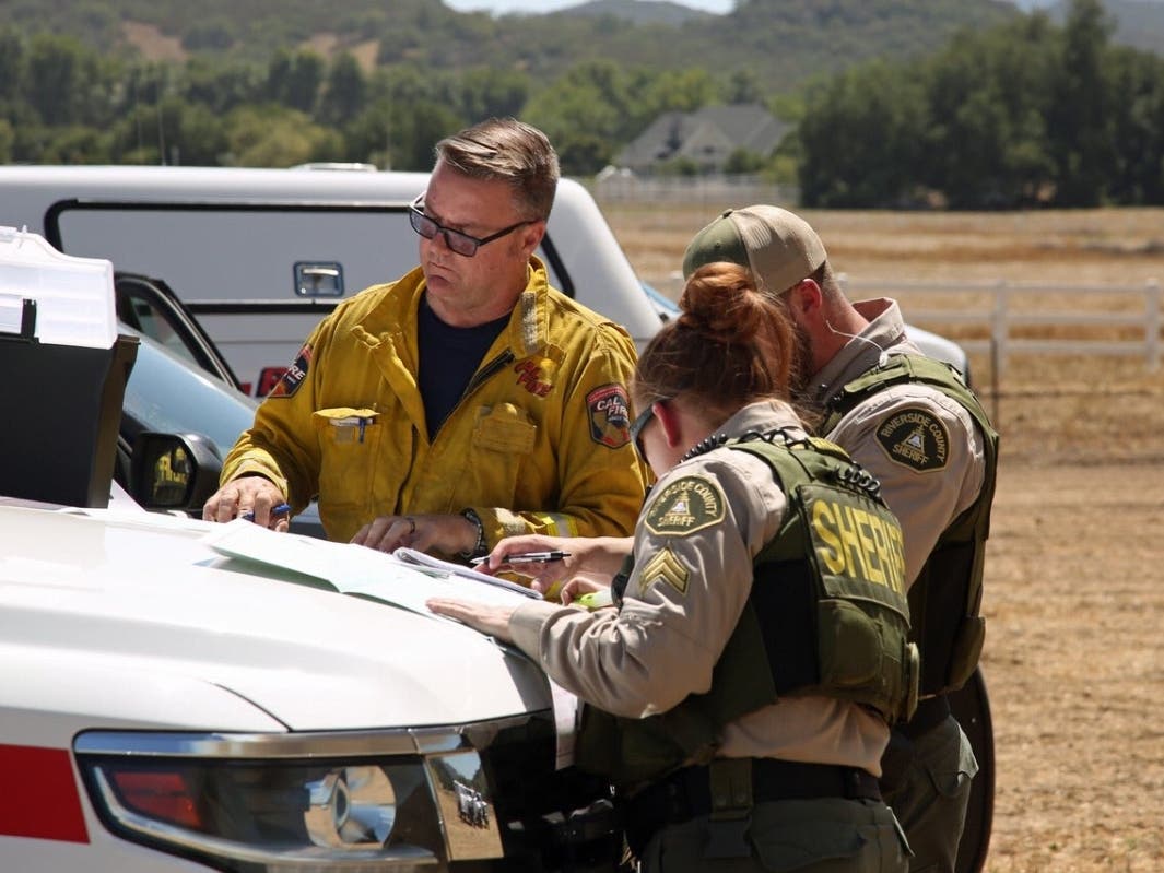
Firefighters held the fire within an area to the north of La Cresta, to the east of Tenaja, to the south of Cold Springs, and to the west of the San Mateo Wildnerness Area, according to a Cal Fire briefing (watch above).
Camp Pendleton was not burning, officials confirmed.
Cal Fire/Riverside County Fire Department reported over the weekend that one firefighter sustained minor injuries and two structures were lost in the flames. There were no further reports Monday of injuries or structures burned.
Sunday afternoon, a Cal Fire/Riverside County Fire Department spokesperson confirmed the fire had spread into San Diego County and was mostly burning there.
Murrieta Valley High School at 42200 Nighthawk Way had served as an evacuation center. Animal Friends of the Valleys, 33751 Mission Trail in Wildomar, was accepting small animals. San Jacinto Animal Campus at 581 S. Grand Avenue in San Jacinto was accepting large animals.
The blaze was first reported at 12:38 p.m. Saturday, according to Cal Fire/Riverside County Fire Department. Crews from multiple agencies were fighting the blaze by ground and air.
A Cal Fire helicopter on the ground in the 36000 block of Avenida La Cresta in La Cresta caught the attention of neighbors and passersby on Saturday. According to fire crew members, the empty lot was being used as a chopper refueling area.
The North County Fire Protection District confirmed over the weekend that the fire was not burning on the Camp Pendleton military base. The agency, which has jurisdiction in northern San Diego County, asked people to avoid Tenaja Truck Trail in De Luz because it was being used as an evacuation route for people living near the fire.
The blaze extended into the Cleveland National Forest, but acreage burned on the federal land was not immediately available, according to Cal Fire/Riverside County Fire Department spokesperson Jody Hagemann. Cleveland National Forest crews were on scene in a coordinated effort with Cal Fire, according to Hagemann.
Fire danger in the area Monday was listed as "extreme," according to the U.S. Forest Service, but cooler weather with drizzle Tuesday morning was offering some relief.
"The main threat will be gusty outflow winds," according to fire officials.
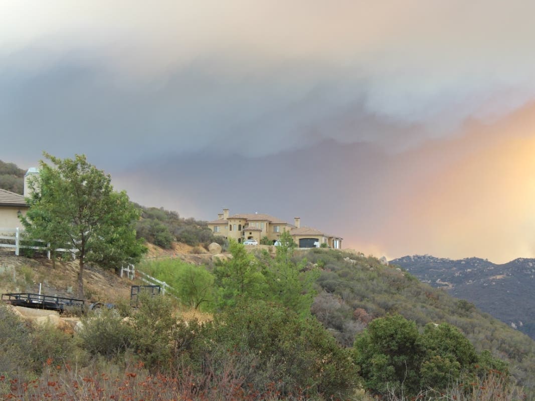
The vegetation fire sent large smoke plumes into the air and shrouded the region over the weekend, prompting South Coast Air Quality Management officials to issue a smoke advisory across Riverside County that extended east to the Coachella Valley and west to the Pacific Ocean. Residents on the Santa Rosa Plateau were experiencing heavy smoke and ash.
Santa Rosa Plateau neighbors worked together to evacuate large animals, mostly horses, over the weekend. The area includes multiple communities at the edge of the Cleveland National Forest in unincorporated Murrieta including Tenaja, La Cresta, Meadow Oaks, La Cresta Highlands, Santa Rosa West, and others. De Luz is also nearby.
There was no word on what sparked the blaze.
NOTE: Want to stay abreast of information pertaining to emergencies in Riverside County? Alert RivCo allows emergency managers and public safety first responders to rapidly alert and warn the public in the event of emergencies such as earthquakes, wildfires, and floods. Sign up for free here.
This is a developing news story, please refresh the page for updates.
Get more local news delivered straight to your inbox. Sign up for free Patch newsletters and alerts.