Home & Garden
Cool Temperatures, Heavy Winds High Surf Expected
As temperatures remain 10 degrees below normal, forecasters warn of the threat of sneaker waves amid high surf.

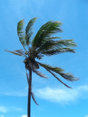
Powerful winds buffeted the Southland amid abnormally low temperatures today as high surf pounded the coast, as it did most of last week.
But sunny weather will prevail. The rain that began Sunday was largely over, with only the odd shower expected in the San Gabriel Mountains, said National Weather Service meteorologist Andrew Rorque.
On Sunday, a mudslide reported in the Fort Tejon area around 7 p.m. Sunday prompted the closure of a 35-mile stretch of the northbound Golden State (5) Freeway in the Castaic area for nearly four hours, according to California Highway Patrol Officer Peter Bishop.
Find out what's happening in Northridge-Chatsworthfor free with the latest updates from Patch.
The northbound Golden State Freeway was closed at Parker Road so the mudslide could be cleared, Bishop said. It was reopened at 11:12 p.m. Sunday. Southbound lanes were not affected.
A cold air mass will keep today’s temperatures around 10 degrees below normal, Rorque said, noting that temperatures will barely reach the 60s.
Find out what's happening in Northridge-Chatsworthfor free with the latest updates from Patch.
Strong northwest winds, meanwhile, swept the region, with the NWS saying the strongest winds were blowing in The Grapevine area in the San Gabriel Mountains. Gusts of between 60 and 70 miles per hour were expected over Interstate 5, along with light snow.
A high wind warning, denoting an expectation of gusts of at least 58 mph, will be in effect until 1 p.m. in the San Gabriels, with the wind forecast to have the greatest impact on I-5 and Pearblossom (138) Highway.
A less serious wind advisory will be in effect until 1 p.m. in the Antelope Valley, where winds of between 25 and 35 mph were expected, gusting to 55 mph, and on Santa Catalina Island, where the wind will be only slightly tamer.
In the Santa Monica Mountains, a wind advisory expired at 3 a.m.
Forecasters warned that the wind would make driving difficult, especially for the operators of high-profile vehicles.
Along the coast, a northwest swell has been increasing, resulting in continued high surf, creating powerful rip currents and possibly causing some minor coastal flooding, the NWS reported. A high surf advisory is expected to be in force until 4 p.m. Surf of between 5 and 8 feet was expected, with sets of 10 feet possible.
“Large waves and strong rip currents will increase the risk of ocean drowning. Sneaker waves can suddenly wash people off of beaches and rock jetties,” an NWS statement said.
“Surf will be highest on exposed west-facing shores, especially from Ventura Harbor to Port Hueneme as well as Venice to Palos Verdes and Malibu in Los Angeles County.”
Forecasters said swimmers caught in rip currents should swim parallel to shore until free of the currents.
The NWS forecast sunny weather today and highs of 43 on Mount Wilson; 46 in Lancaster; 47 in Palmdale; 54 in Saugus; 58 in Mission Viejo and Burbank; 59 in Pasadena; 60 in San Gabriel, Avalon, San Clemente, Yorba Linda, Irvine and Laguna Beach; 61 at LAX, in downtown L.A. and Woodland Hills; 62 in Long Beach, Newport Beach and Fullerton; and 63 in Anaheim. Tuesday’s temperatures will be a few degrees higher, also under sunny skies.
City News Service
Get more local news delivered straight to your inbox. Sign up for free Patch newsletters and alerts.