Politics & Government
Iron Horse Trail plan gets public airing
Residents debate future route for bicycle path through the Hacienda Business Park

Pleasanton residents gathered Tuesday to discuss how best to provide a bicycle route that would serve a large swath of businesses and homes near the Dublin/Pleasanton BART station.
Specifically, they looked at a feasibility study to extend the Iron Horse Trail through Hacienda Business Park to Santa Rita Road.
The East Bay Regional Park District is trying to close a 1.6 mile gap between two sections of the Iron Horse Trail.
Find out what's happening in Pleasantonfor free with the latest updates from Patch.
To the north lies the 28-mile-long portion from Concord to the Pleasanton BART station; to the south is the 1-mile piece that runs from Santa Rita Road to Mohr Avenue. In between is an abandoned railroad right-of-way.
Alameda County owns the land in question, but developments over the years have left the route hard to recognize. A bicycle path would be needed to cross busy streets in mid-block, including Owens Drive, Hacienda Drive and West Las Positas Boulevard.
Find out what's happening in Pleasantonfor free with the latest updates from Patch.
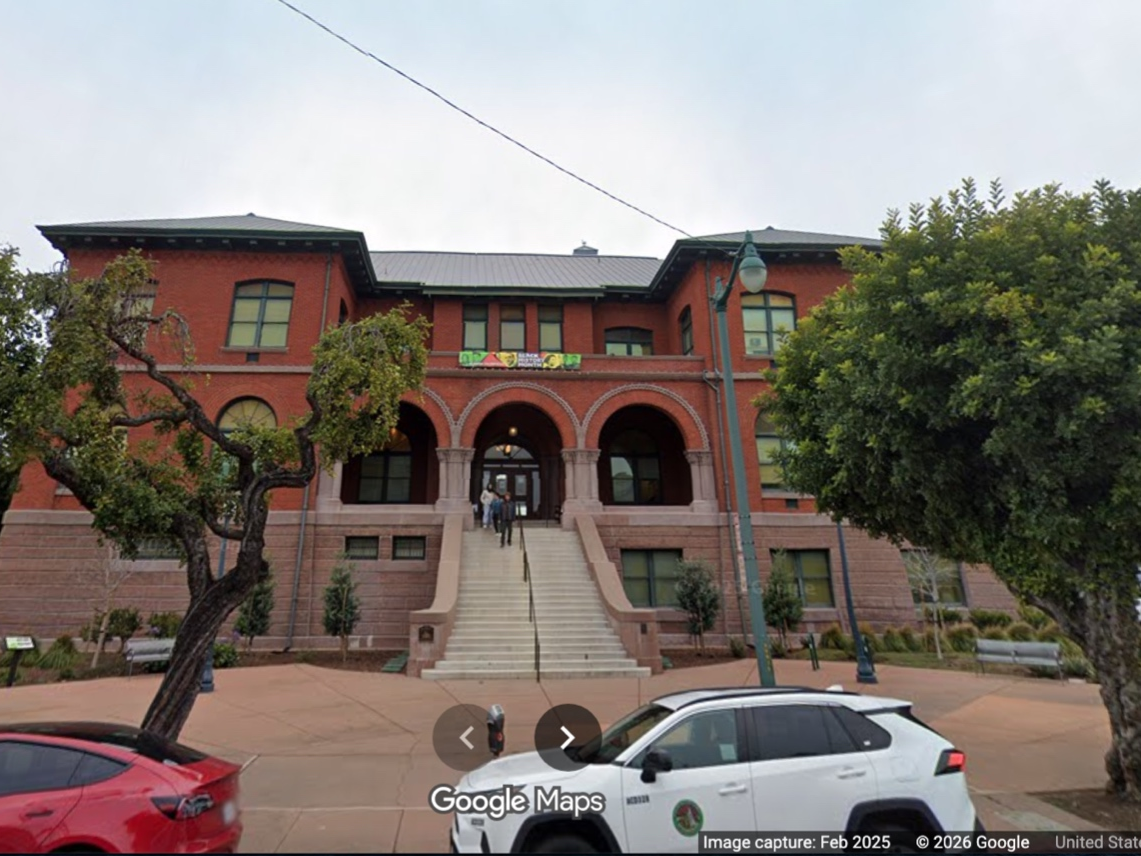
The June 22 meeting at the Veterans Memorial Building in downtown Pleasanton was the first of three public hearings. The next one is tentatively scheduled for mid- to late August, with the final meeting due to occur about two months later.
The parks district hired Callander & Associates to prepare the study; principal Mark Slichter conducted Tuesday's meeting.
Although everyone who spoke endorsed the idea of providing a bicycle and pedestrian route that would enable more people to leave their cars behind while commuting to work, riding to school, running errands and getting exercise, many people asked questions about particular elements of the plan, including:
- Whether parking will be provided for people wanting to use the Iron Horse Trail for exercise. Except for Creekside Park, there is no public parking near the proposed route.
- How bicyclists can be safely routed through the BART station. For now, the Iron Horse Trail ends on the north edge of the station and there is no clear, safe way through it.
- How small children playing in Creekside Park can be separated from bicycle traffic on the future Iron Horse Trail.
- Whether amenities in the Valencia neighborhood's linear park can be preserved, since they lie within the proposed route.
- Whether crossings of five busy streets can be achieved without severely interrupting traffic flows.
- When EBRPD will find enough money for the many improvements that will be needed to close the gap.
Rather than address individual questions, Slichter emphasized, "We're only taking input tonight, not rebuttals." But he said all issues would be addressed eventually.
Pleasanton resident Greg Visscher suggested that the right-of-way be abandoned altogether and that the trail extension instead use Zone 7 canal routes running near the Dublin Library and following Las Positas Boulevard to Staples Ranch, linking to Livermore trails.
"This plan would have the Iron Horse Trail crossing five very busy streets," he said. "It will cost millions and people will get hit" by cars.
He handed out copies of his "unofficial" alternative route.
However, representatives of park distrist and the city of Pleasanton said that while Visscher's idea might be a viable route for a separate bike trail, the Iron Horse Trail will continue to follow the old Southern Pacific route, as it does through Contra Costa County.
Dave Campbell of the East Bay Bicycle Coalition pointed out that the current preferred route has withstood many years of investigation.
"This route is on the city and regional bike plans," he said. "Many years of effort and input have gone into this plan."
Responding to concerns about the route's impact on Creekside Park and Valencia parks and other issues. Ayn Wieskamp, one of the park district board member, suggested a walking tour of the route be scheduled soon.
The Iron Horse Trail's history begins in 1891, when Southern Pacific established its San Ramon Valley Branch Line. SP abandoned the line in 1977 and removed the tracks. Contra Costa County bought the right-of-way for $8 million; the park district built and maintains the trail. Today, the Iron Horse Trail links Concord, Pleasant Hill, Walnut Creek, Alamo, Danville, San Ramon and Dublin.
Eventually, the park district's plan is to extend the trail for a total of more than 50 miles from Suisun Bay to Livermore.