Crime & Safety
Pleasanton Fire Map: See 'Little Fire' Perimeter, Evacuation Areas
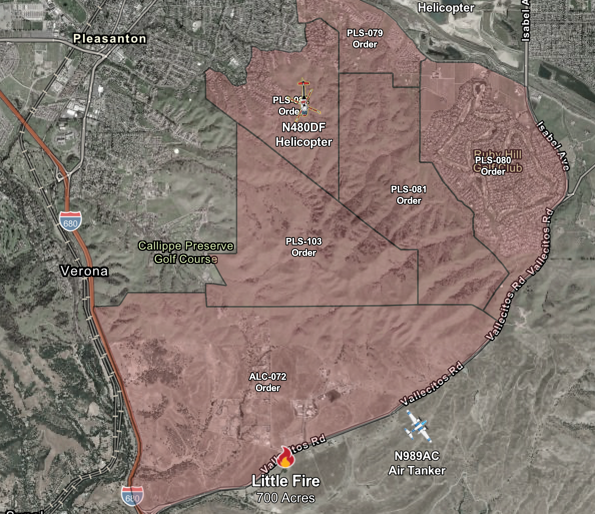
Several areas around Sunol and eastern Pleasanton were placed under evacuation due to the Little Fire.


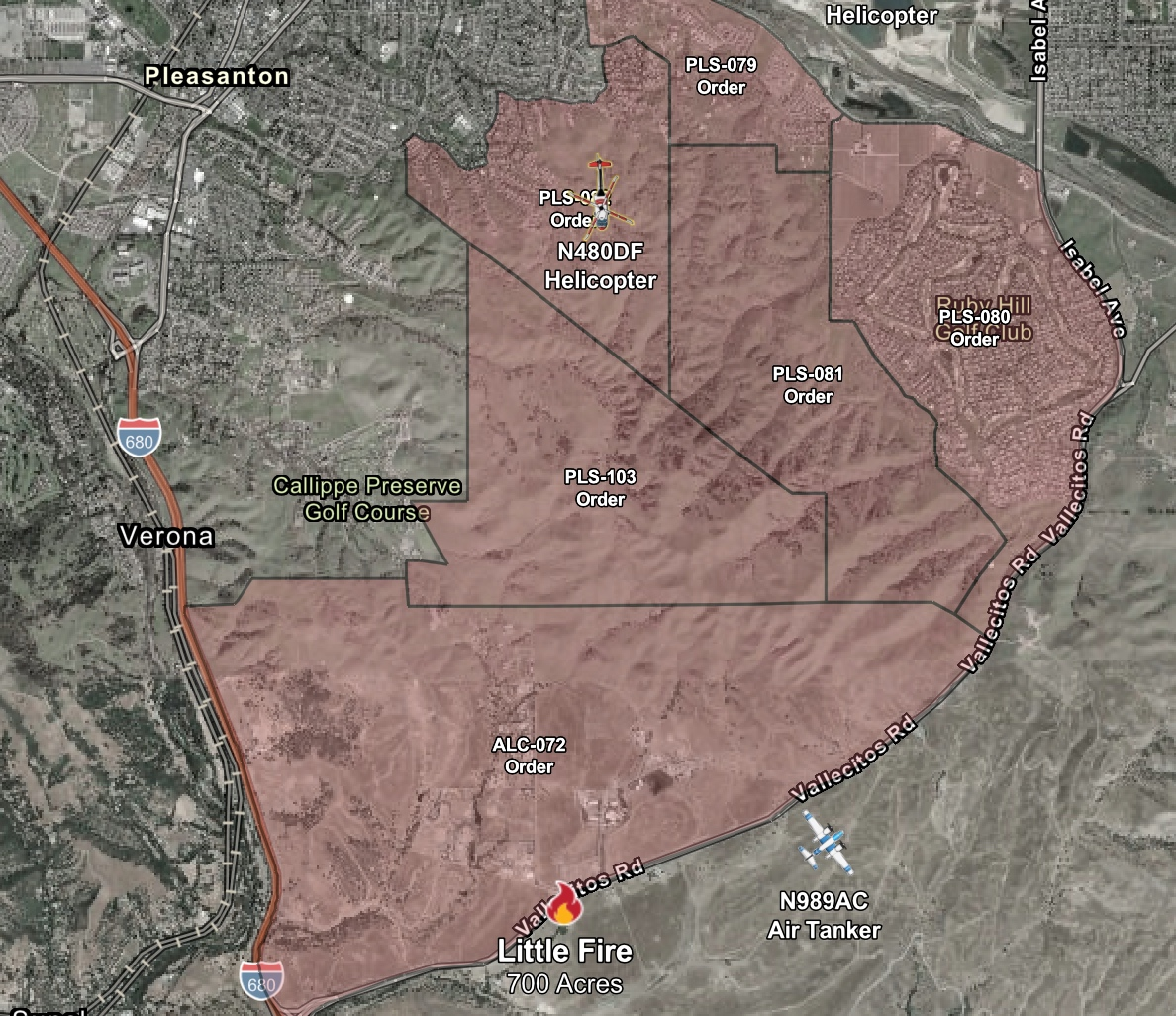
PLEASANTON, CA — The Little Fire, which grew to 700 acres as of 6 p.m. Tuesday afternoon, resulted in the evacuation of six zones in Pleasanton and unincorporated Alameda County.
Find out what's happening in Pleasantonfor free with the latest updates from Patch.
By subscribing, you agree to Patch's Privacy Policy and Terms of Use.
Get more local news delivered straight to your inbox. Sign up for free Patch newsletters and alerts.