Politics & Government
Traffic: Tell me How to Get to Sesame Street.
The old way of getting around town is changing and so the impacts of traffic are also spreading.

In the old days, if you wanted to go somewhere you went to your destination’s website and got their directions. For example, if you were going to the Redwood City City Hall, you would check out their website and find out that:
“By Car
Highway 101 – If you are coming from north of Redwood City, take the Whipple Avenue exit off of the 101. The off-ramp will turn into Veterans Boulevard. At the light, don’t turn right on Whipple, but proceed straight for another quarter of a mile or so. Turn right on Middlefield Road and you are there! From south of Redwood City, take the Woodside Road exit. Take Woodside road south for about a half of a mile, and then turn right on Middlefield Road. After another half-mile or so you have arrived!”
Find out what's happening in Redwood City-Woodsidefor free with the latest updates from Patch.
However, those type of directions assume that people are driving the way they used to drive. Today a lot of drivers use GPS (Global Positioning System) apps to save time. The most popular one seems to be Waze. As they note on their website:
“Get the best route, every day, with real–time help from other drivers…Waze. Outsmarting Traffic, Together.”
Find out what's happening in Redwood City-Woodsidefor free with the latest updates from Patch.
I am not sure the right phrase is “outsmarting traffic together.” The more correct terminology is “changing traffic together”; because if we are all going to start using traffic apps (and we are, remember when only a few of us had caller ID), the way traffic moves around any particular geography is going to change radically and fast.
I spoke to Charles Stimmler owner of Bonavia Limo, a ground transportation company with a fleet of nine vehicles. I asked him about Redwood City and he told me that the “traffic is horrendous.” To get around the area his fleet of drivers use several different apps including Google Maps, Apple Maps, Uber Technologies and the aforementioned Waze, as it turns out a fully owned subsidiary of Google. He explained that these apps include information based on the speeds the various cell phones plugged into the network are traveling which allow them to update a driver’s options based on current driving conditions and reports.
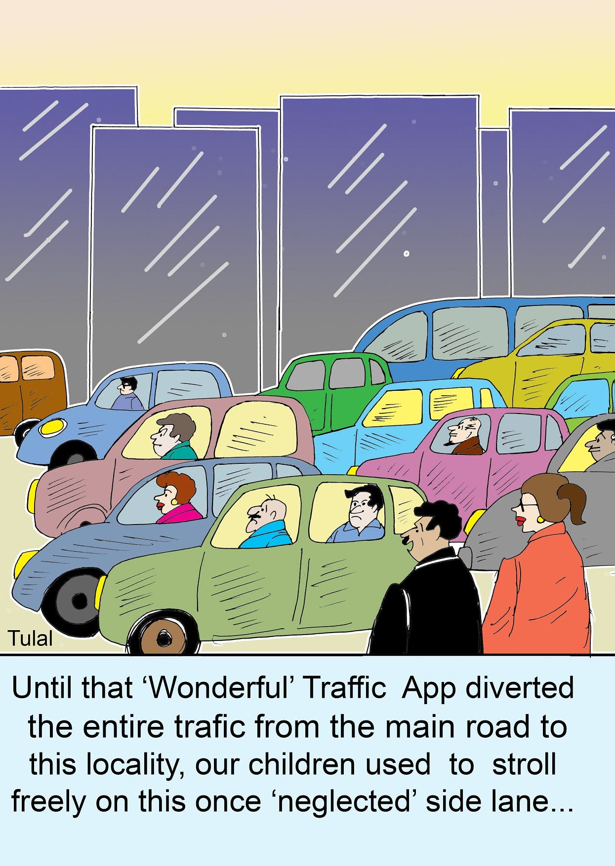
Recently on the campaign trail I was asked if I thought that the FarmHill road re-striping traffic issues were improving. I had to be honest and say I thought the traffic problems were spreading. I can’t tell you how many residents have complained to me that their historically quiet side street was now becoming a heavily used thoroughfare. Thank you Waze and Uber for allowing commuters to shave another thirty seconds by coming through our formerly quiet street or parking lots. Yes, I did say parking lot. Waze is so “intelligent” that if instead of waiting at a light we can cut through a parking lot or a corner gas station, it tells us to do so.
All of the new residents and businesses coming into town are creating additional traffic on our streets and so therefore a lot of residents are asking for a new traffic study. But the way we are getting to our final destination is no longer with high traffic main streets and limited traffic side streets. Given the number of cars on the roads is increasing and the technologies now available to find better routes have improved; cars are not spilling over instead they are being directed onto available side streets and turning those streets into equally dense traffic connectors.
If City Hall was hoping that the majority of new residents and businesses would use already at capacity trains or buses, the fact remains most Californians love their cars. Our side streets are taking the brunt of all the growth around us. City Hall needs to be realistic about its expectations; more people are coming, which means more cars are coming, which means the assumption of using a road diet to slow down car traffic and force people onto trains and buses is not realistic. Instead, “intelligent” apps and GPS systems are showing us new time saving shortcuts to drive to Sesame Street.