Weather
Winter Storm Watch Update For Metro Denver, Boulder
Road conditions should be improved for the evening commute, the National Weather Service said.

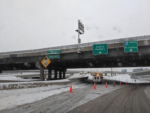
A National Weather Service storm alert remains in place for the metro Denver area and Boulder until 6 p.m. Monday. Up to four additional inches of snow is expected to fall Monday afternoon, weather officials said.
As of 9 a.m. Monday morning, many roadways in Denver's metro area and Boulder were covered with snow.
"Travel will be very difficult," the alert read. "Expect hazardous winter driving conditions on all roads ... especially over the high mountains passes. Roads will become icy and snowpacked with poor visibility in heavy snowfall."
Find out what's happening in Denverfor free with the latest updates from Patch.
National Weather Service urged drivers to slow down and use caution while traveling.
"If you must travel, be prepared for winter driving by keeping
extra warm clothes, a flashlight, food, and water in your vehicle
in case of an emergency."
Find out what's happening in Denverfor free with the latest updates from Patch.
.jpg)
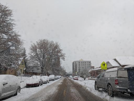
Snowfall will come to an end Monday afternoon as the storm moves off to the east, weather officials said. After the sky clears this afternoon, road conditions should be improved for the evening commute.
.jpg)
The following areas were listed in the Winter Storm Watch: Boulder, City of Denver, Castle Rock, Arvada, Golden, Lakewood, Longmont, Aurora, Brighton, Denver International Airport, Highlands Ranch, Littleton, Parker, Castle Rock, Elbert, Fondis, Kiowa and Larkspur.
Another snow storm is expected Tuesday and Wednesday.
"Moderate to heavy snow may occur with this storm, especially from Tuesday afternoon through Wednesday morning," the National Weather Service said. "Significant snowfall amounts will be possible. Weather
conditions will improve by Thursday."
.jpg)
Get more local news delivered straight to your inbox. Sign up for free Patch newsletters and alerts.