Weather
'Strong Thunderstorms' Forecast Wednesday In CT: Here's When
Find out the latest weather forecast through the weekend.


Today brings another chance for strong thunderstorms in Connecticut.
The National Weather Service says there is a risk for isolated thunderstorms today between 1 p.m. and 8 p.m.
“There is a cold front expected to move through this afternoon/evening, and with it the chance of scattered thunderstorms,” the National Weather Service said.
Find out what's happening in Across Connecticutfor free with the latest updates from Patch.
Any thunderstorm activity is not expected to be widespread. Most of Wednesday will be dry, partly sunny, warm, and humid, according to forecasters. High temperatures will reach into the 80s today.
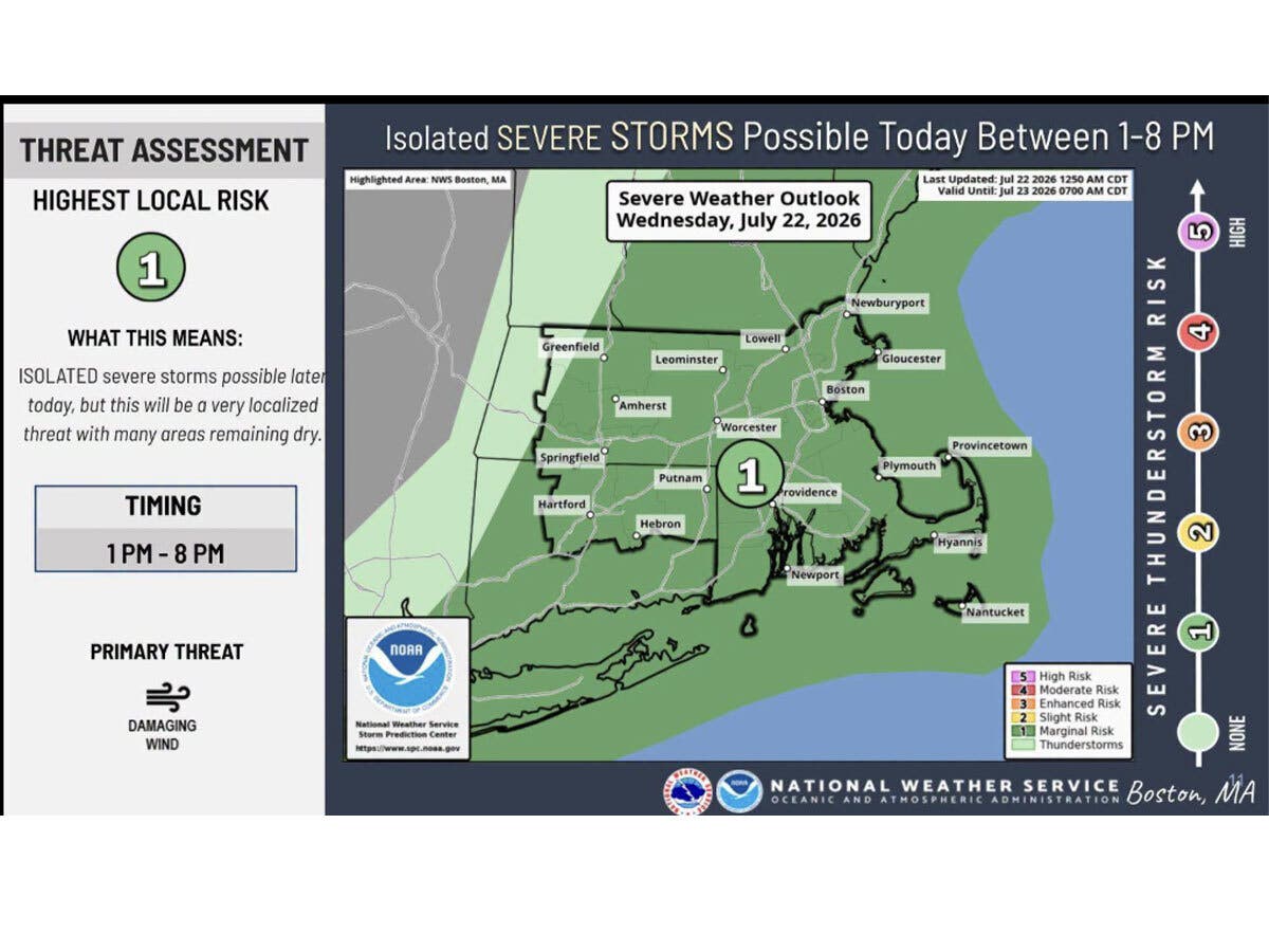
WFSB is calling Wednesday a “First Alert Weather Day” due to the storm chance.
Find out what's happening in Across Connecticutfor free with the latest updates from Patch.
“As a disturbance moves through, in tandem with a cold front, a round of isolated late afternoon storms are possible,” WFSB reports. “Those that develop could be strong to severe, impacting outdoor plans. In addition to lightning, the greatest concern will be damaging wind gusts.”
The second half of the week and the weekend are looking to be calmer and more pleasant. WFSB reports humidity levels will drop.
The National Weather Service predicts Thursday through Sunday will be clear, with sunny days and high daytime temperatures in the low to mid 80s.
Read More:
- Football Player Assaulted After Fight Breaks Out During Game: Police
- Motorcyclist Assaulted, Robbed And Stabbed, Police Say
- Motorcyclist Ignores Highway Closure, Crashes: State Police
Here are the forecast details for southern Connecticut via the National Weather Service:
Today: A 30 percent chance of showers and thunderstorms, mainly after 2 p.m. Partly sunny, with a high near 84. Southwest wind around 10 mph.
Tonight: A 30 percent chance of showers before 8 p.m. Partly cloudy, with a low around 61. North wind around 7 mph.
Thursday: Sunny, with a high near 81. North wind around 6 mph becoming south in the afternoon.
Thursday Night: Mostly clear, with a low around 61. Calm wind.
Friday: Sunny, with a high near 82. Light and variable wind becoming southeast around 6 mph in the afternoon.
Friday Night: Mostly clear, with a low around 62.
Saturday: Sunny, with a high near 82.
Saturday Night: Partly cloudy, with a low around 62.
Sunday: Mostly sunny, with a high near 83.
Here are the forecast details for northern Connecticut via the National Weather Service:
Today: A chance of showers, mainly between 1 p.m. and 3 p.m. Mostly sunny, with a high near 84. Southwest wind 8 to 11 mph, with gusts as high as 21 mph. Chance of precipitation is 30%.
Tonight: Partly cloudy, with a low around 56. Northwest wind 3 to 7 mph.
Thursday: Sunny, with a high near 80. Northwest wind around 7 mph.
Thursday Night: Mostly clear, with a low around 55. Light north wind.
Friday: Sunny, with a high near 83. Calm wind.
Friday Night: Mostly clear, with a low around 57. South wind around 5 mph becoming calm in the evening.
Saturday: Sunny, with a high near 84. Light and variable wind.
Saturday Night: Partly cloudy, with a low around 58. Southeast wind 5 to 7 mph becoming calm in the evening.
Sunday: Mostly sunny, with a high near 84. Calm wind becoming south around 5 mph in the afternoon.
Get more local news delivered straight to your inbox. Sign up for free Patch newsletters and alerts.