Weather
Connecticut Weather: Possible Record High Temps As Fall Begins
Today is the first day of fall, and there are some big changes in the forecast for Connecticut. Here are the latest forecast details.

Today is the first day of fall, and right on cue we’re headed into the warmest stretch of weather that we’ve seen in some time. Temperatures will flirt with 90 degrees in interior sections of the state this weekend, while it will be in the mid 80s at the coast.
According to the National Weather Service, there are no rain chances in the seven-day forecast and temps will largely be in the mid 80s. Basically, it will feel like summer weather.
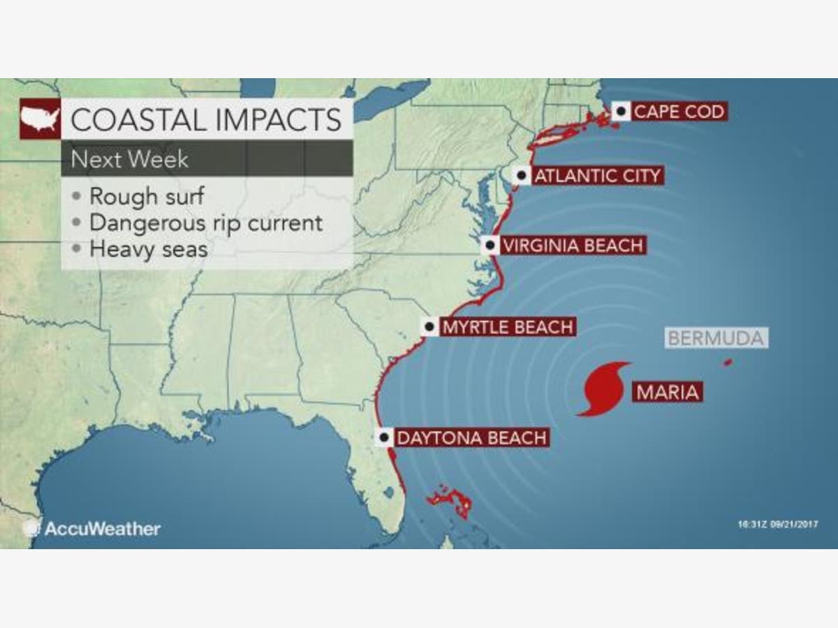
WTNH News 8 Meteorologist Gil Simmons said, “Sun, clouds, and some wind it today! High temperatures will be in the 70s with low humidity. The heat will build in over the weekend with highs getting up to near 90 by Sunday! The humidity is also going to go up over the weekend too! We will be watching Hurricane Maria next week! By the way, Fall begins today at 4:02 PM!”
Find out what's happening in Darienfor free with the latest updates from Patch.
WTNH News 8 Meteorologist Fred Campagna adds that, “Warm weather arrives as soon as Jose departs, and that will be on Saturday. It looks even warmer on Sunday when record highs are possible. Maria will pass east of the Bahamas and needs to be watched through the middle of next week.”
As of right now, most computer models show Maria heading out to sea and away from us.
Find out what's happening in Darienfor free with the latest updates from Patch.
Tracking #maria, and things look better for CT as she takes a turn to the NE, a la #Jose....fringe effects for us? pic.twitter.com/vJ2apgtmqa
— Matt Scott (@themattcast) September 22, 2017
See also: Former Dentist Arrested On Child Porn Charge
- Handyman Stole From Dying Woman: PD
- Military Father Disguised As Referee Shocks Son On Football Field In Surprise Homecoming
Here’s the updated forecast via the National Weather Service:
Today: Partly sunny, high in the mid 70s.
Saturday: Mostly sunny, high in the mid to upper 80s.
Sunday: More sun, temps in the mid 80s.
Monday: More sun, temps in the mid to upper 80s.
What's wrong w this 4cast? For starters, its now Autumn (4:02pm today), & we're looking at record breaking heat Mon! pic.twitter.com/M9InF2G6Bs
— Matt Scott (@themattcast) September 22, 2017
Image via Accuweather.com
Get more local news delivered straight to your inbox. Sign up for free Patch newsletters and alerts.


