Weather
Major Weather Changes On The Way For Connecticut
Despite record warmth so far this fall in Connecticut it appears winter is getting ready to arrive later this week.

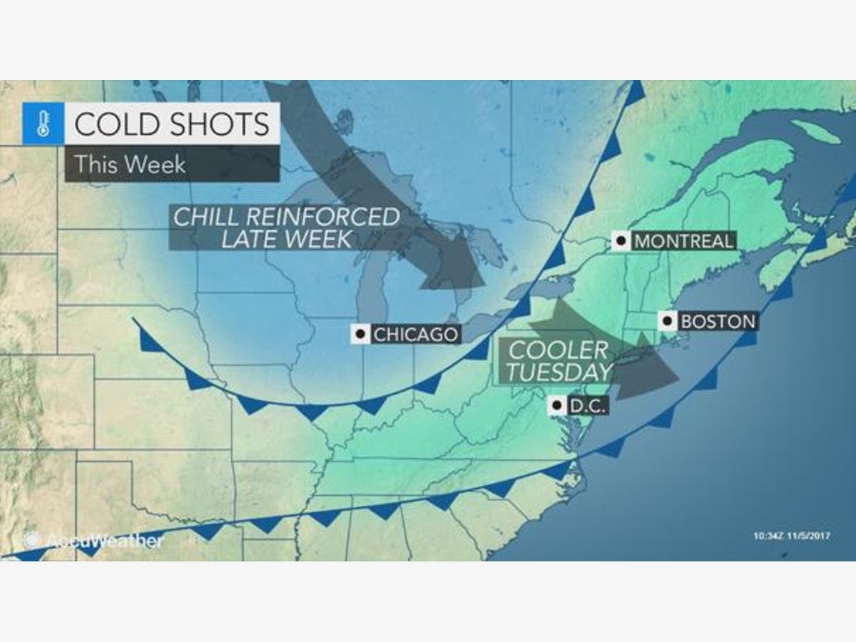
Some big weather changes are on the way for Connecticut this week. Temperatures today will approach 70 degrees and by next weekend the daytime highs will struggle to hit 40 degrees. It appears we’re finally headed toward a period of cold weather after a very warm fall thus far.
Showers and thunderstorms are expected Monday afternoon and after that moves on through this evening, we’re in for a period of quiet, but much cooler weather over the rest of the week.
By Friday night, temps will be below freezing. WTNH News 8 Meteorologist Gil Simmons said, “Happy Monday. Ponytail & Umbrella Alerts today. Rain coming in midday-afternoon. Humid 60s. Fall outfits with cooler temps tomorrow!”
Find out what's happening in Darienfor free with the latest updates from Patch.
Fox 61 Meteorologist Matt Scott said on Monday expect “Another warm start with temps near 60, warmer than the usual highs for early November. Lots of clouds and a little rain, gives way to lots of rain as a front approaches later today. Thunder is possible. As the rain passes, the winds shift from the S to the NW, and kick up. Lows tonight plunge to the upper 30s. Rest of the week? COLDER. Highs Tuesday-Thursday in 50s. Then, even colder highs (40s???) for the end of the week.”
See also: Check Out These 9 Impressive Connecticut Restaurants
Find out what's happening in Darienfor free with the latest updates from Patch.
Here is the updated forecast for southern Connecticut via the National Weather Service:
Today: Showers and possibly a thunderstorm. High near 66. Southwest wind 9 to 11 mph becoming west in the afternoon. Chance of precipitation is 90%. New rainfall amounts between a tenth and quarter of an inch, except higher amounts possible in thunderstorms.
Tonight: A 30 percent chance of showers before 7pm. Cloudy, then gradually becoming partly cloudy, with a low around 42. North wind around 11 mph.
Tuesday: Partly sunny, with a high near 52. Northeast wind 5 to 11 mph.
Tuesday Night: A 20 percent chance of rain. Mostly cloudy, with a low around 39. Northeast wind 7 to 10 mph.
Wednesday: Partly sunny, with a high near 52. Northeast wind 9 to 14 mph.
Wednesday Night: Partly cloudy, with a low around 40.
Thursday: Mostly sunny, with a high near 55.
Thursday Night: Mostly cloudy, with a low around 42.
Friday: Mostly sunny, with a high near 50.
Friday Night: Mostly clear, with a low around 28.
Here is the updated forecast for northern Connecticut via the National Weather Service:
Today: Showers and possibly a thunderstorm. High near 68. South wind around 9 mph becoming northwest in the afternoon. Winds could gust as high as 20 mph. Chance of precipitation is 80%. New rainfall amounts between a tenth and quarter of an inch, except higher amounts possible in thunderstorms.
Tonight: A chance of showers before 7pm. Cloudy during the early evening, then gradual clearing, with a low around 39. North wind 7 to 11 mph, with gusts as high as 25 mph. Chance of precipitation is 30%. New precipitation amounts of less than a tenth of an inch possible.
Tuesday: Increasing clouds, with a high near 51. North wind 5 to 7 mph.
Tuesday Night: A slight chance of showers before 9pm. Mostly cloudy, with a low around 36. North wind 5 to 7 mph. Chance of precipitation is 20%.
Wednesday: Partly sunny, with a high near 52. North wind 5 to 7 mph.
Wednesday Night: Partly cloudy, with a low around 35.
Thursday: Mostly sunny, with a high near 54.
Thursday Night: Partly cloudy, with a low around 37.
Friday: Mostly sunny, with a high near 48.
Friday Night: Mostly clear, with a low around 28.
Image via Accuweather.com
Get more local news delivered straight to your inbox. Sign up for free Patch newsletters and alerts.


