Weather
Tropical Storm Hermine May Impact Connecticut Labor Day Weekend
The National Weather Service says the region may "experience impacts" from a tropical storm this holiday weekend.


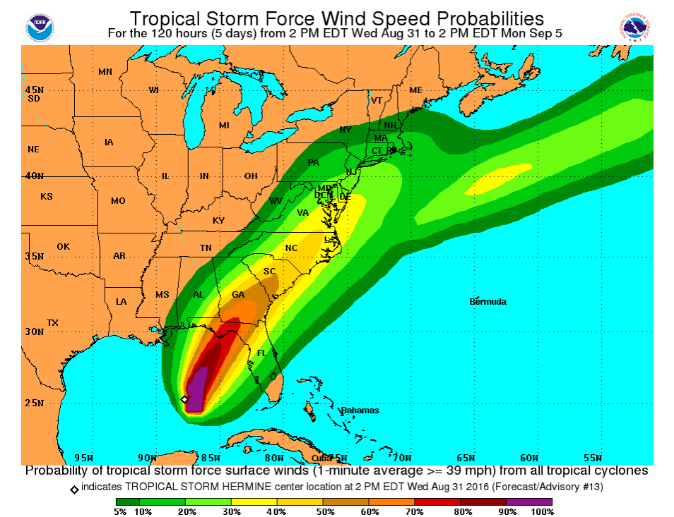
A "tropical depression" in the Gulf of Mexico, reclassified as a tropical storm and given the clunky moniker Tropical Storm Hermine (pronounced "her-mean") Wednesday afternoon, may be headed closer to Connecticut than originally thought, according to a graphic released by government weather officials.
The storm's projected path was still uncertain Wednesday, the National Weather Service (NWS) said.
However, an initial rendering showed Hermine headed to the south of Connecticut, with an expected arrival date of Saturday, Sept. 3, into Monday, Sept. 5 — aka, Labor Day weekend.
Find out what's happening in Darienfor free with the latest updates from Patch.
It is now possible that the powerful storm may impact the state this holiday weekend. Earlier this week, the Labor Day weekend forecast called for sunshine and temps around 80 degrees in Connecticut and now things are potentially changing.
The National Weather Service has already issued a “Hazardous Weather Outlook” for Connecticut due to the potential impact of Hermine.
Find out what's happening in Darienfor free with the latest updates from Patch.
- Also see: Connecticut Fall Festivals 2016 Guide
- Connecticut Native's Life Sentence Commuted by President Obama
- Bridgeport Bluefish Offer Baseball Contract to Tim Tebow
According to the Wednesday evening advisory, the NWS states that the tropical storm may impact the state over the Labor Day weekend. Specific impacts including coastal flooding as well as heavy rain and strong winds.
NBC Connecticut Meteorologist Ryan Hanrahan said on social media that, “We've made big changes to the weekend forecast. It's important to note that while we will be very close to Hermine this weekend a reasonable worst case scenario would be clouds, rain, and some wind. Nothing like Irene or Sandy and more like a typical fall nor'easter.”
"Additional strengthening is forecast during the next 36 hours, and Hermine could be near hurricane strength by the time landfall occurs," the NWS said.
The NWS says there will be a chance of rain and gusty winds in the region beginning late day Saturday or Saturday evening, continuing into Sunday and then tapering off on Monday.
By Simone Wilson and Brian McCready
Images courtesy of the NWS
Get more local news delivered straight to your inbox. Sign up for free Patch newsletters and alerts.


