Home & Garden
WEATHER UPDATE: Hazardous Weather Outlook Issued For Durham, Middlefield
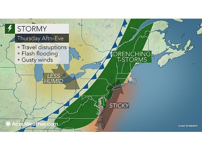
Here is what you need to know about when the storms are forecast to arrive on Thursday and how the weekend looks.

By Brian McCready and Jaimie Cura
The National Weather Service issued a “Hazardous Weather Outlook” for the entire state of Connecticut on Thursday, July 30, due to the chance of thunderstorms.
If we see severe weather, it will likely be between 4 and 7 p.m., according to the NWS.
Find out what's happening in Durham-Middlefieldfor free with the latest updates from Patch.
The chance for severe weather is around 60 percent, according to the weather service. It will remain hot and humid as temps approach the upper 80s on Thursday.
For Fairfield, New Haven, Middlesex and New London counties, the weather advisory states: “There is a marginal risk for strong to severe thunderstorms this afternoon and evening. The main threat is from damaging wind gusts.”
Find out what's happening in Durham-Middlefieldfor free with the latest updates from Patch.
NBC Connecticut Meteorologist Darren Sweeney writes, “Here is a look at the changes over the next 3-days.Tropical today. with storms 4-7 p.m. (a shower possible before, too). Dry tomorrow Just an isolated storm chance late Saturday.”
News 12 Weather writes, “Thunder threat (Thursday). Some storms could be strong. Be “weather aware” Thursday.
Weekend Weather
The weekend looks great if you have outdoor plans, as skies will be sunny with temps in the mid to upper 80s throughout Connecticut on Saturday and Sunday.
Get more local news delivered straight to your inbox. Sign up for free Patch newsletters and alerts.