Home & Garden
WEATHER UPDATE: Several Chances For Storms This Week
We'll let you know what days the unsettled weather is possible for Durham and Middlefield, and how next weekend's forecast is looking.

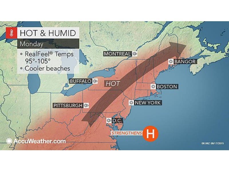
The back-to-work week weather forecast appears to be an unsettled one that begins with a hot and steamy day on Monday, August 17.
Temps will hit between 90 degrees in southern Connecticut and reach into the mid-90s in northern Connecticut.
Skies will be mostly sunny, but there is a slight chance for an isolated afternoon shower or thunderstorm. The chance of unsettled weather is 20-30 percent statewide, the National Weather Service states.
Find out what's happening in Durham-Middlefieldfor free with the latest updates from Patch.
After Monday, we’re not expected to hit 90 degrees again for the rest of the week.
Find out what's happening in Durham-Middlefieldfor free with the latest updates from Patch.
WTNH News 8 Meteorologist Gil Simmons wrote on social media, “A hot & humid day today. Low air quality & a high pollen count!”
On Tuesday, there will be a mix of sun and clouds and a slight chance for an isolated shower or thunderstorm, with temps in the mid to upper 80s. The chance for precipitation is 20-30 percent.
On Wednesday, more clouds than sun will be present and there is a chance for showers and thunderstorm in the southern half of the state, while Hartford and Tolland counties are looking at sunny and completely dry conditions.
Thursday and Friday’s weather forecast as of right now seems the most unsettled, with a 40 percent chance of showers and thunderstorms on both days. It’s expected to be cloudy on both days.
And while it’s a week away, the initial weekend forecast calls for sunny skies and temps in the low 80s.
Have a great week!
Photo Credit: Accuweather.com
Get more local news delivered straight to your inbox. Sign up for free Patch newsletters and alerts.