Weather
Updated Snow Accumulation Estimates, Timing Of Storm: CT Weather
The National Weather Service has released updated snow accumulation estimates for all parts of CT. Here is what they are predicting.

CONNECTICUT — In an evening update, the National Weather Service has released new estimates for snow, ice and rain for the Sunday and Monday storm. The latest news centers on the fact that the storm is expected to trend warmer, which will keep snow totals down a bit, especially along the coast.
Some areas, i.e. Litchfield County could still see near a foot of snow while the rest of northern Connecticut and inland sections of Southern Connecticut may see several inches of snow but sleet and ice is expected to mix in.
Along the immediate coastline, it will mainly be a mixed precipitation, rain event with very minor snow accumulation.
Find out what's happening in Fairfieldfor free with the latest updates from Patch.
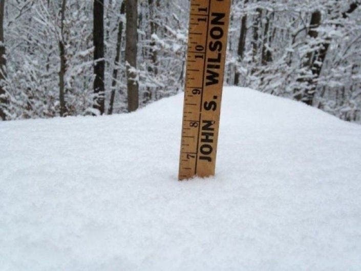
****Sunday, Dec. 1 morning snow, ice update for CT.
Timeline, New Snow/Ice Estimates Made For 2-Day Storm: CT Weather
Here are the evening projections via the National Weather Service:
Find out what's happening in Fairfieldfor free with the latest updates from Patch.
Fairfield County at the immediate coast: A Winter Weather Advisory is in effect until 7 p.m. Sunday. "Mixed precipitation expected. Total snow accumulations of 1 to 3 inches and ice accumulations of a light glaze....Accumulations of freezing rain will be possible in the early to late afternoon hours prior to a change over to all rain.
The coast of New Haven and Middlesex counties and all of New London County:
"A slow moving low pressure system may bring a light snow accumulation to portions of the region Sunday morning into Sunday afternoon. Precipitation is likely to change to all rain Sunday
evening into Monday morning, before potentially changing back to snow Monday afternoon into Monday night with another light snow accumulation possible. A period of wintry mix will be possible as well. This may result in hazardous travel conditions for the Sunday morning/afternoon and Monday afternoon/evening timeframe.
Inland sections of Fairfield, New Haven, and Middlesex counties: A Winter Storm Watch is in effect until Tuesday morning.
"Heavy mixed precipitation possible. Total snow accumulations of 5 to 11 inches and ice accumulations of around one tenth of an inch possible...Precipitation will start as all snow on Sunday. The precipitation becomes a wintry mix late Sunday afternoon into Sunday night before changing back to snow Monday morning. Snow continues into Monday night.
Hartford CT-Tolland CT: A Winter Storm Watch is in effect until Tuesday morning. "Heavy mixed precipitation possible. Total snow accumulations of 5 to 11 inches and ice accumulations of up to two tenths of an inch possible."
Windham County: A Winter Weather Advisory is in effect until 7 a.m. Tuesday. "Mixed precipitation expected. Total snow accumulations of 3 to 6 inches and ice accumulations of around one tenth of an inch."
Litchfield County: A Winter Storm Watch is in effect until Tuesday morning. "Heavy mixed precipitation possible including snow, sleet and freezing rain. Total snow and sleet accumulations potentially of 9 inches or more and around a tenth of an inch of ice is possible."
CT's Weather Experts Predictions:
Nice! Keep bringing those totals down, Rach! https://t.co/xEGY8tjMGS
— Tony Terzi (@T2Fox61) December 1, 2019
There has been some changes in the forecast! #WTNHweather https://t.co/G00v87T37C
— WTNH News 8 (@WTNH) December 1, 2019
A Winter Weather Advisory has been issued by the National Weather Service until 12/01 7:00PM pic.twitter.com/EynXE5cfYG
— Rachel Frank (@RachelFrank_CT) November 30, 2019
Hope this helps you plan things. Snow to ice to rain and then back to snow. The Monday AM commute will be sloppy but generally manageable. #nbcct pic.twitter.com/FYfyzV0bhj
— Ryan Hanrahan (@ryanhanrahan) November 30, 2019
One thing challenging about the forecast is dealing with a mid level dry slot that lingers for a long time Sunday night/Monday AM. The saturated part of column stays near/below freezing BUT with temperatures warmer than -6c not much ice present in cloud. Could be freezing rain. pic.twitter.com/OJnfzbOuk2
— Ryan Hanrahan (@ryanhanrahan) November 30, 2019
Going to drop the numbers here. I went a little higher this morning with apprehension on the initial moderate/heavy snow, but I think this may turn into an icy mess more than a snowy mess. @WTNH pic.twitter.com/oP3m6gfYRB
— Ashley Baylor (@Ash_Baylor) November 30, 2019
Original story: CONNECTICUT — If you need to get somewhere in Connecticut on Sunday, you'll want to do it by noon, which is when it should be snowing everywhere in the state. And there will be no real let up from this very slow moving storm, which will impact the weather for Sunday, Monday and early Tuesday.
This is an unusually long duration storm. A Winter Storm Watch is in effect for Hartford, Tolland, Litchfield counties, and inland sections of Fairfield, New Haven, and Middlesex counties. A Hazardous Weather Outlook is in effect for the coast of Fairfield, New Haven, and Middlesex counties along with New London and Windham counties.
Some parts of Connecticut may see up to a foot or more of heavy, wet snow, but also of great concern is the ice that is predicted to mix in on Sunday night and Monday morning, especially for areas away from the immediate coast.
The National Weather Service says, "Precipitation begins as snow everywhere in the region Sunday morning before transitioning to rain along coastal areas Sunday afternoon into Sunday night. Meanwhile, the interior will transition to a wintry mix. For Monday, the initial wintry mix will change back over to snow for the interior with the coast going from rain to back to snow as well late in the day. Snow will linger Monday night before eventually tapering off by early Tuesday.
"There is potential for significant snow accumulations across the interior with light snow accumulations possible towards the coast within the Sunday through Monday night timeframe. Some light ice accumulations are possible as well. Temperatures are expected to remain several degrees below normal for much of the time period."
Here is the latest snow and ice predictions from the National Weather Service:
Coast of Fairfield, New Haven, and Middlesex counties and all of New London County:
"A slow moving low pressure system may bring a light snow accumulation to portions of the region Sunday morning into Sunday afternoon. Precipitation is likely to change to all rain Sunday evening into Monday morning, before potentially changing back to snow Monday afternoon into Monday night with another light snow accumulation possible. A period of wintry mix will be possible as well. This may result in hazardous travel conditions for the Sunday morning/afternoon and Monday afternoon/evening timeframe."
Inland sections of Fairfield, New Haven, and Middlesex counties:
"Heavy snow and mixed precipitation possible. Total snow accumulations of 8 to 12 inches well inland, and 5 to 8 inches elsewhere. Ice accumulations of around a tenth of an inch or less possible.
"Precipitation will start as all snow on Sunday. The precipitation becomes a wintry mix Sunday afternoon into Sunday night before changing back to snow Monday. Snow continues Monday night.
Hartford and Tolland County:
"Heavy mixed precipitation possible. Total snow accumulations of 5 to 11 inches and ice accumulations of up to two tenths of an inch possible."
Litchfield County:
"Heavy mixed precipitation possible including snow, sleet and freezing rain. Total snow and sleet accumulations potentially of 9 inches or more and up to one tenth of an inch of ice is possible."
Windham County:
Sunday: Snow before 3pm, then snow, possibly mixed with sleet. High near 34. Calm wind becoming east around 6 mph in the afternoon. Chance of precipitation is 80%. New snow and sleet accumulation of 1 to 2 inches possible.
Sunday Night: Freezing rain and sleet before 11pm, then rain, possibly mixed with sleet between 11pm and 4am, then rain likely after 4am. Patchy fog. Low around 30. Northeast wind 9 to 15 mph. Chance of precipitation is 100%. New sleet accumulation of less than a half inch possible.
Monday: Rain before 9am, then snow, possibly mixed with rain. Patchy fog before 2pm. High near 37. North wind 13 to 15 mph. Chance of precipitation is 80%. New snow accumulation of less than a half inch possible.
Monday Night: Snow likely, mainly before 4am. Cloudy, with a low around 28. North wind 9 to 13 mph. Chance of precipitation is 60%. New snow accumulation of 1 to 3 inches possible.
See also: Another National Retailer Closing Remaining Four CT Locations
Here is our latest snowfall forecast for the upcoming storm: pic.twitter.com/Z3sDQsCsOe
— NWS New York NY (@NWSNewYorkNY) November 30, 2019
Snow should break out by early to mid afternoon tomorrow. pic.twitter.com/A6Z07zUf1b
— Sam Sampieri (@SamSampieri) November 30, 2019
First flakes start flying in CT around 9 to 10 a.m. for towns along the NY border. Snowing at a decent clip statewide around noon. #nbcct pic.twitter.com/F9eSL6dHWc
— Josh Cingranelli (@WeatherJosh) November 30, 2019
Get more local news delivered straight to your inbox. Sign up for free Patch newsletters and alerts.