Community Corner
WEATHER UPDATE: Snow Melts, Sub-Zero Temps Return Tonight, Along With Concerns for an Icy Monday Commute
We have your latest Connecticut snowfall totals, and we'll tell you exactly how cold it will feel on Monday and the answer is below zero!

Today’s story is one of good news for about 12 hours.
The snow has ended, temperatures are above the freezing mark for the first time in seemingly ages, and we could exceed 40 degrees today in Connecticut.
The other good news is that a potential major snow storm predicted for the middle of the week looks like it will largely avoid us, and if that happens there will be no snow threats this week until maybe next Sunday, WTNH News 8 reports.
Find out what's happening in Glastonburyfor free with the latest updates from Patch.
Ok that’s the end of the good news. What goes up, inevitably goes down, and that is what will happen to temperatures beginning tonight.
Temperatures will be free-falling Sunday night all the way down into the teens, so that means whatever snow melts today, it will freeze and make for an icy Monday morning commute back to work and school.
Find out what's happening in Glastonburyfor free with the latest updates from Patch.
NBC Connecticut writes there will be black ice due to melting and freezing of snow on Sunday making for a slippery commute. Also because of the warmer temps today, leaking roofs are possible and a barn collapse was reported in North Branford.
And the story will once again be the return of the Sub-Zero cold on Monday.
On Monday the high temperature will be 15 degrees for Connecticut and the low on Monday night will be 5 below zero. The windchill factor on Monday during the day will be 5 below zero and at night it could feel like 15 below.
And speaking of the brutal cold, NBC Connecticut Meteorologist Brad Field writes on Facebook that the Hartford area may set a dubious record.
Brad Field writes, “we’ve suffered for it...we might as well earn bragging rights...we have a week to go and are currently in the lead for coldest month on record (records in our area have been kept since 1905)...Ryan & I BOTH think we have a shot...it’s going to be close!”
In the Hartford area the average temperature this month has been 15.6 degrees and the previous record of 16.5 was set in 1934!
NBC Connecticut Metrologist Darren Sweeney writes on Facebook, “Overall, we had 3-6” snowfall totals with a few higher amounts of 7/8” in Tolland county and lower amounts at the coast. The mixing line tried to work north last night and it did cut down on accumulations in southern CT, but overall, everyone got a nice new batch of snow.
Today: A BREAK!! WOOHOO!!! Temps mid to upper 30s, to near 40 degrees! Enjoy it. Hearing about many roof leaks and even a collapse this morning. If you can safely remove the snow, today is THE best day to do it over the next 7.
As the movie below will show, we are looking at another bitter blast moving in, it arrives late tonight and tomorrow will be bitterly cold with sub-zero wind chills.”
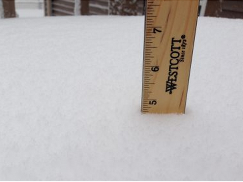
CT snowfall totals from the latest storm on Saturday via the National Weather Service:
Darien, 6.5 inches
Stamford, 6 inches
Wilton, 6 inches
New Canaan, 5.8 inches
Newtown, 5.5 inches
Stratford, 5.5 inches
Danbury, 5 inches
Shelton, 4.7 inches
Norwalk, 3.1 inches
Milford, 5.3 inches
Southbury, 5 inches
North Haven, 4.5 inches
Hartford County saw a range of 2.5 inches all the way up to 8 inches
Tolland County had a range of 3.4 inches up to 8 inches
Fairfield County’s spread was 3.1 inches to 6.5 inches
Middlesex County saw 1.8 inches to 4.5 inches
New London County saw 1.3 inches to 3.5 inches
Let us know how much snow you received in the comments sections.
Other stories on Patch:
Get more local news delivered straight to your inbox. Sign up for free Patch newsletters and alerts.