Community Corner
Winter Storm Watch Issued for Glastonbury
The National Weather Service has updated their predictions for snow that is expected in Glastonbury this weekend.

The National Weather Service has issued a winter storm watch for north central and northeast Connecticut beginning at 7 a.m. Saturday and continuing through 11 p.m. Saturday.
Heavy snow with accumulations of up to 4 to 7 inches of snow may fall on Glastonbury on Saturday and the National Weather Service said the winter weather watch means there is the “potential of accumulating snow of 6 inches or more in a 12-hour period. Plan to have travel completed Saturday morning. Driving conditions may be difficult Saturday afternoon and evening.”
The snow is expected “to begin Saturday morning and may mix with rain around midday before changing back to snow Saturday afternoon and evening.”
Find out what's happening in Glastonburyfor free with the latest updates from Patch.
The weather service also cautions that a heavy snowfall of 5 inches or more could down tree branches and utility wires.
The full forecast is below. Sign up for Glastonbury Patch news alerts to stay on top of the latest weather developments and more, by clicking here.
Find out what's happening in Glastonburyfor free with the latest updates from Patch.
- Tonight: Mostly clear, with a low around 18. Northwest wind around 6 mph becoming calm after midnight.
- Friday: Sunny, with a high near 37. Calm wind becoming southwest around 6 mph in the afternoon.
- Friday Night: A chance of snow, mainly after 4am. Increasing clouds, with a low around 25. South wind around 5 mph becoming calm in the evening. Chance of precipitation is 30%. New snow accumulation of less than a half inch possible.
- Saturday: Snow before 1pm, then rain and snow. High near 34. Calm wind becoming north 5 to 9 mph in the morning. Chance of precipitation is 80%. New snow accumulation of 3 to 5 inches possible.
- Saturday Night: A chance of snow, mainly before 10pm. Mostly cloudy, with a low around 27. West wind around 10 mph, with gusts as high as 21 mph. Chance of precipitation is 40%.
- Sunday: Mostly sunny, with a high near 35.
- Sunday Night: A chance of snow after 3am. Mostly cloudy, with a low around 19. Chance of precipitation is 30%.
- Monday: A chance of snow. Mostly cloudy, with a high near 26. Chance of precipitation is 40%.
- Monday Night: A chance of snow showers. Mostly cloudy, with a low around 11. Chance of precipitation is 30%.
- Tuesday: Mostly sunny, with a high near 21.
- Tuesday Night: Partly cloudy, with a low around 5.
Have a news tip? Email barbara.heins@patch.com.
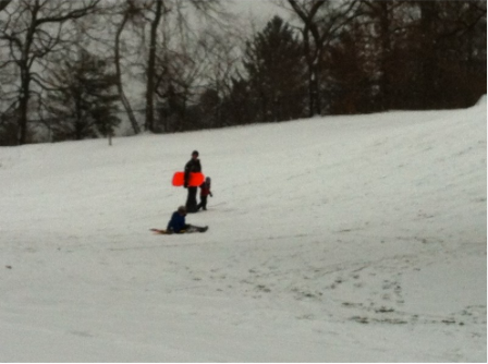
Photo credit: Barbara Heins.
Get more local news delivered straight to your inbox. Sign up for free Patch newsletters and alerts.