Weather
Madison's Work Week Forecast: Stormy Early, Sun, Much Warmer Later
As we head into Memorial Day weekend we let you know what to expect over the next 7 days and yes it will finally begin to feel like summer.

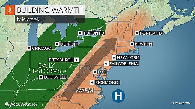
Apparently, the unofficial start of summer will be on Wednesday as the entire state of Connecticut will enjoy sunny skies and temps into the 80s.
We’ve just got to get there first. We’re not necessarily expecting a washout on Monday and Tuesday but showers and thunderstorms are possible at times throughout both days.
Once we get to Wednesday, we’re looking at some warmer and sunnier weather leading right into the long holiday weekend.
Find out what's happening in Madisonfor free with the latest updates from Patch.
Here’s the latest 7-day forecast via the National Weather Service:
Monday: Showers possible, increasing clouds as the day goes on with temps in the low to mid 70s.
Find out what's happening in Madisonfor free with the latest updates from Patch.
Monday night: More showers and thunderstorms possible, up to half an inch of rain is possible with temps in the mid 70s.
Tuesday: Chance of showers and thunderstorms, cloudy with temps in the upper 60s.
Tuesday night: Chance of showers and thunderstorms early, temps in the mid 50s.
Wednesday: Sunshine and temps in the low to mid 80s.
Wednesday night: Temps around 65 degrees.
Thursday: Sunshine, temps in the upper 70s at the coast and mid 80s Inland.
Thursday night: Temps near 60 degrees.
Friday: Sunshine, temps in the low to mid 70s.
Memorial Day Weekend:
Partly sunny skies both days and on Saturday temps in the mid 70s on the coast and low 80s inland. On Sunday, a bit warmer with temps in the upper 70s on the coast and mid 80s inland.
Catch up on the top stories of the week:
Photo credit: Accuweather.com
Get more local news delivered straight to your inbox. Sign up for free Patch newsletters and alerts.