Weather
Latest Details on Snow Chance for Mansfield-Storrs This Weekend
Some initial accumulation estimates have been released concerning how much snow we may receive from this weekend's storm.

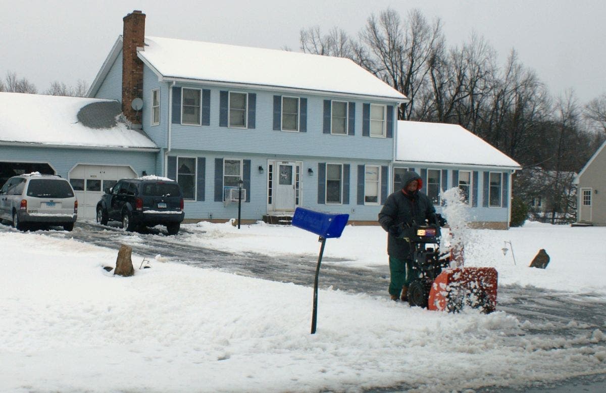
Remember last winter and how odd it was here in Connecticut. We only had a few snowstorms last year and for each of them somehow New London and Windham counties always received the most accumulation. It looks like that for the first widespread snowstorm of the season things appear to be going back to normal and inland areas will see more snow accumulation from this storm.
In an updated forecast, the National Weather Service is beginning to offer initial snow accumulation estimates for the late Sunday and into Monday snow, sleet and rain storm. No matter where you live in Connecticut, the morning commute Monday to work and school will likely be a messy one.
Again, the snow and mixed precipitation is still a few days away, and we know it will change several times before it actually gets here, but the thinking now is that areas on the coast will receive more of a mix of rain and snow, and areas inland, will see colder temps and more of an opportunity for some snow accumulation and mixed precipitation.
Find out what's happening in Mansfield-Storrsfor free with the latest updates from Patch.
WTNH News 8 Meteorologist Gil Simmons wrote, “Bundle up! Windy and cold today right through Sunday. Light snow expected Sunday night and it could be a slow commute on Monday morning! We will also be at the mall in Milford on Sunday between 11 AM and 2 PM with our toy drive!”
NBC Connecticut Meteorologist Ryan Hanrahan, who wrote a detailed blog post about what this storm could do, says right now there is no way of knowing how much snow to expect. Some models show six inches of snow in parts of the state while several models show 1-3 inches of snow, mixed precipitation, and rain for a lot of the state.
Find out what's happening in Mansfield-Storrsfor free with the latest updates from Patch.
Hanrahan also took aim on social media late last night at the new trendy national weather apps that are hyping a storm based on what he says is the opposite of science.
“Let me vent. A lot of people have popular weather apps that they get forecasts from. This particular app is forecasting 6"-11" of snow in parts of Connecticut on Monday. While this is certainly possible... right now this forecast is utter garbage. It's about as useful as throwing darts, shaking a magic 8 ball, or just making it up. Right now all we can say that a winter storm is possible with at least some accumulation and some ice. Could it be a big 6"+ storm? Sure! But a 1"-3" storm with some ice and rain is just as likely!!! And there's also a chance (though quite unlikely) that something goes wrong and the whole thing sort of fizzles,” Hanrahan wrote on his Facebook page.
See also: Does Connecticut Treasury owe you money, check here to find out.
Here’s a detailed look at how much snow Hartford and Tolland counties might receive via the National Weather Service:
Friday: Mostly sunny, high near 35.
Saturday: Mostly sunny, high near 33, feels colder with the wind chill factor.
Sunday: Chance of snow after 3 p.m. More steady snow after 11 p.m. Low around 26 at night.
Monday: Snow hangs on here until 11 a.m. A mix is likely toward noon of both rain and snow
And more snow and rain mix is forecast for Wednesday.
Written by Brian McCready (Patch Staff)
Photo credit: Tim Jensen
Get more local news delivered straight to your inbox. Sign up for free Patch newsletters and alerts.