Weather
Special Weather Statement Updated for Mansfield
The National Weather Service has pinpointed when and where we may see more showers and thunderstorms on Thursday.

Editor's Note: If you received this alert, and you don't live in Mansfield, we apologize for that. It was a misfire on our end. We apologize for that error.
The National Weather Service has continued its “Hazardous Weather Outlook” for much of the state as more thunderstorms and rain are possible later this afternoon and evening hours.
It appears that the areas most likely to receive the strongest storms are in northern Connecticut, specifically Hartford and Tolland counties.
Find out what's happening in Mansfield-Storrsfor free with the latest updates from Patch.
The rest of the state may also see some showers and thunderstorms this afternoon too but it will be more isolated in nature.
In between the chance for showers and thunderstorms it will be mostly cloudy with temps in the mid 80s for southern Connecticut and near 90 degrees in northern Connecticut.
Find out what's happening in Mansfield-Storrsfor free with the latest updates from Patch.
Here’s a breakdown of the updated forecast for Thursday via the National Weather Service:
Hartford and Tolland counties:
Severe thunderstorms are possible this afternoon. A line of thunderstorms may produce damaging winds, localized flooding from torrential rainfall and frequent lightning, the National Weather Service states in a Special Weather statement. A tornado is also possible, the weather service cautions.
The area of greatest concern for severe weather is from 4 p.m. to 9 p.m.
“If you have outdoor plans...stay aware and pay attention to the latest updates….,” the National Weather Service states.
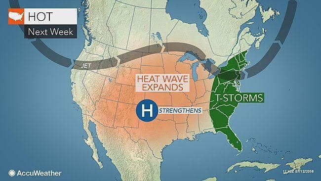
Photo Crerdit: Accuweather.com
Get more local news delivered straight to your inbox. Sign up for free Patch newsletters and alerts.